Lake Cochituate
The lake forms a series of connected basins on the town's north-western edge. Their irregular shorelines give the map broad, open shapes that contrast with the fine lines of the surrounding streets.
Pōhita mape faigofie · United States
42.2834° N / 71.3495° W
A wooded New England town of winding roads, framed by Lake Cochituate on one side and the Charles River on the other.



Taone e tahi, lagona e lima
Pa'i se ata ke va'ai ai i luga o te pā. E tutusa te tau o ata uma — i lomiga, fakapipi'i i faleata, pe ko faila HD.
 Pixels mo'i · Faila lomiga 24 × 36″
Manino mo te lomiga
Ko se kupega 100% mai te faila lomiga mo'i. Poster uma — pe lomiina, fakapipi'i i faleata, pe download-ina — e fakaatagia i luga o a matou setula i te 300 DPI, e oo atu ki te 7,200 × 10,800 pixels, ina ia mautinoa e ma'ai pea auala tuai foki i luga o se lomiga 24 × 36″.
I luga o te pa


Te mape
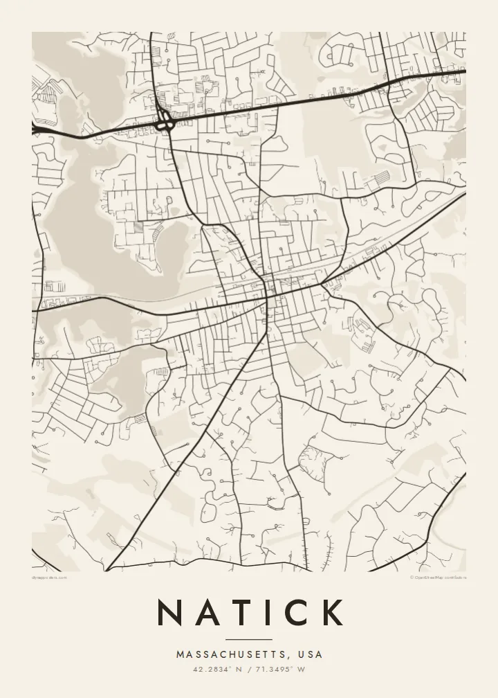
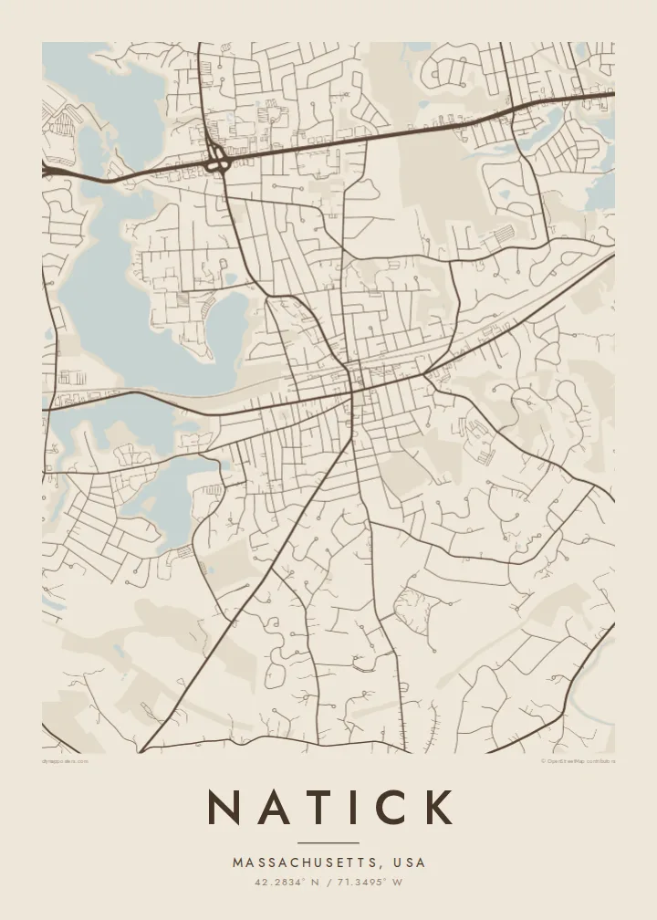
Natick lies in the MetroWest suburbs west of Boston, and its map is shaped more by water and woodland than by any grid. Curving residential streets fill the spaces between ponds and patches of forest, while a few long routes cross the town in straighter lines. The Massachusetts Turnpike runs along the northern side, and the commuter rail line cuts through toward the centre.
Natick was founded in 1651 by the missionary John Eliot as a settlement for Christian Native Americans, the first of the so-called praying towns in Massachusetts. Today it is also known as a stage on the Boston Marathon course, which follows Route 135 through the town centre. A Natick map poster brings these layers together on one sheet of carefully drawn lines.
Lake Cochituate stretches along the north-western side as a chain of long, lobed basins, and the Charles River winds past South Natick in the south. Between them, Route 9 draws a busy commercial corridor across the town. In monochrome, the two bodies of water work as natural borders and give the suburb a clear, recognisable outline.
The lake forms a series of connected basins on the town's north-western edge. Their irregular shorelines give the map broad, open shapes that contrast with the fine lines of the surrounding streets.
In South Natick the Charles River loops past the older village. It is a slow, winding line of water that marks the southern side of the town and softens the lower edge of the print.
The road that carries the Boston Marathon runs through the town centre. It is a straight thread linking Natick to its neighbours, and one many runners will recognise at once.
Fai mo koe
Fakaopoopo he aho, he igoa pe he upu a koe, hui te faiga, te lahi pe te tūlaga.
Ko te va'aiga e leai se totogi e maualalo tona resolution ma iai se fakailoga vai. E fakaatagia lomiga ma faila HD i te 300 DPI, e oo atu ki te 7,200 × 10,800 px, e aunoa ma se fakailoga vai.
Aiheā Natick
Natick maps often end up with families who grew up near the lake, commuters who moved out from Boston, or runners who remember the marathon miles through town. The title, subtitle and coordinates line can all be edited, so a street, a race year or a moving date fits neatly beneath the map.
Five styles are available: Classic black & white, Noir, Paper, Blueprint and Sand. A free 900 px watermarked preview lets you check the framing first. For $9 you get six print sizes as 300 DPI PNG and print-ready PDF files, or you can order a matte poster, framed in wood if you like.
Oka te poster Natick| Lahi o te lomiga | Manino | Faila |
|---|---|---|
| 30 × 40 cm11.8 × 15.7″ | 3,543 × 4,724 px | PNG · PDF |
| 29.7 × 42 cm (A3)11.7 × 16.5″ | 3,508 × 4,961 px | PNG · PDF |
| 42 × 59.4 cm (A2)16.5 × 23.4″ | 4,961 × 7,016 px | PNG · PDF |
| 45.7 × 61 cm18 × 24″ | 5,400 × 7,200 px | PNG · PDF |
| 50 × 70 cm19.7 × 27.6″ | 5,906 × 8,268 px | PNG · PDF |
| 61 × 91.4 cm24 × 36″ | 7,200 × 10,800 px | PNG · PDF |
Mo te fakatatau, ko te fakaakoakoga e hē totogi e 900 px te lautele, e ihi te fakailoga ma mo te lau komipiuta. Ko nā faila HD e oko ki te 8× te manino i itū taki tahi ma e lomia lelei i te lahi kātoa o te pōhita.
Filifili se ata i te pito i luga o te itulau, ona filifili lea o te Poster Lomiina — se lapoa ma, ka manako ai koe, se faleata — pe ko Faila HD Fakaonaonaina. E tasi te laasaga o te ōkaina, ma ka fakafou loa lau itulau ōkaina pe a mae'a te totogi.
E lomiina i luga o se pepa matte kaliki maualuga e 200 gsm, i se tasi o ni lapoa e ono, mai le 30 × 40 cm ki te 24 × 36″. E kamata te tau o poster lomiina mai le $39, aofia ai te uta.
Ioe. Filifili se faleata lakau malō i te lanu uli, tea, oki masani pe lakau pouli. E aumai fakatasi mo se tioata e le gagamu ma ua sauni ke tautau. E kamata te tau o poster fakapipi'i i se faleata mai le $99, aofia ai te uta.
E tuku uma te uta ki fenua e 60+. Ko te pepa takitasi e lomi e te tasi o a matou paaga lomi i fenua e 30+, ka tae mai i aso galue e 3–7. E mafai ke e maimoa ki te tulaga mo te tulitaki i lalo o Taku Fakatonuga. E lauiti nei fenua e 2–5 wiki, ka ko nei fenua e le o tuku atu ai, e fakamatala atu e te weepisi i mua o te totogi.
Auina mai se ata pikitia i loto o te 14 aso mai te taimi na oo mai ai, ka toe lomiina e matou e leai se totogi pe toe totogi atu lau tupe.
Ioe. I te mea fakasa'o i luga o lenei itulau, sui te ulutala, te ulutala lalo ma te laina fakamaoniga tulaga ki so se mea e manako ai koe, ona filifili lea o se ata ma se lapoa. Okaina lomiina, fakapipi'i i faleata, ma fakaonaonaina e fakaaogā uma i tau ata tonu.
Mo le $9 e maua e koe ni faila PNG 300 DPI ma PDF sauni-mo-lomiga i lapoa e ono uma, e aunoa ma se fakailoga vai, ke lomiina i so se mea. E le'i mautinoa? Download muamua se va'aiga fakailoga vai e leai se totogi.
Latalata
