Vila Bay waterfront
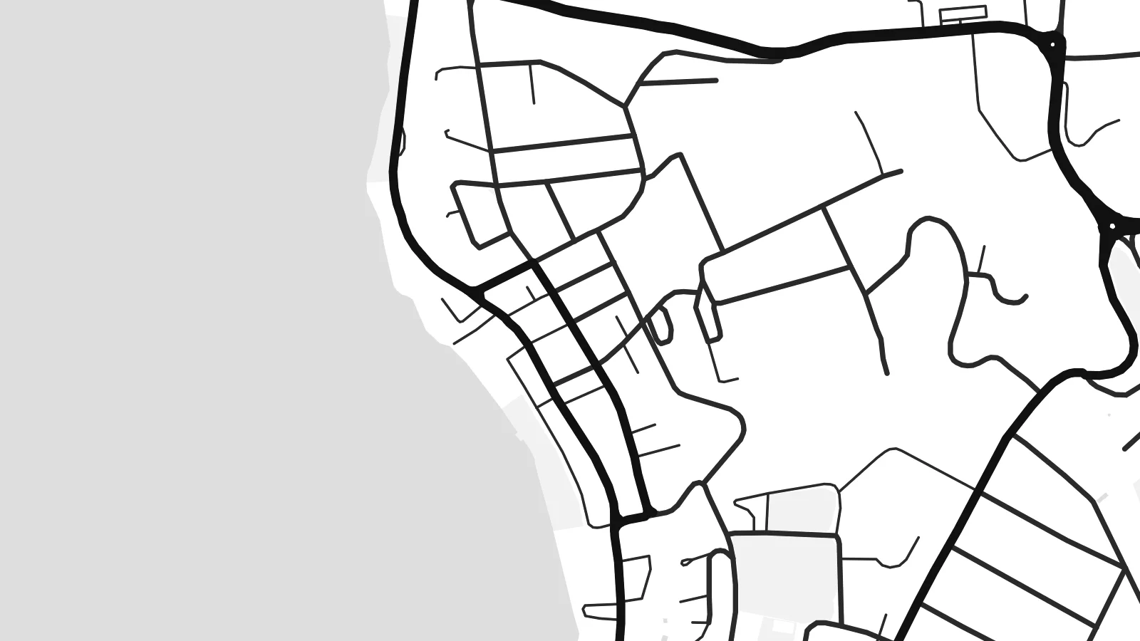
The curve of the harbour anchors the whole composition. The main streets trace the shoreline and quays, then the grid loosens and climbs the hillsides behind the town.
Pōhita mape faigofie · Vanuatu
17.7365° S / 168.3137° E
A harbour town wrapped around Vila Bay, with Iririki Island just offshore and lagoons reaching inland from the south.


Taone e tahi, lagona e lima
Pa'i se ata ke va'ai ai i luga o te pā. E tutusa te tau o ata uma — i lomiga, fakapipi'i i faleata, pe ko faila HD.
 Pixels mo'i · Faila lomiga 24 × 36″
Manino mo te lomiga
Ko se kupega 100% mai te faila lomiga mo'i. Poster uma — pe lomiina, fakapipi'i i faleata, pe download-ina — e fakaatagia i luga o a matou setula i te 300 DPI, e oo atu ki te 7,200 × 10,800 pixels, ina ia mautinoa e ma'ai pea auala tuai foki i luga o se lomiga 24 × 36″.
I luga o te pa


Te mape
Port-Vila sits on the southwest coast of Efate, the island that holds the capital of Vanuatu. From above, water shapes the town on almost every side. The deep curve of Vila Bay lies in front, small islands sit just offshore, and the long arms of Erakor Lagoon push in from the south. Streets follow the shoreline first, then climb in loops toward the ridges behind.
The central waterfront is compact. A short run of commercial streets follows the harbour, and residential roads spread across the slopes above it. Iririki Island is a short crossing from town and shows on paper as a small rounded shape in the bay. Further west, Mele Bay opens to the sea. The coastline breaks into headlands, inlets and reef edges that give the map real texture at its edges.
The town grew as the administrative centre of the New Hebrides, which Britain and France governed jointly until independence in 1980. Both languages still appear in its place names. A Port-Vila map poster keeps that story in line form: an irregular street network bounded by water, a sheltered harbour and a scatter of islands, printed in quiet black and white.
The curve of the harbour anchors the whole composition. The main streets trace the shoreline and quays, then the grid loosens and climbs the hillsides behind the town.
A small island set just off the centre. It sits close enough to read as part of the town but stays clearly separate, and it gives the bay a focal point on the printed sheet.
South of the centre, a winding lagoon cuts deep into the land. It leaves narrow peninsulas and soft, irregular shorelines that contrast with the straighter lines of the streets.
Fai mo koe
Fakaopoopo he aho, he igoa pe he upu a koe, hui te faiga, te lahi pe te tūlaga.
Ko te va'aiga e leai se totogi e maualalo tona resolution ma iai se fakailoga vai. E fakaatagia lomiga ma faila HD i te 300 DPI, e oo atu ki te 7,200 × 10,800 px, e aunoa ma se fakailoga vai.
Aiheā Port-Vila
If you have lived, worked or sailed in Vanuatu, this map is a daily reminder of warm water and a small capital built around its harbour. The mix of open sea, lagoon and looping roads also works simply as a graphic piece, calm enough for a hallway or a study.
You can set your own title and subtitle, add a date such as an arrival or a wedding, and adjust the coordinates line. Choose from five styles: Classic black & white, Noir, Paper, Blueprint or Sand. Then download the $9 HD files or order a printed poster.
Oka te poster Port-Vila| Lahi o te lomiga | Manino | Faila |
|---|---|---|
| 30 × 40 cm11.8 × 15.7″ | 3,543 × 4,724 px | PNG · PDF |
| 29.7 × 42 cm (A3)11.7 × 16.5″ | 3,508 × 4,961 px | PNG · PDF |
| 42 × 59.4 cm (A2)16.5 × 23.4″ | 4,961 × 7,016 px | PNG · PDF |
| 45.7 × 61 cm18 × 24″ | 5,400 × 7,200 px | PNG · PDF |
| 50 × 70 cm19.7 × 27.6″ | 5,906 × 8,268 px | PNG · PDF |
| 61 × 91.4 cm24 × 36″ | 7,200 × 10,800 px | PNG · PDF |
Mo te fakatatau, ko te fakaakoakoga e hē totogi e 900 px te lautele, e ihi te fakailoga ma mo te lau komipiuta. Ko nā faila HD e oko ki te 8× te manino i itū taki tahi ma e lomia lelei i te lahi kātoa o te pōhita.
Filifili se ata i te pito i luga o te itulau, ona filifili lea o te Poster Lomiina — se lapoa ma, ka manako ai koe, se faleata — pe ko Faila HD Fakaonaonaina. E tasi te laasaga o te ōkaina, ma ka fakafou loa lau itulau ōkaina pe a mae'a te totogi.
E lomiina i luga o se pepa matte kaliki maualuga e 200 gsm, i se tasi o ni lapoa e ono, mai le 30 × 40 cm ki te 24 × 36″. E kamata te tau o poster lomiina mai le $39, aofia ai te uta.
Ioe. Filifili se faleata lakau malō i te lanu uli, tea, oki masani pe lakau pouli. E aumai fakatasi mo se tioata e le gagamu ma ua sauni ke tautau. E kamata te tau o poster fakapipi'i i se faleata mai le $99, aofia ai te uta.
E tuku uma te uta ki fenua e 60+. Ko te pepa takitasi e lomi e te tasi o a matou paaga lomi i fenua e 30+, ka tae mai i aso galue e 3–7. E mafai ke e maimoa ki te tulaga mo te tulitaki i lalo o Taku Fakatonuga. E lauiti nei fenua e 2–5 wiki, ka ko nei fenua e le o tuku atu ai, e fakamatala atu e te weepisi i mua o te totogi.
Auina mai se ata pikitia i loto o te 14 aso mai te taimi na oo mai ai, ka toe lomiina e matou e leai se totogi pe toe totogi atu lau tupe.
Ioe. I te mea fakasa'o i luga o lenei itulau, sui te ulutala, te ulutala lalo ma te laina fakamaoniga tulaga ki so se mea e manako ai koe, ona filifili lea o se ata ma se lapoa. Okaina lomiina, fakapipi'i i faleata, ma fakaonaonaina e fakaaogā uma i tau ata tonu.
Mo le $9 e maua e koe ni faila PNG 300 DPI ma PDF sauni-mo-lomiga i lapoa e ono uma, e aunoa ma se fakailoga vai, ke lomiina i so se mea. E le'i mautinoa? Download muamua se va'aiga fakailoga vai e leai se totogi.
