BR-101 highway
The federal highway passes directly through Sooretama, a strong, straight line that organises the town and connects it north and south along the coast.
Pōhita mape faigofie · Brazil
19.1969° S / 40.0978° W
A municipality in northern Espírito Santo where the BR-101 runs between farmland and large blocks of protected Atlantic Forest.




Taone e tahi, lagona e lima
Pa'i se ata ke va'ai ai i luga o te pā. E tutusa te tau o ata uma — i lomiga, fakapipi'i i faleata, pe ko faila HD.
 Pixels mo'i · Faila lomiga 24 × 36″
Manino mo te lomiga
Ko se kupega 100% mai te faila lomiga mo'i. Poster uma — pe lomiina, fakapipi'i i faleata, pe download-ina — e fakaatagia i luga o a matou setula i te 300 DPI, e oo atu ki te 7,200 × 10,800 pixels, ina ia mautinoa e ma'ai pea auala tuai foki i luga o se lomiga 24 × 36″.
I luga o te pa


Te mape
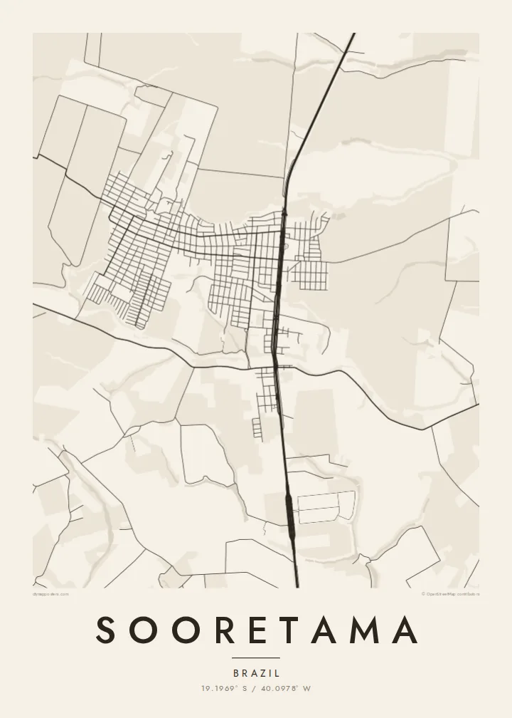
Sooretama is a small municipality in the north of Espírito Santo, in southeastern Brazil, set on the low, gently rolling land between the coast and the interior. Its town centre is compact, with a simple street grid laid out along the BR-101, the federal highway that runs the length of Brazil's Atlantic coast. Beyond the streets, farm plots and rural roads stretch in every direction.
What makes Sooretama distinctive from above is its forest. The municipality contains much of the Sooretama Biological Reserve, a federally protected area of Atlantic Forest, and borders other large reserve land nearby. On a map these appear as broad areas with almost no roads, a striking contrast to the regular field boundaries and highway around the town.
A Sooretama map poster brings out that balance between cultivated land and preserved forest. The straight line of the highway, the neat grid of the town and the finely divided farmland give way to wide, quiet spaces where the forest remains. For a place so closely tied to its landscape, those empty areas are as meaningful as the streets.
The federal highway passes directly through Sooretama, a strong, straight line that organises the town and connects it north and south along the coast.
The Sooretama Biological Reserve protects a large block of Atlantic Forest, visible on the map as a broad, nearly road-free area beside farmland.
Around the town, rural roads and plot boundaries create a regular, finely divided pattern typical of the agricultural north of Espírito Santo.
Fai mo koe
Fakaopoopo he aho, he igoa pe he upu a koe, hui te faiga, te lahi pe te tūlaga.
Ko te va'aiga e leai se totogi e maualalo tona resolution ma iai se fakailoga vai. E fakaatagia lomiga ma faila HD i te 300 DPI, e oo atu ki te 7,200 × 10,800 px, e aunoa ma se fakailoga vai.
Aiheā Sooretama
For people from Sooretama or anyone who has spent time in the forests of northern Espírito Santo, this map is a quiet record of home or of an important journey, with the reserve given the space it deserves.
Set your own title and subtitle, edit the coordinates line, and choose from Classic black & white, Noir, Paper, Blueprint or Sand. The $9 download includes six sizes as 300 DPI PNG and print-ready PDF.
Oka te poster Sooretama| Lahi o te lomiga | Manino | Faila |
|---|---|---|
| 30 × 40 cm (11.8 × 15.7″) | 3,543 × 4,724 px | PNG · PDF |
| 29.7 × 42 cm (A3, 11.7 × 16.5″) | 3,508 × 4,961 px | PNG · PDF |
| 42 × 59.4 cm (A2, 16.5 × 23.4″) | 4,961 × 7,016 px | PNG · PDF |
| 45.7 × 61 cm (18 × 24″) | 5,400 × 7,200 px | PNG · PDF |
| 50 × 70 cm (19.7 × 27.6″) | 5,906 × 8,268 px | PNG · PDF |
| 61 × 91.4 cm (24 × 36″) | 7,200 × 10,800 px | PNG · PDF |
Mo te fakatatau, ko te fakaakoakoga e hē totogi e 900 px te lautele, e ihi te fakailoga ma mo te lau komipiuta. Ko nā faila HD e oko ki te 8× te manino i itū taki tahi ma e lomia lelei i te lahi kātoa o te pōhita.
Filifili se ata i te pito i luga o te itulau, ona filifili lea o te Poster Lomiina — se lapoa ma, ka manako ai koe, se faleata — pe ko Faila HD Fakaonaonaina. E tasi te laasaga o te ōkaina, ma ka fakafou loa lau itulau ōkaina pe a mae'a te totogi.
E lomiina i luga o se pepa matte kaliki maualuga e 200 gsm, i se tasi o ni lapoa e ono, mai le 30 × 40 cm ki te 24 × 36″. E kamata te tau o poster lomiina mai le {printFrom}, aofia ai te uta.
Ioe. Filifili se faleata lakau malō i te lanu uli, tea, oki masani pe lakau pouli. E aumai fakatasi mo se tioata e le gagamu ma ua sauni ke tautau. E kamata te tau o poster fakapipi'i i se faleata mai le {framedFrom}, aofia ai te uta.
E leai se totogi o te ave i te lalolagi katoa. Ko te pepa ata taki tasi e lomi e te hoa lomi e latalata mai ki a matou i atunuku e 30+, ma e masani ona aulia i aso galuega e 3–7. E mafai ke e mulimuli i te tulaga ma te ala o tau poloaiga i lalo o Aku Poloaiga. E nai atunuku e 2–5 vaiaso te umi, ma i te mea e le i ave ai matou, e fakailoa atu e te initeneti a e le i totogi koe.
Auina mai se ata pikitia i loto o te 14 aso mai te taimi na oo mai ai, ka toe lomiina e matou e leai se totogi pe toe totogi atu lau tupe.
Ioe. I te mea fakasa'o i luga o lenei itulau, sui te ulutala, te ulutala lalo ma te laina fakamaoniga tulaga ki so se mea e manako ai koe, ona filifili lea o se ata ma se lapoa. Okaina lomiina, fakapipi'i i faleata, ma fakaonaonaina e fakaaogā uma i tau ata tonu.
Mo le $9 e maua e koe ni faila PNG 300 DPI ma PDF sauni-mo-lomiga i lapoa e ono uma, e aunoa ma se fakailoga vai, ke lomiina i so se mea. E le'i mautinoa? Download muamua se va'aiga fakailoga vai e leai se totogi.
