Castle ridge
The site of Urasoe Castle and the nearby royal tombs sit on a wooded limestone ridge. It leaves a green gap in the urban fabric that the roads bend around.
Pōhita mape faigofie · Japan
26.2590° N / 127.7301° E
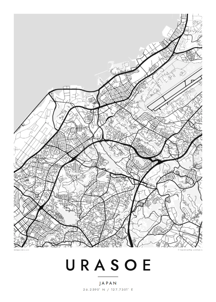
A hilly Okinawan city between the East China Sea and a limestone ridge crowned by an old castle site


Taone e tahi, lagona e lima
Pa'i se ata ke va'ai ai i luga o te pā. E tutusa te tau o ata uma — i lomiga, fakapipi'i i faleata, pe ko faila HD.
 Pixels mo'i · Faila lomiga 24 × 36″
Manino mo te lomiga
Ko se kupega 100% mai te faila lomiga mo'i. Poster uma — pe lomiina, fakapipi'i i faleata, pe download-ina — e fakaatagia i luga o a matou setula i te 300 DPI, e oo atu ki te 7,200 × 10,800 pixels, ina ia mautinoa e ma'ai pea auala tuai foki i luga o se lomiga 24 × 36″.
I luga o te pa


Te mape
Urasoe lies on the west coast of Okinawa Island, directly north of Naha, and on a map the two cities merge into one continuous urban area. The street pattern here is dense but uneven. Narrow lanes wind over low hills, main roads run north–south parallel to the coast, and neighbourhoods fill the gaps in irregular, tightly packed blocks.
Before Shuri became the royal seat, Urasoe was a centre of power on the island. The ruins of Urasoe Castle stand on a ridge in the east of the city, beside the Urasoe Yōdore, royal tombs carved into the cliff. From above, the ridge appears as a green band that the surrounding streets curve around instead of crossing.
Toward the sea the pattern changes. The coastal strip includes a large area of reclaimed and military land, drawn in long straight lines and open spaces that contrast with the fine-grained residential streets inland. An Urasoe map poster brings together the coastline, the ridge and the dense city between them, a place where history sits close to everyday streets.
The site of Urasoe Castle and the nearby royal tombs sit on a wooded limestone ridge. It leaves a green gap in the urban fabric that the roads bend around.
Along the East China Sea, reclaimed land and large institutional sites form broad, regular shapes, very different from the compact neighbourhoods further inland.
Main roads run north–south through the city, linking it to Naha and the centre of the island. They give the dense map a clear sense of direction.
Fai mo koe
Fakaopoopo he aho, he igoa pe he upu a koe, hui te faiga, te lahi pe te tūlaga.
Ko te va'aiga e leai se totogi e maualalo tona resolution ma iai se fakailoga vai. E fakaatagia lomiga ma faila HD i te 300 DPI, e oo atu ki te 7,200 × 10,800 px, e aunoa ma se fakailoga vai.
Aiheā Urasoe
Many people who live in Urasoe work in Naha, yet think of this hillside city as their own. It also matters to anyone interested in the early history of the Ryūkyū Kingdom, and the map holds both the everyday and the historical.
Set the title, add a subtitle and a date, or keep the coordinates line as it is. Five styles are available, from Classic black & white to the blue tones of Blueprint and the warm Sand. Order them as HD files for $9 or as a printed poster.
Oka te poster Urasoe| Lahi o te lomiga | Manino | Faila |
|---|---|---|
| 30 × 40 cm (11.8 × 15.7″) | 3,543 × 4,724 px | PNG · PDF |
| 29.7 × 42 cm (A3, 11.7 × 16.5″) | 3,508 × 4,961 px | PNG · PDF |
| 42 × 59.4 cm (A2, 16.5 × 23.4″) | 4,961 × 7,016 px | PNG · PDF |
| 45.7 × 61 cm (18 × 24″) | 5,400 × 7,200 px | PNG · PDF |
| 50 × 70 cm (19.7 × 27.6″) | 5,906 × 8,268 px | PNG · PDF |
| 61 × 91.4 cm (24 × 36″) | 7,200 × 10,800 px | PNG · PDF |
Mo te fakatatau, ko te fakaakoakoga e hē totogi e 900 px te lautele, e ihi te fakailoga ma mo te lau komipiuta. Ko nā faila HD e oko ki te 8× te manino i itū taki tahi ma e lomia lelei i te lahi kātoa o te pōhita.
Filifili se ata i te pito i luga o te itulau, ona filifili lea o te Poster Lomiina — se lapoa ma, ka manako ai koe, se faleata — pe ko Faila HD Fakaonaonaina. E tasi te laasaga o te ōkaina, ma ka fakafou loa lau itulau ōkaina pe a mae'a te totogi.
E lomiina i luga o se pepa matte kaliki maualuga e 200 gsm, i se tasi o ni lapoa e ono, mai le 30 × 40 cm ki te 24 × 36″. E kamata te tau o poster lomiina mai le {printFrom}, aofia ai te uta.
Ioe. Filifili se faleata lakau malō i te lanu uli, tea, oki masani pe lakau pouli. E aumai fakatasi mo se tioata e le gagamu ma ua sauni ke tautau. E kamata te tau o poster fakapipi'i i se faleata mai le {framedFrom}, aofia ai te uta.
E leai se totogi o te ave i te lalolagi katoa. Ko te pepa ata taki tasi e lomi e te hoa lomi e latalata mai ki a matou i atunuku e 30+, ma e masani ona aulia i aso galuega e 3–7. E mafai ke e mulimuli i te tulaga ma te ala o tau poloaiga i lalo o Aku Poloaiga. E nai atunuku e 2–5 vaiaso te umi, ma i te mea e le i ave ai matou, e fakailoa atu e te initeneti a e le i totogi koe.
Auina mai se ata pikitia i loto o te 14 aso mai te taimi na oo mai ai, ka toe lomiina e matou e leai se totogi pe toe totogi atu lau tupe.
Ioe. I te mea fakasa'o i luga o lenei itulau, sui te ulutala, te ulutala lalo ma te laina fakamaoniga tulaga ki so se mea e manako ai koe, ona filifili lea o se ata ma se lapoa. Okaina lomiina, fakapipi'i i faleata, ma fakaonaonaina e fakaaogā uma i tau ata tonu.
Mo le $9 e maua e koe ni faila PNG 300 DPI ma PDF sauni-mo-lomiga i lapoa e ono uma, e aunoa ma se fakailoga vai, ke lomiina i so se mea. E le'i mautinoa? Download muamua se va'aiga fakailoga vai e leai se totogi.
