Historic centre grid
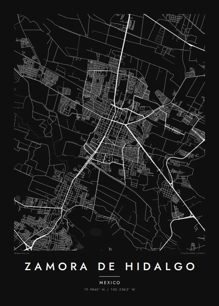
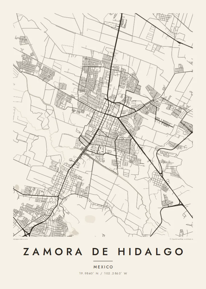
The oldest part of the city is a tight mesh of rectilinear blocks around the main plaza and the sanctuary, noticeably denser than the neighbourhoods that surround it.
Pōhita mape faigofie · Mexico
19.9840° N / 102.2863° W
A compact colonial grid spreading across a fertile valley floor, with the Duero River and farmland around its edges



Taone e tahi, lagona e lima
Pa'i se ata ke va'ai ai i luga o te pā. E tutusa te tau o ata uma — i lomiga, fakapipi'i i faleata, pe ko faila HD.
 Pixels mo'i · Faila lomiga 24 × 36″
Manino mo te lomiga
Ko se kupega 100% mai te faila lomiga mo'i. Poster uma — pe lomiina, fakapipi'i i faleata, pe download-ina — e fakaatagia i luga o a matou setula i te 300 DPI, e oo atu ki te 7,200 × 10,800 pixels, ina ia mautinoa e ma'ai pea auala tuai foki i luga o se lomiga 24 × 36″.
I luga o te pa


Te mape
Zamora de Hidalgo sits in a broad agricultural valley in northwestern Michoacán, and the map shows it plainly. A dense, orderly centre of short blocks gives way to looser neighbourhoods. Those in turn thin out into a patchwork of fields. Along the southern side the built area runs almost continuously into neighbouring Jacona, so from above the two read as one urban shape.
The valley around Zamora is known across Mexico for its strawberries, and the surrounding land is laid out in the long, regular plots of intensive farming. In the city itself, the tall twin-spired sanctuary dedicated to the Virgin of Guadalupe is the landmark people mention first. It was left unfinished for decades and is often described as one of the tallest churches in the country.
A Zamora de Hidalgo map poster reduces all of this to line and space. The historic grid is at the centre, the highways lead out toward Guadalajara and Morelia, and the thin waterways cross the valley. What remains is a portrait of a market city that grew out of the land around it, drawn in quiet black and white.
The oldest part of the city is a tight mesh of rectilinear blocks around the main plaza and the sanctuary, noticeably denser than the neighbourhoods that surround it.
Beyond the urban edge the map breaks into a fine pattern of field boundaries and rural roads, a reminder of the agriculture that shapes the region's economy.
To the south, Zamora's streets merge with those of Jacona, forming a continuous built-up area that reads as a single city on the poster.
Fai mo koe
Fakaopoopo he aho, he igoa pe he upu a koe, hui te faiga, te lahi pe te tūlaga.
Ko te va'aiga e leai se totogi e maualalo tona resolution ma iai se fakailoga vai. E fakaatagia lomiga ma faila HD i te 300 DPI, e oo atu ki te 7,200 × 10,800 px, e aunoa ma se fakailoga vai.
Aiheā Zamora de Hidalgo
For people from Zamora, or those with family in the valley, this map is a way of keeping home on the wall: the familiar blocks, the road out of town, the place where the city meets the fields. It works just as well as a gift for someone who moved away.
You can personalise the poster with your own title, subtitle and coordinates line, perhaps a family name or a meaningful date. Then choose one of five styles, from Classic black & white and Noir to the warmer Paper and Sand or the technical Blueprint.
Oka te poster Zamora de Hidalgo| Lahi o te lomiga | Manino | Faila |
|---|---|---|
| 30 × 40 cm11.8 × 15.7″ | 3,543 × 4,724 px | PNG · PDF |
| 29.7 × 42 cm (A3)11.7 × 16.5″ | 3,508 × 4,961 px | PNG · PDF |
| 42 × 59.4 cm (A2)16.5 × 23.4″ | 4,961 × 7,016 px | PNG · PDF |
| 45.7 × 61 cm18 × 24″ | 5,400 × 7,200 px | PNG · PDF |
| 50 × 70 cm19.7 × 27.6″ | 5,906 × 8,268 px | PNG · PDF |
| 61 × 91.4 cm24 × 36″ | 7,200 × 10,800 px | PNG · PDF |
Mo te fakatatau, ko te fakaakoakoga e hē totogi e 900 px te lautele, e ihi te fakailoga ma mo te lau komipiuta. Ko nā faila HD e oko ki te 8× te manino i itū taki tahi ma e lomia lelei i te lahi kātoa o te pōhita.
Filifili se ata i te pito i luga o te itulau, ona filifili lea o te Poster Lomiina — se lapoa ma, ka manako ai koe, se faleata — pe ko Faila HD Fakaonaonaina. E tasi te laasaga o te ōkaina, ma ka fakafou loa lau itulau ōkaina pe a mae'a te totogi.
E lomiina i luga o se pepa matte kaliki maualuga e 200 gsm, i se tasi o ni lapoa e ono, mai le 30 × 40 cm ki te 24 × 36″. E kamata te tau o poster lomiina mai le $39, aofia ai te uta.
Ioe. Filifili se faleata lakau malō i te lanu uli, tea, oki masani pe lakau pouli. E aumai fakatasi mo se tioata e le gagamu ma ua sauni ke tautau. E kamata te tau o poster fakapipi'i i se faleata mai le $99, aofia ai te uta.
E tuku uma te uta ki fenua e 60+. Ko te pepa takitasi e lomi e te tasi o a matou paaga lomi i fenua e 30+, ka tae mai i aso galue e 3–7. E mafai ke e maimoa ki te tulaga mo te tulitaki i lalo o Taku Fakatonuga. E lauiti nei fenua e 2–5 wiki, ka ko nei fenua e le o tuku atu ai, e fakamatala atu e te weepisi i mua o te totogi.
Auina mai se ata pikitia i loto o te 14 aso mai te taimi na oo mai ai, ka toe lomiina e matou e leai se totogi pe toe totogi atu lau tupe.
Ioe. I te mea fakasa'o i luga o lenei itulau, sui te ulutala, te ulutala lalo ma te laina fakamaoniga tulaga ki so se mea e manako ai koe, ona filifili lea o se ata ma se lapoa. Okaina lomiina, fakapipi'i i faleata, ma fakaonaonaina e fakaaogā uma i tau ata tonu.
Mo le $9 e maua e koe ni faila PNG 300 DPI ma PDF sauni-mo-lomiga i lapoa e ono uma, e aunoa ma se fakailoga vai, ke lomiina i so se mea. E le'i mautinoa? Download muamua se va'aiga fakailoga vai e leai se totogi.
Latalata
