Kiir River
The river, also called Bahr el-Arab, runs across the plain south of the town. It is central to grazing, farming and seasonal movement throughout the region.
Pōsitā mape sitaila faingofua · Sūteni
9.5953° N / 28.4349° E
A town on the flat, seasonally flooded plains between Sudan and South Sudan, near the river the region depends on


Kolo ʻe taha, ongoʻi ʻe nima
Tuki ha sitaile ke sio ai 'i ho holisi. 'Oku tatau pē 'a e totongi 'o e sitaile kotoa pē — tā pepa, fa'o, pe ko e fa'ile HD.
 Pika mo'oni · fa'ile tā 24 × 36″
Mahino ke paaki
Ko ha konga 100% eni mei he fa'ile tā mo'oni. Ko e posita kotoa pē — tā pepa, fa'o, pe download — 'oku ngaohi 'i he'emau sāvā 'i he 300 DPI, 'o a'u ki he 7,200 × 10,800 pika, koe'uhi ke mahino lelei 'a e ngaahi hala si'isi'i taha 'i ha tā 24 × 36″.
'I he pā


Ko e mape
Abyei lies in a flat savannah region on the border between Sudan and South Sudan, and it is known internationally for the unresolved question of which country it belongs to. The area has its own special administrative status, and a United Nations peacekeeping force has been stationed there since 2011. It is home to the Ngok Dinka, and Misseriya herders move through it seasonally with their cattle.
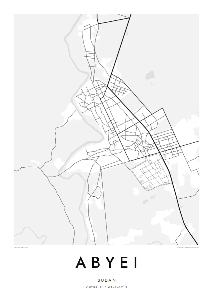
On a map, the landscape is almost entirely level. The Kiir River, also called the Bahr el-Arab, crosses the region to the south of the town, and seasonal watercourses and low-lying wetlands spread across the plain in the rainy months. The town is a compact cluster of streets and compounds, with tracks leading outward across open country.
An Abyei map poster doesn't claim to settle anything. It records a place that many people call home and that others know only from the news: a town, its roads and the waterways that shape life around it. For people from Abyei, for aid workers and for peacekeepers who have served there, the map holds a personal meaning that goes beyond politics.
The river, also called Bahr el-Arab, runs across the plain south of the town. It is central to grazing, farming and seasonal movement throughout the region.
Abyei itself appears as a tight group of streets and compounds. It stands out sharply against the large, open country around it.
Unpaved routes lead away from the town in several directions. They connect it to villages, grazing lands and the wider region.
Ke ʻaʻau pē
Tānaki ha ʻaho, ha hingoa pe ha laine ʻaʻau, pea liliu ʻa e sitaila, saisi pe tuʻunga.
Ko e sio muʻa ta'etotongi 'oku ma'ulalo hono lelei pea 'oku ai hano fakaʻilonga vai. Ko e ngaahi tā mo e fa'ile HD 'oku ngaohi 'i he 300 DPI, 'o a'u ki he 7,200 × 10,800 px, ta'e ha fakaʻilonga vai.
Ko e hā ʻa Abyei
For people from Abyei living elsewhere, and for those who have worked or served there, this map is a way of keeping the place in view on its own terms: as streets, a river and a home, not a headline.
Write the title and subtitle as you see fit, including a name, a date or a dedication, and edit the coordinates line. Choose from Classic black & white, Noir, Paper, Blueprint and Sand. Sand suits the savannah.
'Oda 'a e posita Abyei| Saisi paaki | Tuʻunga mahino | Ngaahi faile |
|---|---|---|
| 30 × 40 cm (11.8 × 15.7″) | 3,543 × 4,724 px | PNG · PDF |
| 29.7 × 42 cm (A3, 11.7 × 16.5″) | 3,508 × 4,961 px | PNG · PDF |
| 42 × 59.4 cm (A2, 16.5 × 23.4″) | 4,961 × 7,016 px | PNG · PDF |
| 45.7 × 61 cm (18 × 24″) | 5,400 × 7,200 px | PNG · PDF |
| 50 × 70 cm (19.7 × 27.6″) | 5,906 × 8,268 px | PNG · PDF |
| 61 × 91.4 cm (24 × 36″) | 7,200 × 10,800 px | PNG · PDF |
Ke fakafehoanaki, ko e sio fakamuʻa taʻetotongi ʻoku fālahi ʻaki ʻa e 900 px, ʻi ai hono fakaʻilonga-vai pea ki he ngaahi screen pē. ʻOku liunga 8 hono mahino ʻo e ngaahi faile HD ʻi he tafaʻaki kotoa pea ʻoku paaki lelei ʻi he saisi kakato ʻo e pōsitā.
Fili ha sitaile 'i he tumu'aki 'o e peesi, pea fili leva ha Posita Tā — ha lahi pea, kapau 'oku ke sai'ia, ha fa'o — pe ko e ngaahi Fa'ile Digital HD. Ko e Checkout ko e sitepu pē 'e taha, pea 'e fakafo'ou leva ho'o peesi 'oda 'i he taimi 'e a'u ai 'a e totongi.
'Oku tā ia 'i ha pepa matte 200 gsm mo'oni lelei taha, 'i ha taha 'o e ngaahi lahi 'e ono, mei he 30 × 40 cm ki he 24 × 36″. 'Oku kamata 'a e ngaahi posita kuo tā 'i he $39, kuo kau ai 'a e 'ave.
'Io. Fili ha fa'o 'akau mo'oni 'i he 'uli'uli, hina, oki fakanatula pe 'akau fu'u 'uli'uli. 'Oku fakataha mai mo ha sio'ata ta'emafesi pea kuo mateuteu ke tautau. 'Oku kamata 'a e ngaahi posita kuo fa'o 'i he $99, kuo kau ai 'a e 'ave.
Ko e tuku atu ʻoku ʻataʻatā ʻi he māmani kātoa. ʻOku paaki ʻa e tohi ʻuluaki taki taha ʻe he tokotaha paaki ofi taha ʻo hotau kau paaki ʻi he fonua ʻe 30 tupu, pea ʻoku fakaʻaongaʻi ʻo aʻu mai ʻi he ʻaho ngāue ʻe 3–7. ʻE lava ke ke muimui ʻi he tuʻunga mo e fakahinohino ʻi he “Ngaahi Ōtā ʻOku Ou Fai”. ʻOku toe fiha fonua ʻoku fakaʻaongaʻi ʻi he uike ʻe 2–5, pea ʻi he ngaahi fonua ʻoku te teʻeki ke tau fakatau ki ai, ʻoku fakahā atu ʻe he sāite ia ki mu'a ke ke totongi.
'Ave mai ha foto kiate kimautolu 'i he lolotonga 'o e 'aho 'e 14 mei he taimi na'e a'u mai ai, pea te mau toe tā ia ta'etotongi pe toe totongi atu 'a ho'o pa'anga.
'Io. 'I he editor 'i he peesi ni, liliu 'a e kaveinga, 'a e kaveinga si'i mo e laine fakafuofua ki ha me'a pē 'oku ke sai'ia ai, pea fili ha sitaile mo ha lahi. Ko e ngaahi 'oda tā, fa'o mo digital kotoa 'oku ngāue'aki ai pē ho'o fakatātā tofu pē.
'I he totongi 'e $9 'oku ke ma'u ai 'a e ngaahi fa'ile PNG 300 DPI mo e PDF kuo mateuteu ki he tā 'i he lahi 'e ono kotoa, 'ikai ha fakaʻilonga vai, ke tā ai 'i ha feitu'u pē. Te ke kei ta'epau? Download muʻa ha sio muʻa ta'etotongi 'oku ai hano fakaʻilonga vai.
Ofi mai
