Ili valley setting
The town sits on the broad, flat floor of the Ili valley, where irrigation from the river and mountain streams supports extensive farmland.
Pōsitā mape sitaila faingofua · Siaina
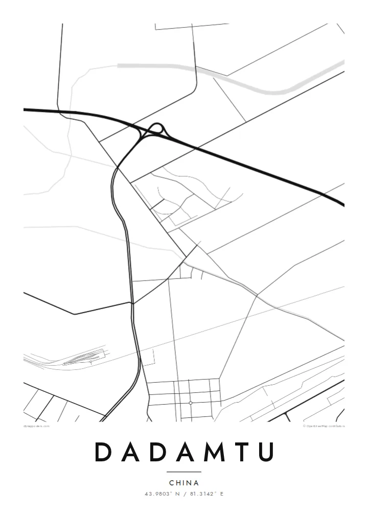
43.9803° N / 81.3142° E
A farming town in the fertile Ili valley of Xinjiang, framed by irrigated fields and tree-lined roads.


Kolo ʻe taha, ongoʻi ʻe nima
Tuki ha sitaile ke sio ai 'i ho holisi. 'Oku tatau pē 'a e totongi 'o e sitaile kotoa pē — tā pepa, fa'o, pe ko e fa'ile HD.
 Pika mo'oni · fa'ile tā 24 × 36″
Mahino ke paaki
Ko ha konga 100% eni mei he fa'ile tā mo'oni. Ko e posita kotoa pē — tā pepa, fa'o, pe download — 'oku ngaohi 'i he'emau sāvā 'i he 300 DPI, 'o a'u ki he 7,200 × 10,800 pika, koe'uhi ke mahino lelei 'a e ngaahi hala si'isi'i taha 'i ha tā 24 × 36″.
'I he pā


Ko e mape
Dadamtu lies in the Ili valley in northwestern Xinjiang, near the city of Yining and not far from the border with Kazakhstan. The valley is one of the greener corners of the region, and water from the Ili River and the surrounding mountains feeds its farms. Seen from above, the town is a loose cluster of streets set among cultivated land.
The land around it is divided into long fields separated by irrigation channels and rows of trees. Straight roads link the town with neighbouring villages and with Yining. Instead of a single dense core, the settlement blends into its agricultural surroundings, a pattern common across the valley floor.
A Dadamtu map poster suits people who have family in the Ili region or who know this part of Central Asia first-hand. Rendered in simple lines, the town's roads and field boundaries form a calm, balanced pattern. It shows a small community in its setting, with the order of the farmland extending all the way to the edge of the frame.
The town sits on the broad, flat floor of the Ili valley, where irrigation from the river and mountain streams supports extensive farmland.
Long, narrow plots and tree-lined channels form parallel lines around the settlement, giving the map an even, striped texture.
Straight roads lead out toward Yining and nearby villages, the clearest connecting lines in an otherwise rural pattern.
Ke ʻaʻau pē
Tānaki ha ʻaho, ha hingoa pe ha laine ʻaʻau, pea liliu ʻa e sitaila, saisi pe tuʻunga.
Ko e sio muʻa ta'etotongi 'oku ma'ulalo hono lelei pea 'oku ai hano fakaʻilonga vai. Ko e ngaahi tā mo e fa'ile HD 'oku ngaohi 'i he 300 DPI, 'o a'u ki he 7,200 × 10,800 px, ta'e ha fakaʻilonga vai.
Ko e hā ʻa Dadamtu
A small place deserves an accurate portrait as much as a large one. This map records Dadamtu for people who call the Ili valley home or have family ties there.
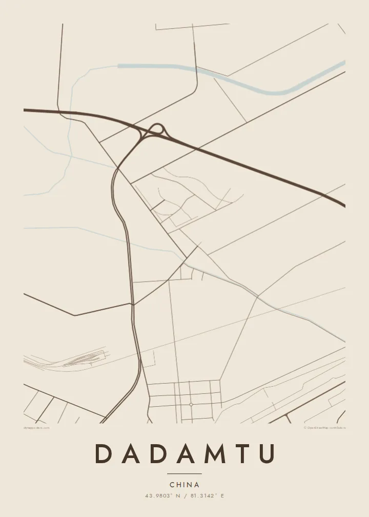
The title, subtitle and coordinates line can all be changed, so you can add names in any script or a meaningful date. Five styles are available: Classic black & white, Noir, Paper, Blueprint and Sand.
'Oda 'a e posita Dadamtu| Saisi paaki | Tuʻunga mahino | Ngaahi faile |
|---|---|---|
| 30 × 40 cm (11.8 × 15.7″) | 3,543 × 4,724 px | PNG · PDF |
| 29.7 × 42 cm (A3, 11.7 × 16.5″) | 3,508 × 4,961 px | PNG · PDF |
| 42 × 59.4 cm (A2, 16.5 × 23.4″) | 4,961 × 7,016 px | PNG · PDF |
| 45.7 × 61 cm (18 × 24″) | 5,400 × 7,200 px | PNG · PDF |
| 50 × 70 cm (19.7 × 27.6″) | 5,906 × 8,268 px | PNG · PDF |
| 61 × 91.4 cm (24 × 36″) | 7,200 × 10,800 px | PNG · PDF |
Ke fakafehoanaki, ko e sio fakamuʻa taʻetotongi ʻoku fālahi ʻaki ʻa e 900 px, ʻi ai hono fakaʻilonga-vai pea ki he ngaahi screen pē. ʻOku liunga 8 hono mahino ʻo e ngaahi faile HD ʻi he tafaʻaki kotoa pea ʻoku paaki lelei ʻi he saisi kakato ʻo e pōsitā.
Fili ha sitaile 'i he tumu'aki 'o e peesi, pea fili leva ha Posita Tā — ha lahi pea, kapau 'oku ke sai'ia, ha fa'o — pe ko e ngaahi Fa'ile Digital HD. Ko e Checkout ko e sitepu pē 'e taha, pea 'e fakafo'ou leva ho'o peesi 'oda 'i he taimi 'e a'u ai 'a e totongi.
'Oku tā ia 'i ha pepa matte 200 gsm mo'oni lelei taha, 'i ha taha 'o e ngaahi lahi 'e ono, mei he 30 × 40 cm ki he 24 × 36″. 'Oku kamata 'a e ngaahi posita kuo tā 'i he {printFrom}, kuo kau ai 'a e 'ave.
'Io. Fili ha fa'o 'akau mo'oni 'i he 'uli'uli, hina, oki fakanatula pe 'akau fu'u 'uli'uli. 'Oku fakataha mai mo ha sio'ata ta'emafesi pea kuo mateuteu ke tautau. 'Oku kamata 'a e ngaahi posita kuo fa'o 'i he {framedFrom}, kuo kau ai 'a e 'ave.
Ko e tuku atu ʻoku ʻataʻatā ʻi he māmani kātoa. ʻOku paaki ʻa e tohi ʻuluaki taki taha ʻe he tokotaha paaki ofi taha ʻo hotau kau paaki ʻi he fonua ʻe 30 tupu, pea ʻoku fakaʻaongaʻi ʻo aʻu mai ʻi he ʻaho ngāue ʻe 3–7. ʻE lava ke ke muimui ʻi he tuʻunga mo e fakahinohino ʻi he “Ngaahi Ōtā ʻOku Ou Fai”. ʻOku toe fiha fonua ʻoku fakaʻaongaʻi ʻi he uike ʻe 2–5, pea ʻi he ngaahi fonua ʻoku te teʻeki ke tau fakatau ki ai, ʻoku fakahā atu ʻe he sāite ia ki mu'a ke ke totongi.
'Ave mai ha foto kiate kimautolu 'i he lolotonga 'o e 'aho 'e 14 mei he taimi na'e a'u mai ai, pea te mau toe tā ia ta'etotongi pe toe totongi atu 'a ho'o pa'anga.
'Io. 'I he editor 'i he peesi ni, liliu 'a e kaveinga, 'a e kaveinga si'i mo e laine fakafuofua ki ha me'a pē 'oku ke sai'ia ai, pea fili ha sitaile mo ha lahi. Ko e ngaahi 'oda tā, fa'o mo digital kotoa 'oku ngāue'aki ai pē ho'o fakatātā tofu pē.
'I he totongi 'e $9 'oku ke ma'u ai 'a e ngaahi fa'ile PNG 300 DPI mo e PDF kuo mateuteu ki he tā 'i he lahi 'e ono kotoa, 'ikai ha fakaʻilonga vai, ke tā ai 'i ha feitu'u pē. Te ke kei ta'epau? Download muʻa ha sio muʻa ta'etotongi 'oku ai hano fakaʻilonga vai.
Ofi mai
