Rhine crossing
The Rhine flows out of the lake through the city, a broad band of water spanned by bridges that divides the old town from the northern districts.
Pōsitā mape sitaila faingofua · Siamane
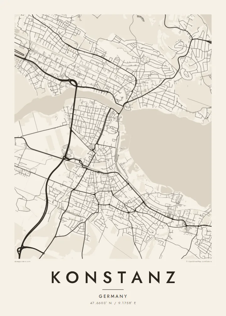
47.6603° N / 9.1758° E
An old town on the shore of Lake Constance, cut by the young Rhine and pressed right against the Swiss border.




Kolo ʻe taha, ongoʻi ʻe nima
Tuki ha sitaile ke sio ai 'i ho holisi. 'Oku tatau pē 'a e totongi 'o e sitaile kotoa pē — tā pepa, fa'o, pe ko e fa'ile HD.
 Pika mo'oni · fa'ile tā 24 × 36″
Mahino ke paaki
Ko ha konga 100% eni mei he fa'ile tā mo'oni. Ko e posita kotoa pē — tā pepa, fa'o, pe download — 'oku ngaohi 'i he'emau sāvā 'i he 300 DPI, 'o a'u ki he 7,200 × 10,800 pika, koe'uhi ke mahino lelei 'a e ngaahi hala si'isi'i taha 'i ha tā 24 × 36″.
'I he pā


Ko e mape
Few cities have a setting as legible from above as Konstanz. It sits on Lake Constance at the point where the Rhine leaves the upper lake, and the river splits the city into two parts joined by bridges. The medieval centre lies on the southern bank, and its streets run straight up to the international border with Kreuzlingen in Switzerland, so the map shows one continuous fabric divided by a line you cannot see.
That border helped save the old town. Konstanz was largely spared from bombing in the Second World War, and its dense, irregular street pattern survives around the minster and the harbour. Between 1414 and 1418 the city hosted the Council of Constance, the only papal election held north of the Alps, and the building where the council met still stands by the water.
North of the Rhine the city spreads across the Bodanrück peninsula, with the university on its hill and the flower island of Mainau, part of the municipality, off the northern shore. A Konstanz map poster brings all of this together: open lake, a river crossing and a compact historic core framed by water on nearly every side.
The Rhine flows out of the lake through the city, a broad band of water spanned by bridges that divides the old town from the northern districts.
South of the river the medieval centre forms a tight, irregular pattern of lanes around the minster, continuing without a break into neighbouring Kreuzlingen across the border.
Lake Constance wraps around the city on several sides, and its long shoreline, harbour and the island of Mainau give the map wide areas of calm open space.
Ke ʻaʻau pē
Tānaki ha ʻaho, ha hingoa pe ha laine ʻaʻau, pea liliu ʻa e sitaila, saisi pe tuʻunga.
Ko e sio muʻa ta'etotongi 'oku ma'ulalo hono lelei pea 'oku ai hano fakaʻilonga vai. Ko e ngaahi tā mo e fa'ile HD 'oku ngaohi 'i he 300 DPI, 'o a'u ki he 7,200 × 10,800 px, ta'e ha fakaʻilonga vai.
Ko e hā ʻa Konstanz
Konstanz is a university city and a place people come back to. A map of it suits former students, anyone who has lived on the lake or crossed the border here every day, and people who simply like a city defined so clearly by water.
Add the lake, a street or a graduation year to the title and subtitle, and keep or edit the coordinates line. The five styles include Blueprint and Paper, and the HD files for $9 come as 300 DPI PNG and print-ready PDF with no watermark.
'Oda 'a e posita Konstanz| Saisi paaki | Tuʻunga mahino | Ngaahi faile |
|---|---|---|
| 30 × 40 cm11.8 × 15.7″ | 3,543 × 4,724 px | PNG · PDF |
| 29.7 × 42 cm (A3)11.7 × 16.5″ | 3,508 × 4,961 px | PNG · PDF |
| 42 × 59.4 cm (A2)16.5 × 23.4″ | 4,961 × 7,016 px | PNG · PDF |
| 45.7 × 61 cm18 × 24″ | 5,400 × 7,200 px | PNG · PDF |
| 50 × 70 cm19.7 × 27.6″ | 5,906 × 8,268 px | PNG · PDF |
| 61 × 91.4 cm24 × 36″ | 7,200 × 10,800 px | PNG · PDF |
Ke fakafehoanaki, ko e sio fakamuʻa taʻetotongi ʻoku fālahi ʻaki ʻa e 900 px, ʻi ai hono fakaʻilonga-vai pea ki he ngaahi screen pē. ʻOku liunga 8 hono mahino ʻo e ngaahi faile HD ʻi he tafaʻaki kotoa pea ʻoku paaki lelei ʻi he saisi kakato ʻo e pōsitā.
Fili ha sitaile 'i he tumu'aki 'o e peesi, pea fili leva ha Posita Tā — ha lahi pea, kapau 'oku ke sai'ia, ha fa'o — pe ko e ngaahi Fa'ile Digital HD. Ko e Checkout ko e sitepu pē 'e taha, pea 'e fakafo'ou leva ho'o peesi 'oda 'i he taimi 'e a'u ai 'a e totongi.
'Oku tā ia 'i ha pepa matte 200 gsm mo'oni lelei taha, 'i ha taha 'o e ngaahi lahi 'e ono, mei he 30 × 40 cm ki he 24 × 36″. 'Oku kamata 'a e ngaahi posita kuo tā 'i he $39, kuo kau ai 'a e 'ave.
'Io. Fili ha fa'o 'akau mo'oni 'i he 'uli'uli, hina, oki fakanatula pe 'akau fu'u 'uli'uli. 'Oku fakataha mai mo ha sio'ata ta'emafesi pea kuo mateuteu ke tautau. 'Oku kamata 'a e ngaahi posita kuo fa'o 'i he $99, kuo kau ai 'a e 'ave.
ʻOku ʻataʻatā ʻa e fakaheka ki he ngaahi fonua ʻe 60+. ʻOku paaki ʻa e tuʻunga taki taha ʻe he tokotaha paaki ofi taha ʻo kitautolu ʻi he ngaahi fonua ʻe 30+, pea ʻoku maʻu angamaheni ia ʻi he ʻaho ngāue ʻe 3–7. ʻE lava ke ke muimui ki he tuʻunga mo e fakaʻilo ʻi he ʻOku ou Fakamaʻu. ʻOku toki ʻaho ʻe 2–5 uike ʻa e ngaahi fonua si'i, pea ʻi he ngaahi fonua ʻoku te teʻeki ke fakaheka ki ai, ʻoku fakahā atu ʻe he uepisaiti ʻi he ʻuluaki ʻo e totongi.
'Ave mai ha foto kiate kimautolu 'i he lolotonga 'o e 'aho 'e 14 mei he taimi na'e a'u mai ai, pea te mau toe tā ia ta'etotongi pe toe totongi atu 'a ho'o pa'anga.
'Io. 'I he editor 'i he peesi ni, liliu 'a e kaveinga, 'a e kaveinga si'i mo e laine fakafuofua ki ha me'a pē 'oku ke sai'ia ai, pea fili ha sitaile mo ha lahi. Ko e ngaahi 'oda tā, fa'o mo digital kotoa 'oku ngāue'aki ai pē ho'o fakatātā tofu pē.
'I he totongi 'e $9 'oku ke ma'u ai 'a e ngaahi fa'ile PNG 300 DPI mo e PDF kuo mateuteu ki he tā 'i he lahi 'e ono kotoa, 'ikai ha fakaʻilonga vai, ke tā ai 'i ha feitu'u pē. Te ke kei ta'epau? Download muʻa ha sio muʻa ta'etotongi 'oku ai hano fakaʻilonga vai.
Ofi mai
