The ferry crossing
The short ferry route between Lévis and Quebec City crosses one of the narrowest parts of the St. Lawrence, linking the two cities facing each other.
Pōsitā mape sitaila faingofua · Kānata
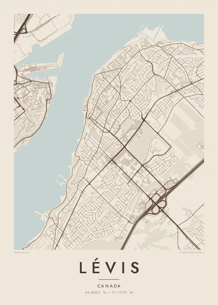
46.8033° N / 71.1779° W
A long shoreline city along the south bank of the St. Lawrence, facing the cliffs and old walls of Quebec City


Kolo ʻe taha, ongoʻi ʻe nima
Tuki ha sitaile ke sio ai 'i ho holisi. 'Oku tatau pē 'a e totongi 'o e sitaile kotoa pē — tā pepa, fa'o, pe ko e fa'ile HD.
 Pika mo'oni · fa'ile tā 24 × 36″
Mahino ke paaki
Ko ha konga 100% eni mei he fa'ile tā mo'oni. Ko e posita kotoa pē — tā pepa, fa'o, pe download — 'oku ngaohi 'i he'emau sāvā 'i he 300 DPI, 'o a'u ki he 7,200 × 10,800 pika, koe'uhi ke mahino lelei 'a e ngaahi hala si'isi'i taha 'i ha tā 24 × 36″.
'I he pā


Ko e mape
Lévis stretches along the south shore of the St. Lawrence River, directly across from Quebec City. On a map, the city is long and narrow in its older parts, following the river for many kilometres. A steep escarpment separates the lower waterfront from the upper town, and later neighbourhoods have spread inland across the plateau.
A ferry has linked Lévis to Quebec City for generations, and the crossing is a short trip across a narrow reach of the river. At the western end, the Quebec Bridge and the Pierre Laporte Bridge span the St. Lawrence close together. Lévis is also where Alphonse Desjardins founded the first caisse populaire in 1900, the origin of the Desjardins cooperative movement.
A Lévis map poster draws the south bank as a strong line of streets facing the wide river. The Chaudière River reaches the St. Lawrence to the west, and the two bridges add clean strokes across the water. If the frame is slightly wider, the old city of Quebec appears on the opposite shore.
The short ferry route between Lévis and Quebec City crosses one of the narrowest parts of the St. Lawrence, linking the two cities facing each other.
The Quebec Bridge and the Pierre Laporte Bridge cross the river side by side at the western end of the city, forming two parallel lines over the water.
A cliff separates the narrow riverside strip from the upper town, and roads climb it on steep curving routes that stand out against the grid above.
Ke ʻaʻau pē
Tānaki ha ʻaho, ha hingoa pe ha laine ʻaʻau, pea liliu ʻa e sitaila, saisi pe tuʻunga.
Ko e sio muʻa ta'etotongi 'oku ma'ulalo hono lelei pea 'oku ai hano fakaʻilonga vai. Ko e ngaahi tā mo e fa'ile HD 'oku ngaohi 'i he 300 DPI, 'o a'u ki he 7,200 × 10,800 px, ta'e ha fakaʻilonga vai.
Ko e hā ʻa Lévis
Lévis is often seen as the view of Quebec City, but for people who live there it is a city with its own identity. A map that puts its shoreline first gives the south bank the attention it deserves.
You can change the title, the subtitle and the coordinates line, in English or French. Five styles are available: Classic black and white, Noir, Paper, Blueprint and Sand. Noir makes the river an especially deep, dramatic band.
'Oda 'a e posita Lévis| Saisi paaki | Tuʻunga mahino | Ngaahi faile |
|---|---|---|
| 30 × 40 cm (11.8 × 15.7″) | 3,543 × 4,724 px | PNG · PDF |
| 29.7 × 42 cm (A3, 11.7 × 16.5″) | 3,508 × 4,961 px | PNG · PDF |
| 42 × 59.4 cm (A2, 16.5 × 23.4″) | 4,961 × 7,016 px | PNG · PDF |
| 45.7 × 61 cm (18 × 24″) | 5,400 × 7,200 px | PNG · PDF |
| 50 × 70 cm (19.7 × 27.6″) | 5,906 × 8,268 px | PNG · PDF |
| 61 × 91.4 cm (24 × 36″) | 7,200 × 10,800 px | PNG · PDF |
Ke fakafehoanaki, ko e sio fakamuʻa taʻetotongi ʻoku fālahi ʻaki ʻa e 900 px, ʻi ai hono fakaʻilonga-vai pea ki he ngaahi screen pē. ʻOku liunga 8 hono mahino ʻo e ngaahi faile HD ʻi he tafaʻaki kotoa pea ʻoku paaki lelei ʻi he saisi kakato ʻo e pōsitā.
Fili ha sitaile 'i he tumu'aki 'o e peesi, pea fili leva ha Posita Tā — ha lahi pea, kapau 'oku ke sai'ia, ha fa'o — pe ko e ngaahi Fa'ile Digital HD. Ko e Checkout ko e sitepu pē 'e taha, pea 'e fakafo'ou leva ho'o peesi 'oda 'i he taimi 'e a'u ai 'a e totongi.
'Oku tā ia 'i ha pepa matte 200 gsm mo'oni lelei taha, 'i ha taha 'o e ngaahi lahi 'e ono, mei he 30 × 40 cm ki he 24 × 36″. 'Oku kamata 'a e ngaahi posita kuo tā 'i he {printFrom}, kuo kau ai 'a e 'ave.
'Io. Fili ha fa'o 'akau mo'oni 'i he 'uli'uli, hina, oki fakanatula pe 'akau fu'u 'uli'uli. 'Oku fakataha mai mo ha sio'ata ta'emafesi pea kuo mateuteu ke tautau. 'Oku kamata 'a e ngaahi posita kuo fa'o 'i he {framedFrom}, kuo kau ai 'a e 'ave.
'Oku ta'etotongi 'a e 'ave 'i māmani kotoa. 'Oku tā 'a e posita taki taha 'e homau kaungāfakatau tā ofi taha 'i he ngaahi fonua 'e laka hake he 30, pea 'oku a'u lelei ia 'i he 'aho ngāue 'e 3–7. 'E lava ke ke sio ki hono tu'unga mo hono 'ave 'i lalo 'i he'eku Ngaahi 'Oda.
'Ave mai ha foto kiate kimautolu 'i he lolotonga 'o e 'aho 'e 14 mei he taimi na'e a'u mai ai, pea te mau toe tā ia ta'etotongi pe toe totongi atu 'a ho'o pa'anga.
'Io. 'I he editor 'i he peesi ni, liliu 'a e kaveinga, 'a e kaveinga si'i mo e laine fakafuofua ki ha me'a pē 'oku ke sai'ia ai, pea fili ha sitaile mo ha lahi. Ko e ngaahi 'oda tā, fa'o mo digital kotoa 'oku ngāue'aki ai pē ho'o fakatātā tofu pē.
'I he totongi 'e $9 'oku ke ma'u ai 'a e ngaahi fa'ile PNG 300 DPI mo e PDF kuo mateuteu ki he tā 'i he lahi 'e ono kotoa, 'ikai ha fakaʻilonga vai, ke tā ai 'i ha feitu'u pē. Te ke kei ta'epau? Download muʻa ha sio muʻa ta'etotongi 'oku ai hano fakaʻilonga vai.
Ofi mai
