Volcanic spine
A chain of peaks runs along the centre of the island, so the land drops away steeply on both sides toward the Pacific and the Sea of Okhotsk.
Pōsitā mape sitaila faingofua · Lūsia
45.9002° N / 149.9840° E
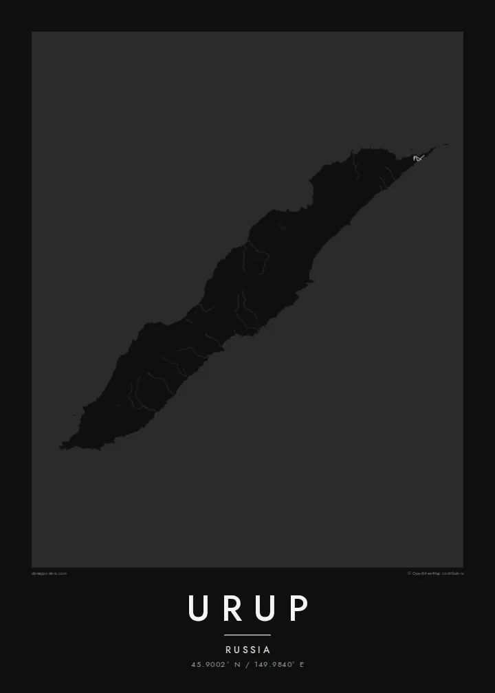
A long, narrow volcanic ridge in the central Kurils, stretched northeast between the Sea of Okhotsk and the Pacific.



Kolo ʻe taha, ongoʻi ʻe nima
Tuki ha sitaile ke sio ai 'i ho holisi. 'Oku tatau pē 'a e totongi 'o e sitaile kotoa pē — tā pepa, fa'o, pe ko e fa'ile HD.
 Pika mo'oni · fa'ile tā 24 × 36″
Mahino ke paaki
Ko ha konga 100% eni mei he fa'ile tā mo'oni. Ko e posita kotoa pē — tā pepa, fa'o, pe download — 'oku ngaohi 'i he'emau sāvā 'i he 300 DPI, 'o a'u ki he 7,200 × 10,800 pika, koe'uhi ke mahino lelei 'a e ngaahi hala si'isi'i taha 'i ha tā 24 × 36″.
'I he pā


Ko e mape
Urup is one of the larger islands of the Kuril chain, the arc of volcanic islands that runs from Hokkaido to Kamchatka. It lies northeast of Iturup, separated from it by the Vries Strait. Today it is administered by Russia and has no permanent population, which makes it one of the emptier places in an already sparsely settled region.
The island is long and slender, running from southwest to northeast, with a mountainous spine of volcanoes along its length. One side faces the open Pacific and the other the Sea of Okhotsk. Both coasts are steep, broken by small bays and river mouths. An Urup map poster is shaped almost entirely by that stretched, ridged form.
Like much of the Kurils, Urup has a layered past of Ainu, Russian and Japanese presence. Over the centuries, hunters and traders came here, drawn partly by sea otters and fur seals. With no real road network, the map is left to coastline and water: a clean line drawn diagonally across a cold northern sea.
A chain of peaks runs along the centre of the island, so the land drops away steeply on both sides toward the Pacific and the Sea of Okhotsk.
To the southwest, a strait separates Urup from Iturup, marking the end of the island and the start of the next link in the Kuril chain.
With the Pacific on one side and the Sea of Okhotsk on the other, the narrow outline sits diagonally across open water on the sheet.
Ke ʻaʻau pē
Tānaki ha ʻaho, ha hingoa pe ha laine ʻaʻau, pea liliu ʻa e sitaila, saisi pe tuʻunga.
Ko e sio muʻa ta'etotongi 'oku ma'ulalo hono lelei pea 'oku ai hano fakaʻilonga vai. Ko e ngaahi tā mo e fa'ile HD 'oku ngaohi 'i he 300 DPI, 'o a'u ki he 7,200 × 10,800 px, ta'e ha fakaʻilonga vai.
Ko e hā ʻa Urup
Urup is a map for people drawn to remote coasts and island arcs: geographers, sailors, people who have travelled or worked in the Kurils, and collectors of places few will ever visit. Its long diagonal shape makes a bold, simple print.
Add your own title, subtitle and coordinates line, and choose Classic black & white, Noir, Paper, Blueprint or Sand. Blueprint suits the island's spare, chart-like character. HD files cost $9 and include six sizes, each as a 300 DPI PNG and a print-ready PDF, or you can order a matte print.
'Oda 'a e posita Urup| Saisi paaki | Tuʻunga mahino | Ngaahi faile |
|---|---|---|
| 30 × 40 cm (11.8 × 15.7″) | 3,543 × 4,724 px | PNG · PDF |
| 29.7 × 42 cm (A3, 11.7 × 16.5″) | 3,508 × 4,961 px | PNG · PDF |
| 42 × 59.4 cm (A2, 16.5 × 23.4″) | 4,961 × 7,016 px | PNG · PDF |
| 45.7 × 61 cm (18 × 24″) | 5,400 × 7,200 px | PNG · PDF |
| 50 × 70 cm (19.7 × 27.6″) | 5,906 × 8,268 px | PNG · PDF |
| 61 × 91.4 cm (24 × 36″) | 7,200 × 10,800 px | PNG · PDF |
Ke fakafehoanaki, ko e sio fakamuʻa taʻetotongi ʻoku fālahi ʻaki ʻa e 900 px, ʻi ai hono fakaʻilonga-vai pea ki he ngaahi screen pē. ʻOku liunga 8 hono mahino ʻo e ngaahi faile HD ʻi he tafaʻaki kotoa pea ʻoku paaki lelei ʻi he saisi kakato ʻo e pōsitā.
Fili ha sitaile 'i he tumu'aki 'o e peesi, pea fili leva ha Posita Tā — ha lahi pea, kapau 'oku ke sai'ia, ha fa'o — pe ko e ngaahi Fa'ile Digital HD. Ko e Checkout ko e sitepu pē 'e taha, pea 'e fakafo'ou leva ho'o peesi 'oda 'i he taimi 'e a'u ai 'a e totongi.
'Oku tā ia 'i ha pepa matte 200 gsm mo'oni lelei taha, 'i ha taha 'o e ngaahi lahi 'e ono, mei he 30 × 40 cm ki he 24 × 36″. 'Oku kamata 'a e ngaahi posita kuo tā 'i he {printFrom}, kuo kau ai 'a e 'ave.
'Io. Fili ha fa'o 'akau mo'oni 'i he 'uli'uli, hina, oki fakanatula pe 'akau fu'u 'uli'uli. 'Oku fakataha mai mo ha sio'ata ta'emafesi pea kuo mateuteu ke tautau. 'Oku kamata 'a e ngaahi posita kuo fa'o 'i he {framedFrom}, kuo kau ai 'a e 'ave.
Ko e tuku atu ʻoku ʻataʻatā ʻi he māmani kātoa. ʻOku paaki ʻa e tohi ʻuluaki taki taha ʻe he tokotaha paaki ofi taha ʻo hotau kau paaki ʻi he fonua ʻe 30 tupu, pea ʻoku fakaʻaongaʻi ʻo aʻu mai ʻi he ʻaho ngāue ʻe 3–7. ʻE lava ke ke muimui ʻi he tuʻunga mo e fakahinohino ʻi he “Ngaahi Ōtā ʻOku Ou Fai”. ʻOku toe fiha fonua ʻoku fakaʻaongaʻi ʻi he uike ʻe 2–5, pea ʻi he ngaahi fonua ʻoku te teʻeki ke tau fakatau ki ai, ʻoku fakahā atu ʻe he sāite ia ki mu'a ke ke totongi.
'Ave mai ha foto kiate kimautolu 'i he lolotonga 'o e 'aho 'e 14 mei he taimi na'e a'u mai ai, pea te mau toe tā ia ta'etotongi pe toe totongi atu 'a ho'o pa'anga.
'Io. 'I he editor 'i he peesi ni, liliu 'a e kaveinga, 'a e kaveinga si'i mo e laine fakafuofua ki ha me'a pē 'oku ke sai'ia ai, pea fili ha sitaile mo ha lahi. Ko e ngaahi 'oda tā, fa'o mo digital kotoa 'oku ngāue'aki ai pē ho'o fakatātā tofu pē.
'I he totongi 'e $9 'oku ke ma'u ai 'a e ngaahi fa'ile PNG 300 DPI mo e PDF kuo mateuteu ki he tā 'i he lahi 'e ono kotoa, 'ikai ha fakaʻilonga vai, ke tā ai 'i ha feitu'u pē. Te ke kei ta'epau? Download muʻa ha sio muʻa ta'etotongi 'oku ai hano fakaʻilonga vai.
