Lake Senba
The lake forms a large, smooth oval on the southwest side of the centre. Its shores are lined with walking paths and connect directly to the green of Kairakuen.
Minimalist harita posteri · Japonya
36.3500° N / 140.4500° E
A castle town on a narrow plateau between a river and a lake, with a famous plum garden on its western edge.


Tek şehir, beş farklı hava
Bir stili duvarda görmek için dokun. Tüm stiller aynı fiyat — baskı, çerçeveli veya HD dosya olarak.
 Gerçek piksel boyutu · 24 × 36″ baskı dosyası
Baskıda keskin
Bu, gerçek baskı dosyasından %100 oranında bir kırpma. Her poster — baskı, çerçeveli veya indirilen — sunucularımızda 300 DPI'de, 7,200 × 10,800 piksele kadar oluşturulur; böylece en ince sokaklar bile 24 × 36″ baskıda keskin kalır.
Duvarda


Harita
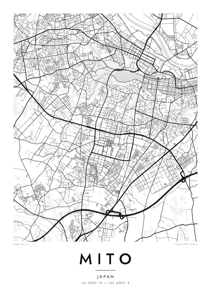
Mito, the capital of Ibaraki Prefecture, grew on a long, narrow plateau. The Naka River runs to the north and Lake Senba lies to the south and west. From above, that setting shapes the whole map. The old centre follows the ridge from east to west, with the river's floodplain on one side and the water and parkland of the lake on the other.
In the Edo period Mito was the seat of one of the three senior branches of the Tokugawa family. Its best-known landmark from that era is Kairakuen, a large garden created in the 1840s and counted among the three great gardens of Japan. It is especially famous for its thousands of plum trees, which bloom in late winter.
A Mito map poster shows the city's unusual long shape. The main streets run along the plateau, the rail lines follow the lowlands, and the broad oval of Lake Senba joins the green of Kairakuen to the west. Modern suburbs spread across the surrounding plains, but the old outline of the castle town is still easy to trace.
The lake forms a large, smooth oval on the southwest side of the centre. Its shores are lined with walking paths and connect directly to the green of Kairakuen.
The famous plum garden occupies a broad open area on the western edge of the old town, overlooking the lake. On the map it appears as a green gap in the streets.
The main streets of the historic centre run along a narrow ridge between river and lake. Together they give the city its long east–west form.
Size özel yapın
Bir tarih, bir isim ya da kendi cümlenizi ekleyin; stili, boyutu veya yönü değiştirin.
Ücretsiz önizleme düşük çözünürlüklü ve filigranlıdır. Baskılar ve HD dosyalar filigransız olarak 300 DPI'de, 7,200 × 10,800 px'e kadar oluşturulur.
Neden Mito
For people from Ibaraki and anyone who has seen the plum blossom at Kairakuen, this map records the city's defining shape. The lake, garden and plateau sit together in one balanced frame.
Personalise the title, subtitle and coordinates, perhaps with a season or year. Choose one of five styles: Classic black & white, Noir, Paper, Blueprint or Sand. Paper suits the garden-and-lake setting especially well.
Mito posterini sipariş et| Baskı boyutu | Çözünürlük | Dosyalar |
|---|---|---|
| 30 × 40 cm (11.8 × 15.7″) | 3,543 × 4,724 px | PNG · PDF |
| 29.7 × 42 cm (A3, 11.7 × 16.5″) | 3,508 × 4,961 px | PNG · PDF |
| 42 × 59.4 cm (A2, 16.5 × 23.4″) | 4,961 × 7,016 px | PNG · PDF |
| 45.7 × 61 cm (18 × 24″) | 5,400 × 7,200 px | PNG · PDF |
| 50 × 70 cm (19.7 × 27.6″) | 5,906 × 8,268 px | PNG · PDF |
| 61 × 91.4 cm (24 × 36″) | 7,200 × 10,800 px | PNG · PDF |
Karşılaştırma için: ücretsiz önizleme 900 piksel genişliğinde, filigranlı ve ekranlar için tasarlanmıştır. HD dosyalar her yönde 8 kata kadar daha yüksek çözünürlüğe sahiptir ve tam poster boyutunda temiz basılır.
Sayfanın üst kısmından bir stil seç, ardından Baskılı Poster — bir boyut ve istersen bir çerçeve — ya da Dijital HD Dosyalar seçeneğini işaretle. Ödeme tek adımda tamamlanır ve ödeme onaylanır onaylanmaz sipariş sayfan güncellenir.
Premium 200 gsm mat kağıda, 30 × 40 cm'den 24 × 36″'a kadar altı boyuttan birinde basılır. Baskılı posterler {printFrom} fiyatından başlar, kargo dahil.
Evet. Siyah, beyaz, doğal meşe veya koyu ahşap renginde masif ahşap bir çerçeve seçebilirsin. Kırılmaz cam ile gelir ve asmaya hazırdır. Çerçeveli posterler {framedFrom} fiyatından başlar, kargo dahil.
Kargo dünya genelinde ücretsizdir. Her poster, 30'dan fazla ülkedeki baskı ortaklarımızdan sana en yakın olanında basılır ve genellikle 3-7 iş günü içinde ulaşır. Durumu ve kargo takibini Siparişlerim bölümünden takip edebilirsin.
Teslimattan itibaren 14 gün içinde bize bir fotoğraf gönder, posterini ücretsiz olarak yeniden basalım ya da ücretini iade edelim.
Evet. Bu sayfadaki düzenleyicide başlığı, alt başlığı ve koordinat satırını istediğin gibi değiştirebilir, bir stil ve boyut seçebilirsin. Baskılı, çerçeveli ve dijital siparişlerin hepsi tam olarak senin tasarımını kullanır.
$9 karşılığında, filigransız, istediğin yerde bastırabileceğin, altı boyutun tamamında 300 DPI PNG ve baskıya hazır PDF dosyaları alırsın. Henüz emin değil misin? Önce ücretsiz, filigranlı bir önizleme indir.
Yakındakiler
