Museum Island
The northern end of the Spree island holds five major museums between two arms of the river. It is a compact shape, recognizable on any map of Berlin.
Minimalist harita posteri · Almanya
52.5222° N / 13.3977° E
The Spree splits around Museum Island while Unter den Linden draws a straight line west to the Brandenburg Gate.


Tek şehir, beş farklı hava
Bir stili duvarda görmek için dokun. Tüm stiller aynı fiyat — baskı, çerçeveli veya HD dosya olarak.
 Gerçek piksel boyutu · 24 × 36″ baskı dosyası
Baskıda keskin
Bu, gerçek baskı dosyasından %100 oranında bir kırpma. Her poster — baskı, çerçeveli veya indirilen — sunucularımızda 300 DPI'de, 7,200 × 10,800 piksele kadar oluşturulur; böylece en ince sokaklar bile 24 × 36″ baskıda keskin kalır.
Duvarda


Harita
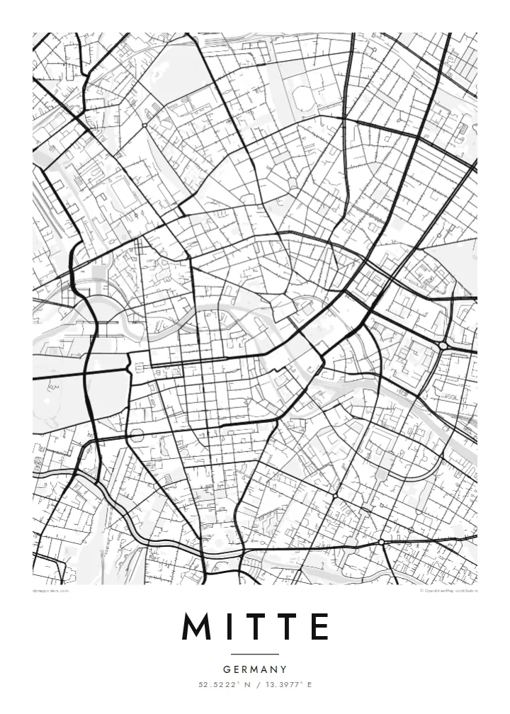
Mitte is Berlin's historic core, and its map is organized around the Spree. The river divides into two arms here, enclosing an island whose northern tip holds Museum Island, a UNESCO World Heritage ensemble of five museums. West of the water, Unter den Linden runs in a broad straight line to the Brandenburg Gate and the Tiergarten. Friedrichstraße crosses it on a long north–south axis.
East of the river, the plan changes. Alexanderplatz opens as a large irregular space beneath the television tower, completed in 1969, and wide postwar boulevards replace the older baroque grid. The Berlin Wall ran along much of Mitte's western and southern edges. You can still trace its former line where newer buildings fill strips that once stood empty.
A Mitte map poster brings these layers together on one sheet: the curving river, the ordered blocks of Friedrichstadt south of Unter den Linden, squares such as Gendarmenmarkt, and the looser plan around Alexanderplatz. The center of the image is dense and opens toward the park on one side, which gives the composition a natural sense of weight.
The northern end of the Spree island holds five major museums between two arms of the river. It is a compact shape, recognizable on any map of Berlin.
A wide tree-lined boulevard runs from the island west to the Brandenburg Gate. It is one of the clearest straight lines in the city.
Within the Friedrichstadt grid, this square framed by two domed churches and a concert hall stands out as a precise open rectangle among regular blocks.
Size özel yapın
Bir tarih, bir isim ya da kendi cümlenizi ekleyin; stili, boyutu veya yönü değiştirin.
Ücretsiz önizleme düşük çözünürlüklü ve filigranlıdır. Baskılar ve HD dosyalar filigransız olarak 300 DPI'de, 7,200 × 10,800 px'e kadar oluşturulur.
Neden Mitte
Mitte is where many visitors first meet Berlin, and where many residents work, study or first settle. Its map carries the city's divided past without spelling it out, which makes it a thoughtful piece for a wall.
You can personalize the title and subtitle with a year or an address, and keep or edit the coordinates. Choose one of five styles. Blueprint suits the river and the grid especially well. Download the files for $9 or order a printed poster.
Mitte posterini sipariş et| Baskı boyutu | Çözünürlük | Dosyalar |
|---|---|---|
| 30 × 40 cm (11.8 × 15.7″) | 3,543 × 4,724 px | PNG · PDF |
| 29.7 × 42 cm (A3, 11.7 × 16.5″) | 3,508 × 4,961 px | PNG · PDF |
| 42 × 59.4 cm (A2, 16.5 × 23.4″) | 4,961 × 7,016 px | PNG · PDF |
| 45.7 × 61 cm (18 × 24″) | 5,400 × 7,200 px | PNG · PDF |
| 50 × 70 cm (19.7 × 27.6″) | 5,906 × 8,268 px | PNG · PDF |
| 61 × 91.4 cm (24 × 36″) | 7,200 × 10,800 px | PNG · PDF |
Karşılaştırma için: ücretsiz önizleme 900 piksel genişliğinde, filigranlı ve ekranlar için tasarlanmıştır. HD dosyalar her yönde 8 kata kadar daha yüksek çözünürlüğe sahiptir ve tam poster boyutunda temiz basılır.
Sayfanın üst kısmından bir stil seç, ardından Baskılı Poster — bir boyut ve istersen bir çerçeve — ya da Dijital HD Dosyalar seçeneğini işaretle. Ödeme tek adımda tamamlanır ve ödeme onaylanır onaylanmaz sipariş sayfan güncellenir.
Premium 200 gsm mat kağıda, 30 × 40 cm'den 24 × 36″'a kadar altı boyuttan birinde basılır. Baskılı posterler {printFrom} fiyatından başlar, kargo dahil.
Evet. Siyah, beyaz, doğal meşe veya koyu ahşap renginde masif ahşap bir çerçeve seçebilirsin. Kırılmaz cam ile gelir ve asmaya hazırdır. Çerçeveli posterler {framedFrom} fiyatından başlar, kargo dahil.
Kargo dünya genelinde ücretsizdir. Her poster, 30'dan fazla ülkedeki baskı ortaklarımızdan sana en yakın olanında basılır ve genellikle 3-7 iş günü içinde ulaşır. Durumu ve kargo takibini Siparişlerim bölümünden takip edebilirsin.
Teslimattan itibaren 14 gün içinde bize bir fotoğraf gönder, posterini ücretsiz olarak yeniden basalım ya da ücretini iade edelim.
Evet. Bu sayfadaki düzenleyicide başlığı, alt başlığı ve koordinat satırını istediğin gibi değiştirebilir, bir stil ve boyut seçebilirsin. Baskılı, çerçeveli ve dijital siparişlerin hepsi tam olarak senin tasarımını kullanır.
$9 karşılığında, filigransız, istediğin yerde bastırabileceğin, altı boyutun tamamında 300 DPI PNG ve baskıya hazır PDF dosyaları alırsın. Henüz emin değil misin? Önce ücretsiz, filigranlı bir önizleme indir.
Yakındakiler
