Straight plain roads
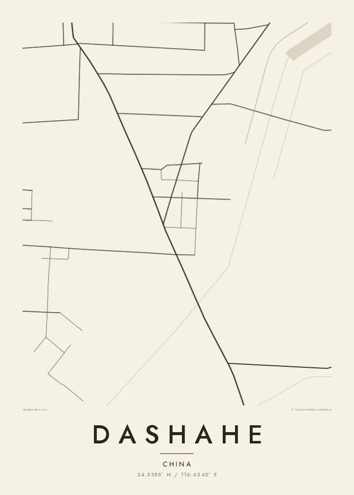
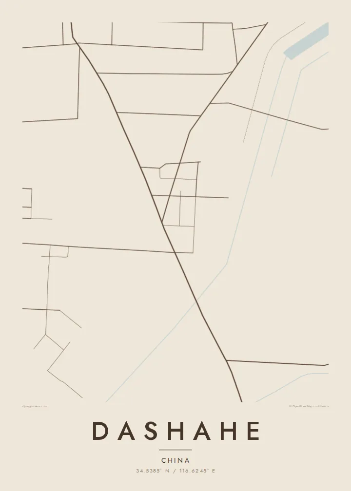
Main roads cross the flat countryside in long straight lines, meeting at the town centre and giving the map a strong linear framework.
Pousita mape faigofie · China
34.5385° N / 116.6245° E
A farming town on the flat north Jiangsu plain, laid out in straight roads between fields and orchards



Taone e tasi, lagona e lima
Pau te tapaki o se style ke lavea i luga i te puipui. E tutasi te tau o style takitasi — telotele mo faaki, e aunoa io me fai ki faila HD.
 Pixel tonu · faila lolomi 24 × 36″
Manino ki te lomiga
Tenei se 100% mai te faila lolomi tonu. Poster takitasi — telotele, faaki io me download — e faite i luga i a matou server i te 300 DPI, e oko atu ki 7,200 × 10,800 pixel, ko ala e maofio ei mo maiga vaega foliki i luga i te lolomi 24 × 36″.
I te pakitala


Te mape
Dashahe lies in the far north-west of Jiangsu, in the countryside around Xuzhou, close to where the province meets Shandong, Henan and Anhui. The land here is the North China Plain at its flattest, shaped over centuries by the shifting course of the Yellow River, whose old bed still crosses this part of the province.
The map reflects that terrain. Roads run in long straight lines, fields form a rectilinear patchwork, and the town itself is a compact cluster of blocks where the main routes intersect. Villages are scattered across the plain at regular distances, each a small knot of buildings among the farmland.
A Dashahe map poster presents that geometry with clarity. In monochrome, the grid of fields, the linear roads and the dense centre combine into an almost abstract composition, a portrait of a rural Chinese town defined by the land around it.
Main roads cross the flat countryside in long straight lines, meeting at the town centre and giving the map a strong linear framework.
Farmland surrounds the town in regular rectangular plots, creating a fine grid texture that fills much of the poster around the built-up area.
The plain here was formed by the historic Yellow River, whose former channel runs through this corner of Jiangsu and still marks the landscape.
Fai ke fakatau ki a koe
Fakaopoopo se aso, se igoa io me se fuaiupu o koe, sui te sitaila, te lasi io me te tuuga.
Te preview fua e maulalo te malamalama kae iai se watermark. Poster telotele mo faila HD e faite i te 300 DPI, e oko atu ki 7,200 × 10,800 px, aunoa mo se watermark.
Kaia a Dashahe
For people who grew up in Dashahe and now live in larger cities, this map is a way to keep the home town and its fields present. Its orderly lines also suit anyone who likes maps that feel close to graphic design.
You can set your own title, subtitle and coordinates line and choose Classic black & white, Noir, Paper, Blueprint or Sand. Files in six sizes, 300 DPI PNG and PDF, cost $9, and printed posters are available too.
Otaina te poster Dashahe| Lasi o te lomiga | Manino | Faila |
|---|---|---|
| 30 × 40 cm11.8 × 15.7″ | 3,543 × 4,724 px | PNG · PDF |
| 29.7 × 42 cm (A3)11.7 × 16.5″ | 3,508 × 4,961 px | PNG · PDF |
| 42 × 59.4 cm (A2)16.5 × 23.4″ | 4,961 × 7,016 px | PNG · PDF |
| 45.7 × 61 cm18 × 24″ | 5,400 × 7,200 px | PNG · PDF |
| 50 × 70 cm19.7 × 27.6″ | 5,906 × 8,268 px | PNG · PDF |
| 61 × 91.4 cm24 × 36″ | 7,200 × 10,800 px | PNG · PDF |
Ke fakatusa, a te ata fakataitai fua e 900 px te lautele, mo te fakailoga kae mo lau lavea i luga i te komipiuta. A faila HD e oko ki te 8× te manino i itu katoa kae lomi faka‵lei i te lasi katoa o te pousita.
Filifili se style i te pito i luga o te itulau, kae filifili Poster Telotele — se lasi mo se faaki manafai e manako koe — io me Faila Digital HD. E tasi te sitepu mo te checkout, kae ka fakafou te itulau o tau ota i te taimi e mafai ei te totogi.
E telotele i luga o te pepa vali gali 200 gsm i se tasi mai lasi e ono, mai te 30 × 40 cm ki te 24 × 36″. E kamata te poster telotele mai i te $39, kae aofia ei te uta.
Ioe. Filifili se faaki lakau maoli i te kulokula, tea, oak maoli io me lakau pogisa. E oo mai ki tioata e se malepe kae toka ke tautau. E kamata te poster faaki mai i te $99, kae aofia ei te uta.
E tuku fua ki fenua e 60+. A poloaiga taki tasi e ta ne te tauhaga e latalata mai i a matou tauhaga ta i fenua e 30+, kae e masani o aunoa i aso galue e 3–7. E mafai o salasala te tulaga mo te sukesuke i lalo o Aku poloaiga. I nisi fenua e 2–5 vaiaso, kae i mea e seki tuku atu ei matou, e fakailoa atu e te mea tafaoga i mua o te totogi.
Auina mai se ata i loto i te 14 aso mai te taimi e oko ei kae ka toe telotele fua ne matou io me toe totogi atu tau tupe.
Ioe. I te editor i te itulau tenei, sui te ulutala, te ulutala lalo mo te laina o coordinate ki so se mea e manako koe, kae filifili se style mo se lasi. Oga telotele, faaki mo digital e faigana katoa i tau tusiga tonu.
Mo te $9 ka maua ne koe faila PNG 300 DPI mo PDF fakatoka lolomi i lasi e ono katoa, aunoa mo se watermark, ke lolomi i so se koga. E se mautinoa koe? Download muamua se preview fua e iai te watermark.
