Connaught Place
A circular commercial centre built as concentric rings of colonnaded buildings, with roads radiating outward. It is one of the most recognisable geometric shapes in the city.
Pousita mape faigofie · India
28.6519° N / 77.2315° E
A river city of layered capitals, from the walled lanes of Shahjahanabad to the radial avenues of New Delhi


Taone e tasi, lagona e lima
Pau te tapaki o se style ke lavea i luga i te puipui. E tutasi te tau o style takitasi — telotele mo faaki, e aunoa io me fai ki faila HD.
 Pixel tonu · faila lolomi 24 × 36″
Manino ki te lomiga
Tenei se 100% mai te faila lolomi tonu. Poster takitasi — telotele, faaki io me download — e faite i luga i a matou server i te 300 DPI, e oko atu ki 7,200 × 10,800 pixel, ko ala e maofio ei mo maiga vaega foliki i luga i te lolomi 24 × 36″.
I te pakitala


Te mape
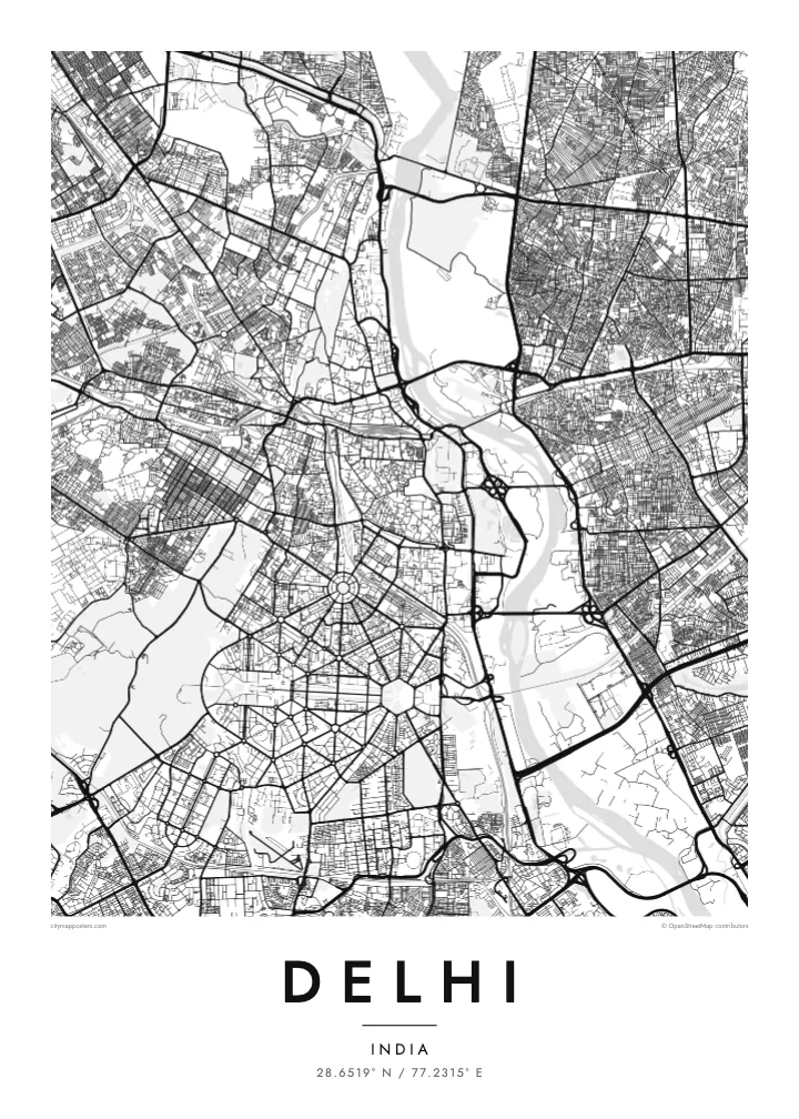
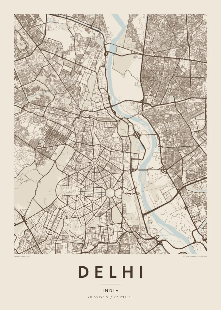
Delhi spreads mainly along the western bank of the Yamuna River, with the forested Ridge, an old extension of the Aravalli hills, running through it from north to south. The city is built in layers, each capital placed beside the last, so the map shows distinct patterns side by side: medieval ruins to the south, the Mughal walled city to the north, and the ordered avenues of New Delhi in between.
Shahjahanabad, now Old Delhi, is a dense web of lanes around the Red Fort and the Jama Masjid, with Chandni Chowk running straight through it. To the south, New Delhi was laid out in the 1910s and 1920s with broad tree-lined avenues, roundabouts and hexagonal blocks. Connaught Place forms a set of concentric circles, and Kartavya Path runs east from Rashtrapati Bhavan to India Gate.
Three UNESCO World Heritage Sites lie within the city: the Red Fort Complex, Humayun’s Tomb and the Qutb Minar with its monuments. A Delhi map poster brings together the contrasts between these eras, the organic lanes of Old Delhi and the formal geometry of the colonial capital, framed by the Ring Road and the Yamuna.
A circular commercial centre built as concentric rings of colonnaded buildings, with roads radiating outward. It is one of the most recognisable geometric shapes in the city.
The ceremonial avenue, formerly Rajpath, runs in a straight line between Rashtrapati Bhavan and India Gate, flanked by lawns and water channels, forming the central axis of New Delhi.
Around the Red Fort and Chandni Chowk, a tight network of lanes and bazaars fills the former walled city, creating the finest, densest texture anywhere on the map.
Fai ke fakatau ki a koe
Fakaopoopo se aso, se igoa io me se fuaiupu o koe, sui te sitaila, te lasi io me te tuuga.
Te preview fua e maulalo te malamalama kae iai se watermark. Poster telotele mo faila HD e faite i te 300 DPI, e oko atu ki 7,200 × 10,800 px, aunoa mo se watermark.
Kaia a Delhi
Delhi is a city of neighbourhoods and memories: a family house in Old Delhi, college years on the North Campus, a first flat somewhere in the south. A map poster keeps those places in one frame and shows how they connect.
Title it Delhi, New Delhi or the name of your colony, and add a subtitle with a date or a message. Edit the coordinates line as you like, and choose from Classic black & white, Noir, Paper, Blueprint and Sand in any of six print sizes.
Otaina te poster Delhi| Lasi o te lomiga | Manino | Faila |
|---|---|---|
| 30 × 40 cm11.8 × 15.7″ | 3,543 × 4,724 px | PNG · PDF |
| 29.7 × 42 cm (A3)11.7 × 16.5″ | 3,508 × 4,961 px | PNG · PDF |
| 42 × 59.4 cm (A2)16.5 × 23.4″ | 4,961 × 7,016 px | PNG · PDF |
| 45.7 × 61 cm18 × 24″ | 5,400 × 7,200 px | PNG · PDF |
| 50 × 70 cm19.7 × 27.6″ | 5,906 × 8,268 px | PNG · PDF |
| 61 × 91.4 cm24 × 36″ | 7,200 × 10,800 px | PNG · PDF |
Ke fakatusa, a te ata fakataitai fua e 900 px te lautele, mo te fakailoga kae mo lau lavea i luga i te komipiuta. A faila HD e oko ki te 8× te manino i itu katoa kae lomi faka‵lei i te lasi katoa o te pousita.
Filifili se style i te pito i luga o te itulau, kae filifili Poster Telotele — se lasi mo se faaki manafai e manako koe — io me Faila Digital HD. E tasi te sitepu mo te checkout, kae ka fakafou te itulau o tau ota i te taimi e mafai ei te totogi.
E telotele i luga o te pepa vali gali 200 gsm i se tasi mai lasi e ono, mai te 30 × 40 cm ki te 24 × 36″. E kamata te poster telotele mai i te $39, kae aofia ei te uta.
Ioe. Filifili se faaki lakau maoli i te kulokula, tea, oak maoli io me lakau pogisa. E oo mai ki tioata e se malepe kae toka ke tautau. E kamata te poster faaki mai i te $99, kae aofia ei te uta.
E tuku fua ki fenua e 60+. A poloaiga taki tasi e ta ne te tauhaga e latalata mai i a matou tauhaga ta i fenua e 30+, kae e masani o aunoa i aso galue e 3–7. E mafai o salasala te tulaga mo te sukesuke i lalo o Aku poloaiga. I nisi fenua e 2–5 vaiaso, kae i mea e seki tuku atu ei matou, e fakailoa atu e te mea tafaoga i mua o te totogi.
Auina mai se ata i loto i te 14 aso mai te taimi e oko ei kae ka toe telotele fua ne matou io me toe totogi atu tau tupe.
Ioe. I te editor i te itulau tenei, sui te ulutala, te ulutala lalo mo te laina o coordinate ki so se mea e manako koe, kae filifili se style mo se lasi. Oga telotele, faaki mo digital e faigana katoa i tau tusiga tonu.
Mo te $9 ka maua ne koe faila PNG 300 DPI mo PDF fakatoka lolomi i lasi e ono katoa, aunoa mo se watermark, ke lolomi i so se koga. E se mautinoa koe? Download muamua se preview fua e iai te watermark.
