Satpura ridges
Wooded hills surround the town, and roads curve to follow them. The irregular pattern contrasts with the flatter plains elsewhere in central India.
Pousita mape faigofie · India
21.5533° N / 76.8897° E
A forest-edge town in the Satpura hills near the Tapi, where roads wind between rivers and wooded ridges



Taone e tasi, lagona e lima
Pau te tapaki o se style ke lavea i luga i te puipui. E tutasi te tau o style takitasi — telotele mo faaki, e aunoa io me fai ki faila HD.
 Pixel tonu · faila lolomi 24 × 36″
Manino ki te lomiga
Tenei se 100% mai te faila lolomi tonu. Poster takitasi — telotele, faaki io me download — e faite i luga i a matou server i te 300 DPI, e oko atu ki 7,200 × 10,800 pixel, ko ala e maofio ei mo maiga vaega foliki i luga i te lolomi 24 × 36″.
I te pakitala


Te mape
Dhārni lies in the Satpura range in central India, close to the border between Maharashtra and Madhya Pradesh. It is in the Melghat area, a hilly, heavily forested region crossed by rivers flowing to the Tapi. The town is a local centre for the surrounding villages, many of them home to the Korku and other Adivasi communities.
The Melghat Tiger Reserve lies nearby, one of India's early tiger reserves. The forests, hills and rivers of the area shape both daily life and the layout of the settlements. Roads and houses follow the valleys and gentler slopes, avoiding the steepest ground.
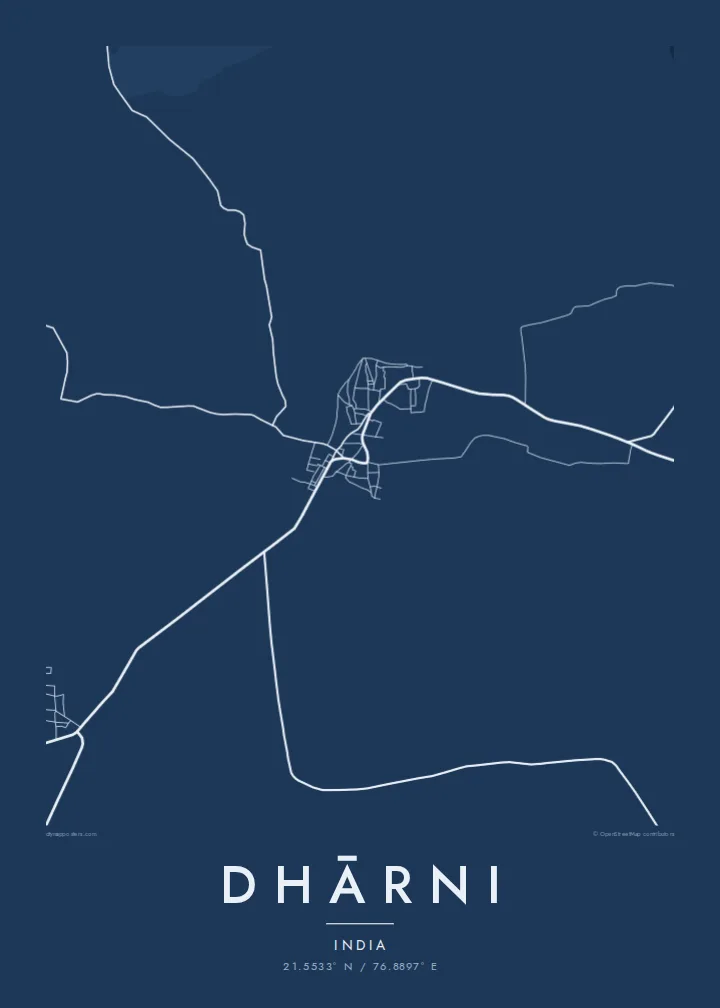
A Dhārni map poster shows a compact town in a much larger natural landscape. Streets cluster in the centre, roads wind through the hills in long curves, and rivers and streams cut across the frame. The irregular, organic pattern reflects a place where the terrain still decides where people can build.
Wooded hills surround the town, and roads curve to follow them. The irregular pattern contrasts with the flatter plains elsewhere in central India.
Rivers and streams from the hills flow towards the Tapi. They add winding lines across the map and define the valleys where settlements lie.
The town sits close to the forests of Melghat. Beyond the streets the map opens out into large areas with few roads, giving the print space.
Fai ke fakatau ki a koe
Fakaopoopo se aso, se igoa io me se fuaiupu o koe, sui te sitaila, te lasi io me te tuuga.
Te preview fua e maulalo te malamalama kae iai se watermark. Poster telotele mo faila HD e faite i te 300 DPI, e oko atu ki 7,200 × 10,800 px, aunoa mo se watermark.
Kaia a Dhārni
For people from Dhārni and the Melghat villages, as well as for those who have worked or travelled here, this map is a reminder of the town, its hills and the forest beyond.
Personalise the title, subtitle and coordinates with a village name, a family name or a special date. Choose from Classic black and white, Noir, Paper, Blueprint or Sand. Sand reflects the warm tones of the Satpura landscape.
Otaina te poster Dhārni| Lasi o te lomiga | Manino | Faila |
|---|---|---|
| 30 × 40 cm11.8 × 15.7″ | 3,543 × 4,724 px | PNG · PDF |
| 29.7 × 42 cm (A3)11.7 × 16.5″ | 3,508 × 4,961 px | PNG · PDF |
| 42 × 59.4 cm (A2)16.5 × 23.4″ | 4,961 × 7,016 px | PNG · PDF |
| 45.7 × 61 cm18 × 24″ | 5,400 × 7,200 px | PNG · PDF |
| 50 × 70 cm19.7 × 27.6″ | 5,906 × 8,268 px | PNG · PDF |
| 61 × 91.4 cm24 × 36″ | 7,200 × 10,800 px | PNG · PDF |
Ke fakatusa, a te ata fakataitai fua e 900 px te lautele, mo te fakailoga kae mo lau lavea i luga i te komipiuta. A faila HD e oko ki te 8× te manino i itu katoa kae lomi faka‵lei i te lasi katoa o te pousita.
Filifili se style i te pito i luga o te itulau, kae filifili Poster Telotele — se lasi mo se faaki manafai e manako koe — io me Faila Digital HD. E tasi te sitepu mo te checkout, kae ka fakafou te itulau o tau ota i te taimi e mafai ei te totogi.
E telotele i luga o te pepa vali gali 200 gsm i se tasi mai lasi e ono, mai te 30 × 40 cm ki te 24 × 36″. E kamata te poster telotele mai i te $39, kae aofia ei te uta.
Ioe. Filifili se faaki lakau maoli i te kulokula, tea, oak maoli io me lakau pogisa. E oo mai ki tioata e se malepe kae toka ke tautau. E kamata te poster faaki mai i te $99, kae aofia ei te uta.
E tuku fua ki fenua e 60+. A poloaiga taki tasi e ta ne te tauhaga e latalata mai i a matou tauhaga ta i fenua e 30+, kae e masani o aunoa i aso galue e 3–7. E mafai o salasala te tulaga mo te sukesuke i lalo o Aku poloaiga. I nisi fenua e 2–5 vaiaso, kae i mea e seki tuku atu ei matou, e fakailoa atu e te mea tafaoga i mua o te totogi.
Auina mai se ata i loto i te 14 aso mai te taimi e oko ei kae ka toe telotele fua ne matou io me toe totogi atu tau tupe.
Ioe. I te editor i te itulau tenei, sui te ulutala, te ulutala lalo mo te laina o coordinate ki so se mea e manako koe, kae filifili se style mo se lasi. Oga telotele, faaki mo digital e faigana katoa i tau tusiga tonu.
Mo te $9 ka maua ne koe faila PNG 300 DPI mo PDF fakatoka lolomi i lasi e ono katoa, aunoa mo se watermark, ke lolomi i so se koga. E se mautinoa koe? Download muamua se preview fua e iai te watermark.
