The Nahe valley
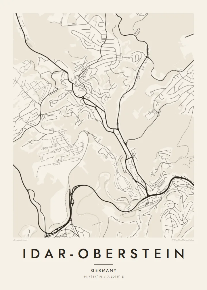
The river bends through a deep valley, and the town lines both banks in a thin continuous strip, giving the map a strong, flowing diagonal from one edge to the other.
Pousita mape faigofie · Germany
49.7144° N / 7.3078° E
A long, narrow town threaded through the steep Nahe valley, its streets squeezed between wooded slopes and river




Taone e tasi, lagona e lima
Pau te tapaki o se style ke lavea i luga i te puipui. E tutasi te tau o style takitasi — telotele mo faaki, e aunoa io me fai ki faila HD.
 Pixel tonu · faila lolomi 24 × 36″
Manino ki te lomiga
Tenei se 100% mai te faila lolomi tonu. Poster takitasi — telotele, faaki io me download — e faite i luga i a matou server i te 300 DPI, e oko atu ki 7,200 × 10,800 pixel, ko ala e maofio ei mo maiga vaega foliki i luga i te lolomi 24 × 36″.
I te pakitala


Te mape
Idar-Oberstein stretches along the valley of the Nahe in the Hunsrück uplands of Rhineland-Palatinate, and its map looks more like a ribbon than a circle. The town follows the river for several kilometres, with steep, forested hillsides pressing in from both sides. Side valleys, including that of the Idarbach, branch off to the north and carry their own lines of houses and roads.
The present town was formed in 1933 by joining Idar and Oberstein, along with neighbouring communities, which explains its elongated shape and its several distinct centres. In the middle of town the main road runs directly above the Nahe for a stretch, so the river partly disappears from view at street level, a detail that makes the valley floor look unusually crowded on the map.
Idar-Oberstein is known across Europe as a centre of gemstone and agate cutting, a craft rooted in local deposits and later sustained by imported stones. Above Oberstein, the Felsenkirche, a church built into a rock face, overlooks the valley. An Idar-Oberstein map poster records how a town of stone-cutters fitted itself into a narrow, winding river valley.
The river bends through a deep valley, and the town lines both banks in a thin continuous strip, giving the map a strong, flowing diagonal from one edge to the other.
In the centre, the main road is built over the Nahe for a section of its course, so the river line vanishes beneath traffic, an unusual feature in any German town plan.
Tributary valleys such as the Idarbach open off the main valley, each carrying a finger of streets uphill and giving the town its branching, tree-like outline.
Fai ke fakatau ki a koe
Fakaopoopo se aso, se igoa io me se fuaiupu o koe, sui te sitaila, te lasi io me te tuuga.
Te preview fua e maulalo te malamalama kae iai se watermark. Poster telotele mo faila HD e faite i te 300 DPI, e oko atu ki 7,200 × 10,800 px, aunoa mo se watermark.
Kaia a Idar-Oberstein
The narrow valley shape makes Idar-Oberstein a distinctive map to frame, and it carries meaning for people with ties to the gemstone trade, the Hunsrück or the soldiers and families who have lived nearby. It reads as both a place portrait and a study of landscape.
Personalise the title, subtitle and coordinates line with a name or a date, and choose Classic black and white, Noir, Paper, Blueprint or Sand. The $9 digital files include six sizes as 300 DPI PNG and print-ready PDF, without a watermark. Printed and framed posters are also available.
Otaina te poster Idar-Oberstein| Lasi o te lomiga | Manino | Faila |
|---|---|---|
| 30 × 40 cm11.8 × 15.7″ | 3,543 × 4,724 px | PNG · PDF |
| 29.7 × 42 cm (A3)11.7 × 16.5″ | 3,508 × 4,961 px | PNG · PDF |
| 42 × 59.4 cm (A2)16.5 × 23.4″ | 4,961 × 7,016 px | PNG · PDF |
| 45.7 × 61 cm18 × 24″ | 5,400 × 7,200 px | PNG · PDF |
| 50 × 70 cm19.7 × 27.6″ | 5,906 × 8,268 px | PNG · PDF |
| 61 × 91.4 cm24 × 36″ | 7,200 × 10,800 px | PNG · PDF |
Ke fakatusa, a te ata fakataitai fua e 900 px te lautele, mo te fakailoga kae mo lau lavea i luga i te komipiuta. A faila HD e oko ki te 8× te manino i itu katoa kae lomi faka‵lei i te lasi katoa o te pousita.
Filifili se style i te pito i luga o te itulau, kae filifili Poster Telotele — se lasi mo se faaki manafai e manako koe — io me Faila Digital HD. E tasi te sitepu mo te checkout, kae ka fakafou te itulau o tau ota i te taimi e mafai ei te totogi.
E telotele i luga o te pepa vali gali 200 gsm i se tasi mai lasi e ono, mai te 30 × 40 cm ki te 24 × 36″. E kamata te poster telotele mai i te $39, kae aofia ei te uta.
Ioe. Filifili se faaki lakau maoli i te kulokula, tea, oak maoli io me lakau pogisa. E oo mai ki tioata e se malepe kae toka ke tautau. E kamata te poster faaki mai i te $99, kae aofia ei te uta.
E tuku fua ki fenua e 60+. A poloaiga taki tasi e ta ne te tauhaga e latalata mai i a matou tauhaga ta i fenua e 30+, kae e masani o aunoa i aso galue e 3–7. E mafai o salasala te tulaga mo te sukesuke i lalo o Aku poloaiga. I nisi fenua e 2–5 vaiaso, kae i mea e seki tuku atu ei matou, e fakailoa atu e te mea tafaoga i mua o te totogi.
Auina mai se ata i loto i te 14 aso mai te taimi e oko ei kae ka toe telotele fua ne matou io me toe totogi atu tau tupe.
Ioe. I te editor i te itulau tenei, sui te ulutala, te ulutala lalo mo te laina o coordinate ki so se mea e manako koe, kae filifili se style mo se lasi. Oga telotele, faaki mo digital e faigana katoa i tau tusiga tonu.
Mo te $9 ka maua ne koe faila PNG 300 DPI mo PDF fakatoka lolomi i lasi e ono katoa, aunoa mo se watermark, ke lolomi i so se koga. E se mautinoa koe? Download muamua se preview fua e iai te watermark.
