Shrine forests
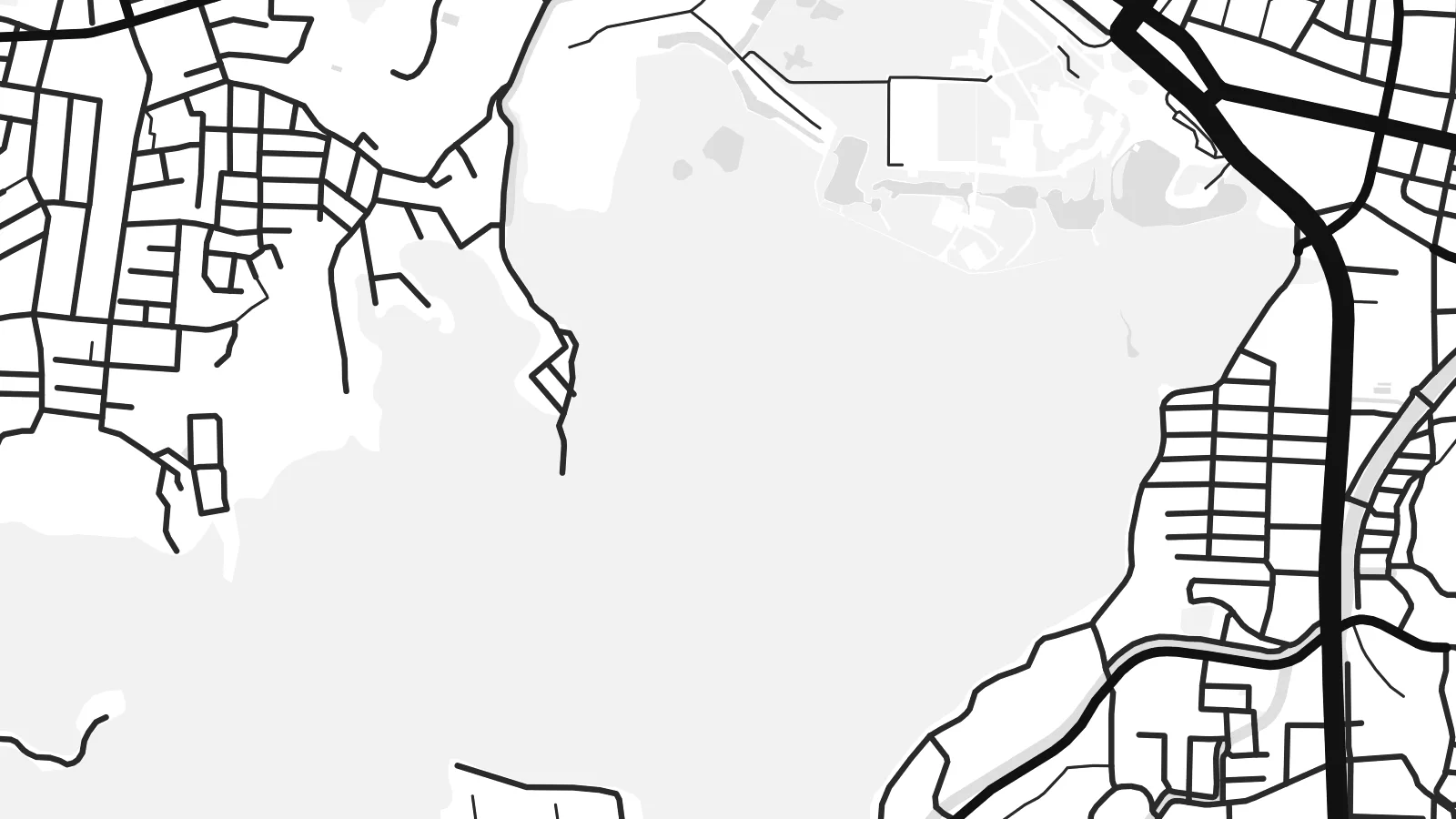
The grounds of Naikū and Gekū appear as broad open areas surrounded by streets. They are some of the largest calm shapes on the map, and they anchor the whole composition.
Pousita mape faigofie · Japan
34.4833° N / 136.7000° E
A shrine city between forested hills and Ise Bay, laid out along two rivers and the old pilgrim roads.


Taone e tasi, lagona e lima
Pau te tapaki o se style ke lavea i luga i te puipui. E tutasi te tau o style takitasi — telotele mo faaki, e aunoa io me fai ki faila HD.
 Pixel tonu · faila lolomi 24 × 36″
Manino ki te lomiga
Tenei se 100% mai te faila lolomi tonu. Poster takitasi — telotele, faaki io me download — e faite i luga i a matou server i te 300 DPI, e oko atu ki 7,200 × 10,800 pixel, ko ala e maofio ei mo maiga vaega foliki i luga i te lolomi 24 × 36″.
I te pakitala


Te mape
Ise lies in Mie Prefecture on the Kii Peninsula, between Ise Bay to the north and steep, wooded hills to the south. The Miyagawa and Isuzu rivers cross the plain, and the city's streets follow the routes that pilgrims walked for centuries between the two main precincts of the Ise Grand Shrine.
The shrine is among the most important sites in Shinto. Its inner shrine, Naikū, is dedicated to the sun goddess Amaterasu, and the outer shrine, Gekū, stands closer to the city centre. The main shrine buildings are traditionally rebuilt every twenty years. The coastal district of Futami, known for the paired Meoto Iwa rocks, is also part of the city.
An Ise map poster shows a clear contrast. Dense streets gather near the railway stations and along the old approach to Naikū, while the shrine forests appear as large unbroken areas. Rivers wind through the middle, and the bay shore forms a long northern edge.
The grounds of Naikū and Gekū appear as broad open areas surrounded by streets. They are some of the largest calm shapes on the map, and they anchor the whole composition.
Two rivers cross the city on their way to the bay. They add flowing lines through the grid, and the Isuzu passes right beside the inner shrine.
Ise Bay forms the northern boundary. It gives the poster a long shoreline, and the Futami coast lies towards its eastern end.
Fai ke fakatau ki a koe
Fakaopoopo se aso, se igoa io me se fuaiupu o koe, sui te sitaila, te lasi io me te tuuga.
Te preview fua e maulalo te malamalama kae iai se watermark. Poster telotele mo faila HD e faite i te 300 DPI, e oko atu ki 7,200 × 10,800 px, aunoa mo se watermark.
Kaia a Ise
A visit to Ise is often a meaningful one, whether as a pilgrimage, a family trip or a first encounter with Shinto architecture. A map of the city is a quiet reminder of that visit.
Add the date of your visit to the subtitle, edit the coordinates line if you like, and pick from five styles, including the cool Blueprint and the dark Noir. The HD files cover six print sizes, from A3 up to 24×36″.
Otaina te poster Ise| Lasi o te lomiga | Manino | Faila |
|---|---|---|
| 30 × 40 cm11.8 × 15.7″ | 3,543 × 4,724 px | PNG · PDF |
| 29.7 × 42 cm (A3)11.7 × 16.5″ | 3,508 × 4,961 px | PNG · PDF |
| 42 × 59.4 cm (A2)16.5 × 23.4″ | 4,961 × 7,016 px | PNG · PDF |
| 45.7 × 61 cm18 × 24″ | 5,400 × 7,200 px | PNG · PDF |
| 50 × 70 cm19.7 × 27.6″ | 5,906 × 8,268 px | PNG · PDF |
| 61 × 91.4 cm24 × 36″ | 7,200 × 10,800 px | PNG · PDF |
Ke fakatusa, a te ata fakataitai fua e 900 px te lautele, mo te fakailoga kae mo lau lavea i luga i te komipiuta. A faila HD e oko ki te 8× te manino i itu katoa kae lomi faka‵lei i te lasi katoa o te pousita.
Filifili se style i te pito i luga o te itulau, kae filifili Poster Telotele — se lasi mo se faaki manafai e manako koe — io me Faila Digital HD. E tasi te sitepu mo te checkout, kae ka fakafou te itulau o tau ota i te taimi e mafai ei te totogi.
E telotele i luga o te pepa vali gali 200 gsm i se tasi mai lasi e ono, mai te 30 × 40 cm ki te 24 × 36″. E kamata te poster telotele mai i te $39, kae aofia ei te uta.
Ioe. Filifili se faaki lakau maoli i te kulokula, tea, oak maoli io me lakau pogisa. E oo mai ki tioata e se malepe kae toka ke tautau. E kamata te poster faaki mai i te $99, kae aofia ei te uta.
E tuku fua ki fenua e 60+. A poloaiga taki tasi e ta ne te tauhaga e latalata mai i a matou tauhaga ta i fenua e 30+, kae e masani o aunoa i aso galue e 3–7. E mafai o salasala te tulaga mo te sukesuke i lalo o Aku poloaiga. I nisi fenua e 2–5 vaiaso, kae i mea e seki tuku atu ei matou, e fakailoa atu e te mea tafaoga i mua o te totogi.
Auina mai se ata i loto i te 14 aso mai te taimi e oko ei kae ka toe telotele fua ne matou io me toe totogi atu tau tupe.
Ioe. I te editor i te itulau tenei, sui te ulutala, te ulutala lalo mo te laina o coordinate ki so se mea e manako koe, kae filifili se style mo se lasi. Oga telotele, faaki mo digital e faigana katoa i tau tusiga tonu.
Mo te $9 ka maua ne koe faila PNG 300 DPI mo PDF fakatoka lolomi i lasi e ono katoa, aunoa mo se watermark, ke lolomi i so se koga. E se mautinoa koe? Download muamua se preview fua e iai te watermark.
