Ravi and Ujh rivers
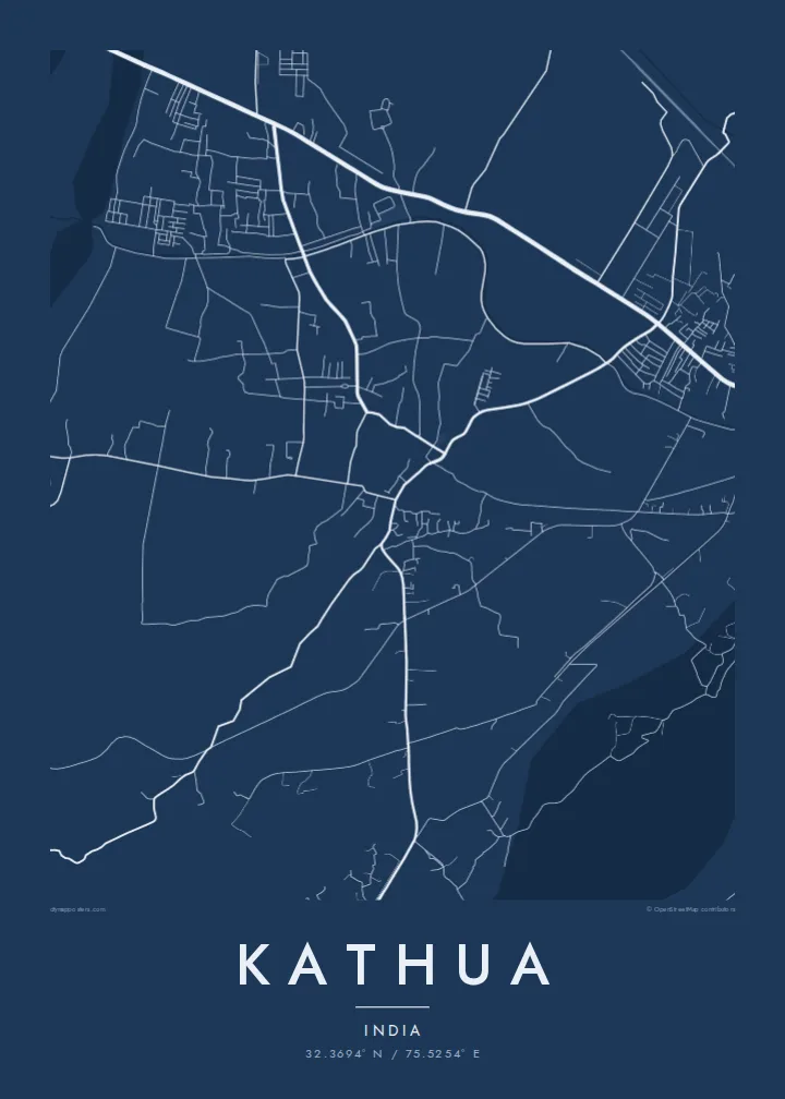
Two rivers cross the landscape around Kathua in wide, braided channels. Their pale beds and shifting courses form the strongest natural lines on the map.
Pousita mape faigofie · India
32.3694° N / 75.5254° E
The southern gateway town of Jammu and Kashmir, set between the Ravi and Ujh rivers at the foot of the Shivalik hills.



Taone e tasi, lagona e lima
Pau te tapaki o se style ke lavea i luga i te puipui. E tutasi te tau o style takitasi — telotele mo faaki, e aunoa io me fai ki faila HD.
 Pixel tonu · faila lolomi 24 × 36″
Manino ki te lomiga
Tenei se 100% mai te faila lolomi tonu. Poster takitasi — telotele, faaki io me download — e faite i luga i a matou server i te 300 DPI, e oko atu ki 7,200 × 10,800 pixel, ko ala e maofio ei mo maiga vaega foliki i luga i te lolomi 24 × 36″.
I te pakitala


Te mape
Kathua sits at the southern edge of Jammu and Kashmir, where the Punjab plains meet the first ridges of the Shivalik hills. On a map the town lies between river channels. The Ravi marks the boundary with Punjab not far to the south, and the Ujh runs close by. National Highway 44, the main road north toward Jammu and the Kashmir valley, crosses the area in a long line.
Because of this position, Kathua is often called the gateway to Jammu and Kashmir, the first district most road and rail travellers enter from Punjab. The town has grown along the highway and railway, with an older core and newer neighbourhoods and industrial areas. North and east, the land rises into wooded hills and valleys toward Basohli and the higher ranges.
A Kathua map poster captures that threshold geography: braided river beds, a highway corridor, and a town where the flat land ends and the hills begin. In black and white, the pale river channels and the dense town streets make a clear contrast. It is a good fit for a place defined by arrivals and departures.
Two rivers cross the landscape around Kathua in wide, braided channels. Their pale beds and shifting courses form the strongest natural lines on the map.
National Highway 44 passes the town on its way north to Jammu and Srinagar. It is the main line of movement in the composition.
North of the town, the land rises into low wooded ridges and valleys. They mark the start of the hill country that leads into Jammu and Kashmir.
Fai ke fakatau ki a koe
Fakaopoopo se aso, se igoa io me se fuaiupu o koe, sui te sitaila, te lasi io me te tuuga.
Te preview fua e maulalo te malamalama kae iai se watermark. Poster telotele mo faila HD e faite i te 300 DPI, e oko atu ki 7,200 × 10,800 px, aunoa mo se watermark.
Kaia a Kathua
Kathua is where many journeys into Jammu and Kashmir begin, and for its residents it is simply home. A map of the town, its rivers and its highway is a meaningful piece for anyone connected to this crossroads between the plains and the hills.
Personalise the title, subtitle and coordinates, and choose from five styles, from Classic black & white to Sand. Each $9 download includes six print sizes as 300 DPI PNGs and print-ready PDFs, and printed posters ship from partners in more than 30 countries.
Otaina te poster Kathua| Lasi o te lomiga | Manino | Faila |
|---|---|---|
| 30 × 40 cm11.8 × 15.7″ | 3,543 × 4,724 px | PNG · PDF |
| 29.7 × 42 cm (A3)11.7 × 16.5″ | 3,508 × 4,961 px | PNG · PDF |
| 42 × 59.4 cm (A2)16.5 × 23.4″ | 4,961 × 7,016 px | PNG · PDF |
| 45.7 × 61 cm18 × 24″ | 5,400 × 7,200 px | PNG · PDF |
| 50 × 70 cm19.7 × 27.6″ | 5,906 × 8,268 px | PNG · PDF |
| 61 × 91.4 cm24 × 36″ | 7,200 × 10,800 px | PNG · PDF |
Ke fakatusa, a te ata fakataitai fua e 900 px te lautele, mo te fakailoga kae mo lau lavea i luga i te komipiuta. A faila HD e oko ki te 8× te manino i itu katoa kae lomi faka‵lei i te lasi katoa o te pousita.
Filifili se style i te pito i luga o te itulau, kae filifili Poster Telotele — se lasi mo se faaki manafai e manako koe — io me Faila Digital HD. E tasi te sitepu mo te checkout, kae ka fakafou te itulau o tau ota i te taimi e mafai ei te totogi.
E telotele i luga o te pepa vali gali 200 gsm i se tasi mai lasi e ono, mai te 30 × 40 cm ki te 24 × 36″. E kamata te poster telotele mai i te $39, kae aofia ei te uta.
Ioe. Filifili se faaki lakau maoli i te kulokula, tea, oak maoli io me lakau pogisa. E oo mai ki tioata e se malepe kae toka ke tautau. E kamata te poster faaki mai i te $99, kae aofia ei te uta.
E tuku fua ki fenua e 60+. A poloaiga taki tasi e ta ne te tauhaga e latalata mai i a matou tauhaga ta i fenua e 30+, kae e masani o aunoa i aso galue e 3–7. E mafai o salasala te tulaga mo te sukesuke i lalo o Aku poloaiga. I nisi fenua e 2–5 vaiaso, kae i mea e seki tuku atu ei matou, e fakailoa atu e te mea tafaoga i mua o te totogi.
Auina mai se ata i loto i te 14 aso mai te taimi e oko ei kae ka toe telotele fua ne matou io me toe totogi atu tau tupe.
Ioe. I te editor i te itulau tenei, sui te ulutala, te ulutala lalo mo te laina o coordinate ki so se mea e manako koe, kae filifili se style mo se lasi. Oga telotele, faaki mo digital e faigana katoa i tau tusiga tonu.
Mo te $9 ka maua ne koe faila PNG 300 DPI mo PDF fakatoka lolomi i lasi e ono katoa, aunoa mo se watermark, ke lolomi i so se koga. E se mautinoa koe? Download muamua se preview fua e iai te watermark.
