Castle hill
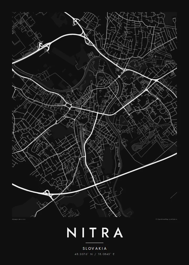
The castle and cathedral stand on a rocky rise above the old town. On the map, the streets curve around it in tight rings.
Pousita mape faigofie · Slovakia
48.3076° N / 18.0845° E
An old Slovak city under Zobor hill, with a castle on its rock and the Nitra River curving past.



Taone e tasi, lagona e lima
Pau te tapaki o se style ke lavea i luga i te puipui. E tutasi te tau o style takitasi — telotele mo faaki, e aunoa io me fai ki faila HD.
 Pixel tonu · faila lolomi 24 × 36″
Manino ki te lomiga
Tenei se 100% mai te faila lolomi tonu. Poster takitasi — telotele, faaki io me download — e faite i luga i a matou server i te 300 DPI, e oko atu ki 7,200 × 10,800 pixel, ko ala e maofio ei mo maiga vaega foliki i luga i te lolomi 24 × 36″.
I te pakitala


Te mape
Nitra sits in western Slovakia where the lowlands meet the Tribeč hills. Zobor rises steeply to the north and fills one corner of the map with contour-like curves. Below it, the old town lies around a castle hill, and the Nitra River loops along the eastern side of the centre.
The streets of the historic core are short and irregular. They follow the base of the castle rock and the former city walls. Further out, the pattern becomes more planned, with housing estates, broad avenues and the large exhibition grounds of Agrokomplex. The river and its floodplain remain an open band through the middle of the city.
Nitra is one of the oldest cities in Slovakia and was the seat of the early medieval Principality of Nitra. The first Christian church in the region is recorded there, consecrated around 828. A Nitra map poster shows the castle hill, the river bends and the slopes of Zobor as one quiet composition.
The castle and cathedral stand on a rocky rise above the old town. On the map, the streets curve around it in tight rings.
The hill to the north interrupts the street network with steep, wooded ground. It gives the map an edge of open space.
The river bends past the centre with a broad floodplain. Its loops add soft, flowing lines to the drawing.
Fai ke fakatau ki a koe
Fakaopoopo se aso, se igoa io me se fuaiupu o koe, sui te sitaila, te lasi io me te tuuga.
Te preview fua e maulalo te malamalama kae iai se watermark. Poster telotele mo faila HD e faite i te 300 DPI, e oko atu ki 7,200 × 10,800 px, aunoa mo se watermark.
Kaia a Nitra
Nitra is a university city, and many former students have spent formative years there. A map of the castle hill and the river becomes a quiet reminder of those years, or of family roots in the region.
You can personalise the title, subtitle and coordinates line, including Slovak spelling. Choose from five styles: Classic black & white, Noir, Paper, Blueprint or Sand.
Otaina te poster Nitra| Lasi o te lomiga | Manino | Faila |
|---|---|---|
| 30 × 40 cm11.8 × 15.7″ | 3,543 × 4,724 px | PNG · PDF |
| 29.7 × 42 cm (A3)11.7 × 16.5″ | 3,508 × 4,961 px | PNG · PDF |
| 42 × 59.4 cm (A2)16.5 × 23.4″ | 4,961 × 7,016 px | PNG · PDF |
| 45.7 × 61 cm18 × 24″ | 5,400 × 7,200 px | PNG · PDF |
| 50 × 70 cm19.7 × 27.6″ | 5,906 × 8,268 px | PNG · PDF |
| 61 × 91.4 cm24 × 36″ | 7,200 × 10,800 px | PNG · PDF |
Ke fakatusa, a te ata fakataitai fua e 900 px te lautele, mo te fakailoga kae mo lau lavea i luga i te komipiuta. A faila HD e oko ki te 8× te manino i itu katoa kae lomi faka‵lei i te lasi katoa o te pousita.
Filifili se style i te pito i luga o te itulau, kae filifili Poster Telotele — se lasi mo se faaki manafai e manako koe — io me Faila Digital HD. E tasi te sitepu mo te checkout, kae ka fakafou te itulau o tau ota i te taimi e mafai ei te totogi.
E telotele i luga o te pepa vali gali 200 gsm i se tasi mai lasi e ono, mai te 30 × 40 cm ki te 24 × 36″. E kamata te poster telotele mai i te $39, kae aofia ei te uta.
Ioe. Filifili se faaki lakau maoli i te kulokula, tea, oak maoli io me lakau pogisa. E oo mai ki tioata e se malepe kae toka ke tautau. E kamata te poster faaki mai i te $99, kae aofia ei te uta.
E tuku fua ki fenua e 60+. A poloaiga taki tasi e ta ne te tauhaga e latalata mai i a matou tauhaga ta i fenua e 30+, kae e masani o aunoa i aso galue e 3–7. E mafai o salasala te tulaga mo te sukesuke i lalo o Aku poloaiga. I nisi fenua e 2–5 vaiaso, kae i mea e seki tuku atu ei matou, e fakailoa atu e te mea tafaoga i mua o te totogi.
Auina mai se ata i loto i te 14 aso mai te taimi e oko ei kae ka toe telotele fua ne matou io me toe totogi atu tau tupe.
Ioe. I te editor i te itulau tenei, sui te ulutala, te ulutala lalo mo te laina o coordinate ki so se mea e manako koe, kae filifili se style mo se lasi. Oga telotele, faaki mo digital e faigana katoa i tau tusiga tonu.
Mo te $9 ka maua ne koe faila PNG 300 DPI mo PDF fakatoka lolomi i lasi e ono katoa, aunoa mo se watermark, ke lolomi i so se koga. E se mautinoa koe? Download muamua se preview fua e iai te watermark.
