Sea bridges
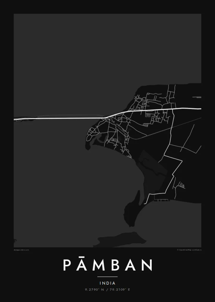
Parallel rail and road bridges cross the Pamban channel to the mainland. On the map they are bold straight lines stretched over open water.
Pousita mape faigofie · India
9.2790° N / 79.2109° E
A fishing town at the western tip of Pamban Island, where rail and road bridges span the sea to mainland India.



Taone e tasi, lagona e lima
Pau te tapaki o se style ke lavea i luga i te puipui. E tutasi te tau o style takitasi — telotele mo faaki, e aunoa io me fai ki faila HD.
 Pixel tonu · faila lolomi 24 × 36″
Manino ki te lomiga
Tenei se 100% mai te faila lolomi tonu. Poster takitasi — telotele, faaki io me download — e faite i luga i a matou server i te 300 DPI, e oko atu ki 7,200 × 10,800 pixel, ko ala e maofio ei mo maiga vaega foliki i luga i te lolomi 24 × 36″.
I te pakitala


Te mape
Pāmban sits at the western end of Pamban Island, off the coast of Tamil Nadu, facing the mainland across the Pamban channel. Palk Bay lies on one side and the Gulf of Mannar on the other, and the town occupies a thin strip of sand between them. Streets run close to the shore, and boats line the beaches, since much of local life revolves around fishing.
The town is best known for its bridges. The original Pamban railway bridge opened in 1914 with a lifting span for ships and was for many years one of the most famous engineering works in India. A new vertical-lift rail bridge has since replaced it. It runs alongside the road bridge that links the island to the mainland and on to Rameswaram.
A Pāmban map poster shows a rare composition: two long, straight lines crossing open water, a narrow island edged by sea on both sides, and a small grid of streets pressed against the shore. Few towns show such a clear relationship between land, water and engineering, and it comes through strongly in black and white.
Parallel rail and road bridges cross the Pamban channel to the mainland. On the map they are bold straight lines stretched over open water.
Palk Bay lies to the north and the Gulf of Mannar to the south, so the town sits on a narrow band of land between two bodies of water.
A road and a railway run east along the island toward Rameswaram, forming a single thin spine across the low, sandy landscape.
Fai ke fakatau ki a koe
Fakaopoopo se aso, se igoa io me se fuaiupu o koe, sui te sitaila, te lasi io me te tuuga.
Te preview fua e maulalo te malamalama kae iai se watermark. Poster telotele mo faila HD e faite i te 300 DPI, e oko atu ki 7,200 × 10,800 px, aunoa mo se watermark.
Kaia a Pāmban
Pāmban is familiar to anyone who has crossed the bridge on the way to Rameswaram, and to many engineers and railway enthusiasts. The map suits a hallway or office, where the lines of the bridges become an elegant, almost diagrammatic focal point.
Add a title and a subtitle, such as the date of a pilgrimage or a family journey, and adjust the coordinates line. Choose Classic black & white, Noir, Paper, Blueprint or Sand, then download the $9 HD files or order a printed poster.
Otaina te poster Pāmban| Lasi o te lomiga | Manino | Faila |
|---|---|---|
| 30 × 40 cm11.8 × 15.7″ | 3,543 × 4,724 px | PNG · PDF |
| 29.7 × 42 cm (A3)11.7 × 16.5″ | 3,508 × 4,961 px | PNG · PDF |
| 42 × 59.4 cm (A2)16.5 × 23.4″ | 4,961 × 7,016 px | PNG · PDF |
| 45.7 × 61 cm18 × 24″ | 5,400 × 7,200 px | PNG · PDF |
| 50 × 70 cm19.7 × 27.6″ | 5,906 × 8,268 px | PNG · PDF |
| 61 × 91.4 cm24 × 36″ | 7,200 × 10,800 px | PNG · PDF |
Ke fakatusa, a te ata fakataitai fua e 900 px te lautele, mo te fakailoga kae mo lau lavea i luga i te komipiuta. A faila HD e oko ki te 8× te manino i itu katoa kae lomi faka‵lei i te lasi katoa o te pousita.
Filifili se style i te pito i luga o te itulau, kae filifili Poster Telotele — se lasi mo se faaki manafai e manako koe — io me Faila Digital HD. E tasi te sitepu mo te checkout, kae ka fakafou te itulau o tau ota i te taimi e mafai ei te totogi.
E telotele i luga o te pepa vali gali 200 gsm i se tasi mai lasi e ono, mai te 30 × 40 cm ki te 24 × 36″. E kamata te poster telotele mai i te $39, kae aofia ei te uta.
Ioe. Filifili se faaki lakau maoli i te kulokula, tea, oak maoli io me lakau pogisa. E oo mai ki tioata e se malepe kae toka ke tautau. E kamata te poster faaki mai i te $99, kae aofia ei te uta.
E tuku fua ki fenua e 60+. A poloaiga taki tasi e ta ne te tauhaga e latalata mai i a matou tauhaga ta i fenua e 30+, kae e masani o aunoa i aso galue e 3–7. E mafai o salasala te tulaga mo te sukesuke i lalo o Aku poloaiga. I nisi fenua e 2–5 vaiaso, kae i mea e seki tuku atu ei matou, e fakailoa atu e te mea tafaoga i mua o te totogi.
Auina mai se ata i loto i te 14 aso mai te taimi e oko ei kae ka toe telotele fua ne matou io me toe totogi atu tau tupe.
Ioe. I te editor i te itulau tenei, sui te ulutala, te ulutala lalo mo te laina o coordinate ki so se mea e manako koe, kae filifili se style mo se lasi. Oga telotele, faaki mo digital e faigana katoa i tau tusiga tonu.
Mo te $9 ka maua ne koe faila PNG 300 DPI mo PDF fakatoka lolomi i lasi e ono katoa, aunoa mo se watermark, ke lolomi i so se koga. E se mautinoa koe? Download muamua se preview fua e iai te watermark.
