Po Klong Garai hill
The Cham tower complex stands on a small hill near the Tháp Chàm area. On the map it is a compact green patch marking one of the best-preserved Cham sites in Vietnam.
Pousita mape faigofie · Vietnam
11.5643° N / 108.9886° E
A low coastal city by a river mouth and the South China Sea, with Cham towers on its western hill



Taone e tasi, lagona e lima
Pau te tapaki o se style ke lavea i luga i te puipui. E tutasi te tau o style takitasi — telotele mo faaki, e aunoa io me fai ki faila HD.
 Pixel tonu · faila lolomi 24 × 36″
Manino ki te lomiga
Tenei se 100% mai te faila lolomi tonu. Poster takitasi — telotele, faaki io me download — e faite i luga i a matou server i te 300 DPI, e oko atu ki 7,200 × 10,800 pixel, ko ala e maofio ei mo maiga vaega foliki i luga i te lolomi 24 × 36″.
I te pakitala


Te mape
Phan Rang-Tháp Chàm lies in the former Ninh Thuận province, now part of Khánh Hòa, on one of the driest stretches of the Vietnamese coast. The city spreads across flat ground between the Dinh River and the sea. A central grid of streets gives way at the edges to irrigated fields and the vineyards the area is known for.
The double name reflects two parts of one city. Phan Rang is the older commercial centre near the coast. Tháp Chàm, to the west, takes its name from the Cham towers of Po Klong Garai, built around the turn of the fourteenth century on a low hill. The region's Cham heritage remains visible in its temples, villages and festivals.
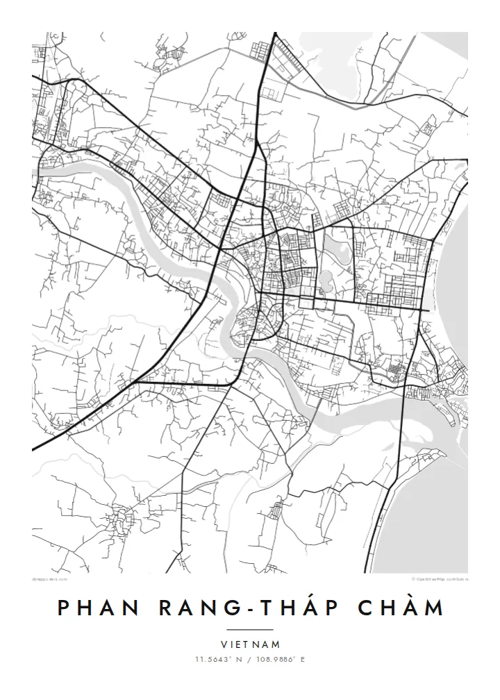
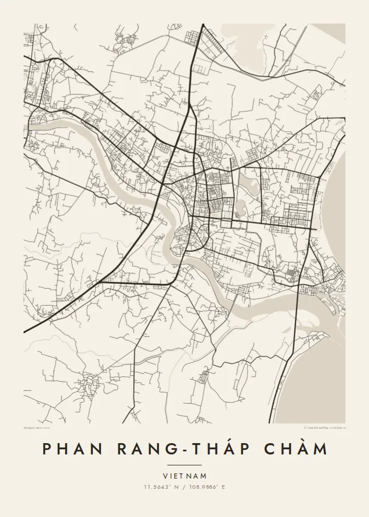
A Phan Rang-Tháp Chàm map poster shows a city stretched between river, railway and sea. It holds a dense core, the long, smooth curve of Ninh Chữ beach to the north-east and the open, sun-baked farmland beyond. In black and white the calm coastline and simple grid make an unusually clear, balanced composition.
The Cham tower complex stands on a small hill near the Tháp Chàm area. On the map it is a compact green patch marking one of the best-preserved Cham sites in Vietnam.
North-east of the centre, the shore curves in a long, smooth bay lined with beachfront roads, one of the cleanest lines in the composition.
The Dinh River runs past the south of the city to the sea. Irrigated fields and vineyards line it, standing out in an otherwise very dry landscape.
Fai ke fakatau ki a koe
Fakaopoopo se aso, se igoa io me se fuaiupu o koe, sui te sitaila, te lasi io me te tuuga.
Te preview fua e maulalo te malamalama kae iai se watermark. Poster telotele mo faila HD e faite i te 300 DPI, e oko atu ki 7,200 × 10,800 px, aunoa mo se watermark.
Kaia a Phan Rang-Tháp Chàm
This map suits people with roots in the region's Cham or Kinh communities, travellers who drove the coast road between Nha Trang and Phan Thiết, or anyone who remembers the grapes, the wind and the sea. Its open, airy layout fits a bright, uncluttered room.
Set your own title and subtitle, add a date and edit the coordinates line. The Sand style echoes the dry coastal landscape, and Classic black & white, Noir, Paper and Blueprint are also available. Choose the $9 HD bundle in six sizes or a matte print with an optional frame.
Otaina te poster Phan Rang-Tháp Chàm| Lasi o te lomiga | Manino | Faila |
|---|---|---|
| 30 × 40 cm11.8 × 15.7″ | 3,543 × 4,724 px | PNG · PDF |
| 29.7 × 42 cm (A3)11.7 × 16.5″ | 3,508 × 4,961 px | PNG · PDF |
| 42 × 59.4 cm (A2)16.5 × 23.4″ | 4,961 × 7,016 px | PNG · PDF |
| 45.7 × 61 cm18 × 24″ | 5,400 × 7,200 px | PNG · PDF |
| 50 × 70 cm19.7 × 27.6″ | 5,906 × 8,268 px | PNG · PDF |
| 61 × 91.4 cm24 × 36″ | 7,200 × 10,800 px | PNG · PDF |
Ke fakatusa, a te ata fakataitai fua e 900 px te lautele, mo te fakailoga kae mo lau lavea i luga i te komipiuta. A faila HD e oko ki te 8× te manino i itu katoa kae lomi faka‵lei i te lasi katoa o te pousita.
Filifili se style i te pito i luga o te itulau, kae filifili Poster Telotele — se lasi mo se faaki manafai e manako koe — io me Faila Digital HD. E tasi te sitepu mo te checkout, kae ka fakafou te itulau o tau ota i te taimi e mafai ei te totogi.
E telotele i luga o te pepa vali gali 200 gsm i se tasi mai lasi e ono, mai te 30 × 40 cm ki te 24 × 36″. E kamata te poster telotele mai i te $39, kae aofia ei te uta.
Ioe. Filifili se faaki lakau maoli i te kulokula, tea, oak maoli io me lakau pogisa. E oo mai ki tioata e se malepe kae toka ke tautau. E kamata te poster faaki mai i te $99, kae aofia ei te uta.
E tuku fua ki fenua e 60+. A poloaiga taki tasi e ta ne te tauhaga e latalata mai i a matou tauhaga ta i fenua e 30+, kae e masani o aunoa i aso galue e 3–7. E mafai o salasala te tulaga mo te sukesuke i lalo o Aku poloaiga. I nisi fenua e 2–5 vaiaso, kae i mea e seki tuku atu ei matou, e fakailoa atu e te mea tafaoga i mua o te totogi.
Auina mai se ata i loto i te 14 aso mai te taimi e oko ei kae ka toe telotele fua ne matou io me toe totogi atu tau tupe.
Ioe. I te editor i te itulau tenei, sui te ulutala, te ulutala lalo mo te laina o coordinate ki so se mea e manako koe, kae filifili se style mo se lasi. Oga telotele, faaki mo digital e faigana katoa i tau tusiga tonu.
Mo te $9 ka maua ne koe faila PNG 300 DPI mo PDF fakatoka lolomi i lasi e ono katoa, aunoa mo se watermark, ke lolomi i so se koga. E se mautinoa koe? Download muamua se preview fua e iai te watermark.
Koga pili
