Lahar-shaped riverbeds
The channels draining from the Pinatubo area run through the municipality as wide, braided corridors, left behind by the volcanic sediment that moved down them after the 1991 eruption.
Pousita mape faigofie · Philippines
15.0711° N / 120.5423° E
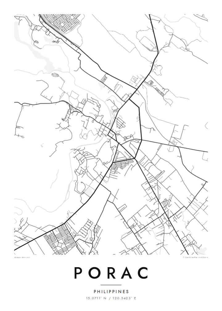
A Pampanga town spreading west from the plain toward the foothills, crossed by wide, pale lahar-scarred riverbeds.


Taone e tasi, lagona e lima
Pau te tapaki o se style ke lavea i luga i te puipui. E tutasi te tau o style takitasi — telotele mo faaki, e aunoa io me fai ki faila HD.
 Pixel tonu · faila lolomi 24 × 36″
Manino ki te lomiga
Tenei se 100% mai te faila lolomi tonu. Poster takitasi — telotele, faaki io me download — e faite i luga i a matou server i te 300 DPI, e oko atu ki 7,200 × 10,800 pixel, ko ala e maofio ei mo maiga vaega foliki i luga i te lolomi 24 × 36″.
I te pakitala


Te mape
Porac lies on the western edge of the Central Luzon plain, where flat rice land starts to rise toward the Zambales Mountains. From above, the town centre is a compact cluster of streets, while barangays spread outward along roads, the lines between them filled with fields. To the west the land becomes rougher and the street pattern thins out.
The town's recent history is written on its rivers. After Mount Pinatubo erupted in 1991, lahar flows moved down the channels that drain the volcano's slopes and buried large areas of Porac under volcanic sediment. On a map, the Porac River and nearby waterways show up as unusually wide, braided corridors, much broader than the water they usually carry.
A Porac map poster captures a place that rebuilt on new ground. The regular grid of the centre, the scattered villages and the broad riverbeds together describe a town between plain and mountain. In monochrome the sand channels read as pale bands running across the fields. The result is a record of change as much as of streets.
The channels draining from the Pinatubo area run through the municipality as wide, braided corridors, left behind by the volcanic sediment that moved down them after the 1991 eruption.
The poblacion forms a small, orderly block of streets, the densest part of the map and the point from which roads spread out to the surrounding barangays.
West of the centre, settlement thins and the roads start to wind. The map shows the change from flat Pampanga farmland to the uplands below the Zambales range.
Fai ke fakatau ki a koe
Fakaopoopo se aso, se igoa io me se fuaiupu o koe, sui te sitaila, te lasi io me te tuuga.
Te preview fua e maulalo te malamalama kae iai se watermark. Poster telotele mo faila HD e faite i te 300 DPI, e oko atu ki 7,200 × 10,800 px, aunoa mo se watermark.
Kaia a Porac
For families from Porac, and those who have moved away, this map carries the town's story of loss and rebuilding. It works as a quiet reminder of home, and the braided riverbeds make an unusual composition that visitors ask about.
Add a barangay name, a family name or an important date to the title and subtitle, and adjust the coordinates line. Pick one of five styles, from Classic black & white to Sand. Order it as a matte print, framed or unframed, or download the files for $9.
Otaina te poster Porac| Lasi o te lomiga | Manino | Faila |
|---|---|---|
| 30 × 40 cm11.8 × 15.7″ | 3,543 × 4,724 px | PNG · PDF |
| 29.7 × 42 cm (A3)11.7 × 16.5″ | 3,508 × 4,961 px | PNG · PDF |
| 42 × 59.4 cm (A2)16.5 × 23.4″ | 4,961 × 7,016 px | PNG · PDF |
| 45.7 × 61 cm18 × 24″ | 5,400 × 7,200 px | PNG · PDF |
| 50 × 70 cm19.7 × 27.6″ | 5,906 × 8,268 px | PNG · PDF |
| 61 × 91.4 cm24 × 36″ | 7,200 × 10,800 px | PNG · PDF |
Ke fakatusa, a te ata fakataitai fua e 900 px te lautele, mo te fakailoga kae mo lau lavea i luga i te komipiuta. A faila HD e oko ki te 8× te manino i itu katoa kae lomi faka‵lei i te lasi katoa o te pousita.
Filifili se style i te pito i luga o te itulau, kae filifili Poster Telotele — se lasi mo se faaki manafai e manako koe — io me Faila Digital HD. E tasi te sitepu mo te checkout, kae ka fakafou te itulau o tau ota i te taimi e mafai ei te totogi.
E telotele i luga o te pepa vali gali 200 gsm i se tasi mai lasi e ono, mai te 30 × 40 cm ki te 24 × 36″. E kamata te poster telotele mai i te $39, kae aofia ei te uta.
Ioe. Filifili se faaki lakau maoli i te kulokula, tea, oak maoli io me lakau pogisa. E oo mai ki tioata e se malepe kae toka ke tautau. E kamata te poster faaki mai i te $99, kae aofia ei te uta.
E tuku fua ki fenua e 60+. A poloaiga taki tasi e ta ne te tauhaga e latalata mai i a matou tauhaga ta i fenua e 30+, kae e masani o aunoa i aso galue e 3–7. E mafai o salasala te tulaga mo te sukesuke i lalo o Aku poloaiga. I nisi fenua e 2–5 vaiaso, kae i mea e seki tuku atu ei matou, e fakailoa atu e te mea tafaoga i mua o te totogi.
Auina mai se ata i loto i te 14 aso mai te taimi e oko ei kae ka toe telotele fua ne matou io me toe totogi atu tau tupe.
Ioe. I te editor i te itulau tenei, sui te ulutala, te ulutala lalo mo te laina o coordinate ki so se mea e manako koe, kae filifili se style mo se lasi. Oga telotele, faaki mo digital e faigana katoa i tau tusiga tonu.
Mo te $9 ka maua ne koe faila PNG 300 DPI mo PDF fakatoka lolomi i lasi e ono katoa, aunoa mo se watermark, ke lolomi i so se koga. E se mautinoa koe? Download muamua se preview fua e iai te watermark.
