Verrazzano-Narrows Bridge
This long suspension span crosses the Narrows from the island's northeast corner to Brooklyn. On the map it is a single clean line over open water, marking the entrance to New York Harbor.
Pousita mape faigofie · United States
40.5623° N / 74.1399° W
An island borough ringed by kills and bays, crossed by one great bridge and centred on a long green spine




Taone e tasi, lagona e lima
Pau te tapaki o se style ke lavea i luga i te puipui. E tutasi te tau o style takitasi — telotele mo faaki, e aunoa io me fai ki faila HD.
 Pixel tonu · faila lolomi 24 × 36″
Manino ki te lomiga
Tenei se 100% mai te faila lolomi tonu. Poster takitasi — telotele, faaki io me download — e faite i luga i a matou server i te 300 DPI, e oko atu ki 7,200 × 10,800 pixel, ko ala e maofio ei mo maiga vaega foliki i luga i te lolomi 24 × 36″.
I te pakitala


Te mape
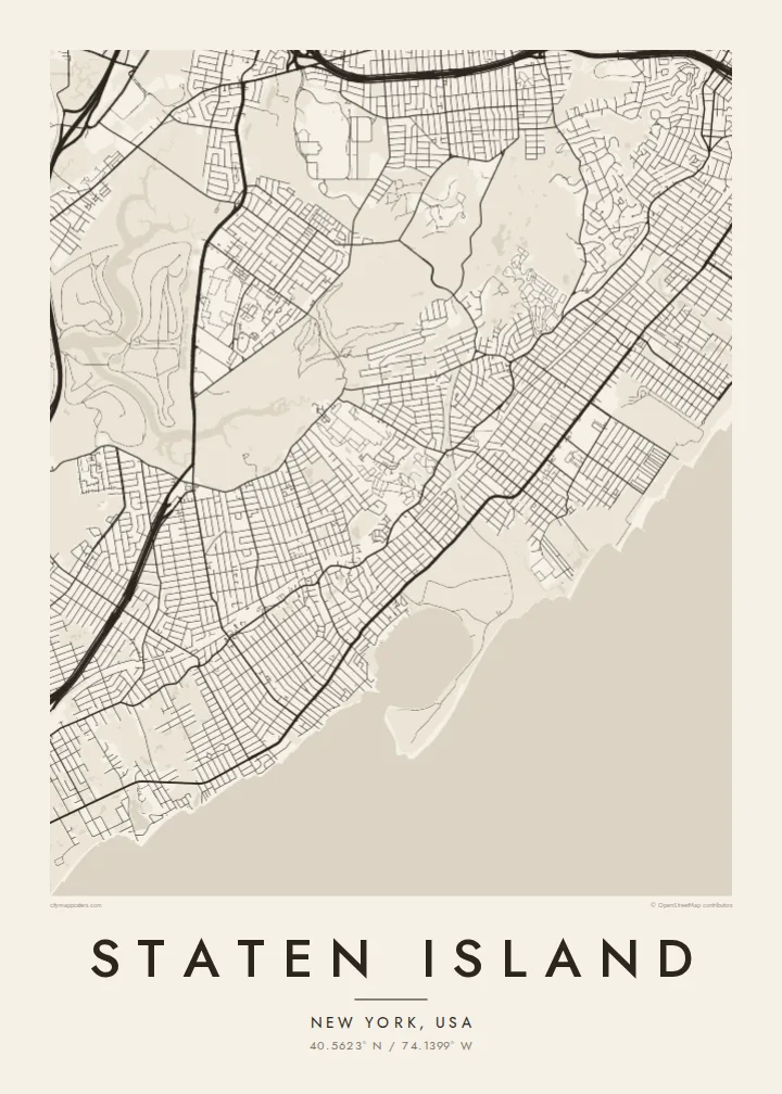
Staten Island is the most southern of New York City's five boroughs, and its outline is unmistakable on a map. The Kill Van Kull runs along its north shore, the Arthur Kill separates it from New Jersey on the west, and Lower New York Bay and Raritan Bay wrap the east and south. Inside that outline, the street pattern changes from dense grids near the ferry to looser suburban loops further south.
Four bridges tie the island to its neighbours: the Verrazzano-Narrows Bridge to Brooklyn, and the Goethals Bridge, Bayonne Bridge and Outerbridge Crossing to New Jersey. The Staten Island Expressway runs across the middle to link them. The free Staten Island Ferry leaves from St. George at the northern tip and has long carried commuters and visitors across the harbour to Manhattan.
A Staten Island map poster shows how much open land the borough still has. The Greenbelt fills a large wooded area in the middle, and on the west side, the former Fresh Kills landfill is being turned into Freshkills Park. Tidal creeks and marshes cut into the shoreline, so the edges look soft and uneven.
This long suspension span crosses the Narrows from the island's northeast corner to Brooklyn. On the map it is a single clean line over open water, marking the entrance to New York Harbor.
A connected stretch of woods, trails and parkland runs through the centre of the island. In black and white, it shows up as a large quiet area among the surrounding streets.
At the northern tip, the ferry terminal sits where the Kill Van Kull meets the Upper Bay. From here the dense early grid spreads uphill and gradually loosens as it moves inland.
Fai ke fakatau ki a koe
Fakaopoopo se aso, se igoa io me se fuaiupu o koe, sui te sitaila, te lasi io me te tuuga.
Te preview fua e maulalo te malamalama kae iai se watermark. Poster telotele mo faila HD e faite i te 300 DPI, e oko atu ki 7,200 × 10,800 px, aunoa mo se watermark.
Kaia a Staten Island
For many New Yorkers, Staten Island is home, and it is a place people feel strongly about. The island's outline makes a clear shape for a poster, and the bridges and green centre give it more detail than a plain street grid.
Add a personal title, a subtitle naming your neighbourhood and a coordinates line, then choose Classic black & white, Noir, Paper, Blueprint or Sand. HD files cost $9 in six print sizes, and printed posters come on matte paper with an optional wooden frame.
Otaina te poster Staten Island| Lasi o te lomiga | Manino | Faila |
|---|---|---|
| 30 × 40 cm11.8 × 15.7″ | 3,543 × 4,724 px | PNG · PDF |
| 29.7 × 42 cm (A3)11.7 × 16.5″ | 3,508 × 4,961 px | PNG · PDF |
| 42 × 59.4 cm (A2)16.5 × 23.4″ | 4,961 × 7,016 px | PNG · PDF |
| 45.7 × 61 cm18 × 24″ | 5,400 × 7,200 px | PNG · PDF |
| 50 × 70 cm19.7 × 27.6″ | 5,906 × 8,268 px | PNG · PDF |
| 61 × 91.4 cm24 × 36″ | 7,200 × 10,800 px | PNG · PDF |
Ke fakatusa, a te ata fakataitai fua e 900 px te lautele, mo te fakailoga kae mo lau lavea i luga i te komipiuta. A faila HD e oko ki te 8× te manino i itu katoa kae lomi faka‵lei i te lasi katoa o te pousita.
Filifili se style i te pito i luga o te itulau, kae filifili Poster Telotele — se lasi mo se faaki manafai e manako koe — io me Faila Digital HD. E tasi te sitepu mo te checkout, kae ka fakafou te itulau o tau ota i te taimi e mafai ei te totogi.
E telotele i luga o te pepa vali gali 200 gsm i se tasi mai lasi e ono, mai te 30 × 40 cm ki te 24 × 36″. E kamata te poster telotele mai i te $39, kae aofia ei te uta.
Ioe. Filifili se faaki lakau maoli i te kulokula, tea, oak maoli io me lakau pogisa. E oo mai ki tioata e se malepe kae toka ke tautau. E kamata te poster faaki mai i te $99, kae aofia ei te uta.
E tuku fua ki fenua e 60+. A poloaiga taki tasi e ta ne te tauhaga e latalata mai i a matou tauhaga ta i fenua e 30+, kae e masani o aunoa i aso galue e 3–7. E mafai o salasala te tulaga mo te sukesuke i lalo o Aku poloaiga. I nisi fenua e 2–5 vaiaso, kae i mea e seki tuku atu ei matou, e fakailoa atu e te mea tafaoga i mua o te totogi.
Auina mai se ata i loto i te 14 aso mai te taimi e oko ei kae ka toe telotele fua ne matou io me toe totogi atu tau tupe.
Ioe. I te editor i te itulau tenei, sui te ulutala, te ulutala lalo mo te laina o coordinate ki so se mea e manako koe, kae filifili se style mo se lasi. Oga telotele, faaki mo digital e faigana katoa i tau tusiga tonu.
Mo te $9 ka maua ne koe faila PNG 300 DPI mo PDF fakatoka lolomi i lasi e ono katoa, aunoa mo se watermark, ke lolomi i so se koga. E se mautinoa koe? Download muamua se preview fua e iai te watermark.
