Winding tidal creeks
Channels loop through the land around the town, their curves standing out clearly against the straight lines of roads and fields.
Pousita mape faigofie · Myanmar (Burma)
16.7600° N / 96.5250° E
A delta town southeast of Yangon, set among tidal creeks, rice paddies and long straight embankment roads



Taone e tasi, lagona e lima
Pau te tapaki o se style ke lavea i luga i te puipui. E tutasi te tau o style takitasi — telotele mo faaki, e aunoa io me fai ki faila HD.
 Pixel tonu · faila lolomi 24 × 36″
Manino ki te lomiga
Tenei se 100% mai te faila lolomi tonu. Poster takitasi — telotele, faaki io me download — e faite i luga i a matou server i te 300 DPI, e oko atu ki 7,200 × 10,800 pixel, ko ala e maofio ei mo maiga vaega foliki i luga i te lolomi 24 × 36″.
I te pakitala


Te mape
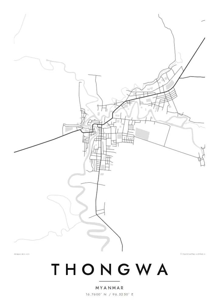
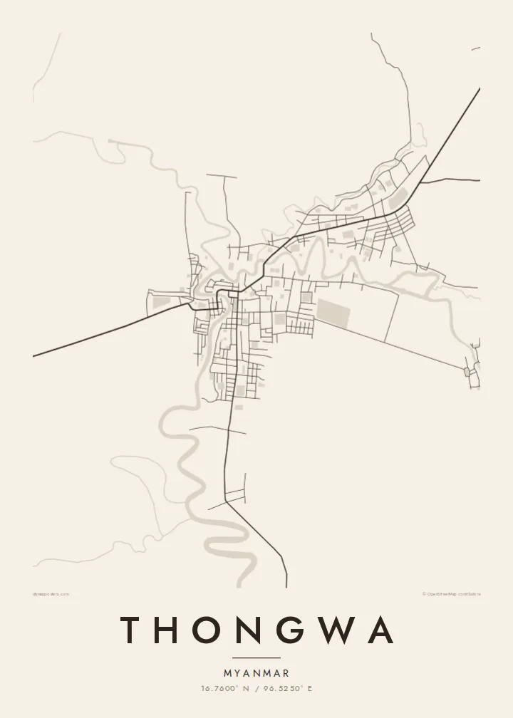
Thongwa is a town and township in the Yangon Region of Myanmar, located on the low, flat delta land southeast of the city of Yangon. The landscape is shaped by water. Creeks and channels wind through the countryside, and the fields between them are laid out as long rectangles of paddy.
From above, the town itself is a modest cluster of streets gathered along the roads and waterways that connect it to neighbouring settlements. Raised roads run across the fields in long, straight lines, and in places they follow the banks of channels. The surrounding area is mainly farming land, and rice cultivation dominates it.
A Thongwa map poster traces the balance between the small, compact town and the wide delta that surrounds it. The meandering creeks give the page soft, organic lines, and the roads and field boundaries provide order. It is an understated composition, suited to anyone with a personal link to this corner of lower Myanmar.
Channels loop through the land around the town, their curves standing out clearly against the straight lines of roads and fields.
Roads cross the flat delta in long, straight runs, linking Thongwa to neighbouring townships and toward Yangon.
Around the town, the land is divided into rectangular rice fields, which gives the outer part of the map a fine, regular texture.
Fai ke fakatau ki a koe
Fakaopoopo se aso, se igoa io me se fuaiupu o koe, sui te sitaila, te lasi io me te tuuga.
Te preview fua e maulalo te malamalama kae iai se watermark. Poster telotele mo faila HD e faite i te 300 DPI, e oko atu ki 7,200 × 10,800 px, aunoa mo se watermark.
Kaia a Thongwa
For families from Thongwa living in Yangon or abroad, a map is a simple way to keep the town and its waterways close, with the roads and creeks drawn exactly as they are.
You can personalise the title, subtitle and coordinates, and choose between Classic black & white, Noir, Paper, Blueprint and Sand. A free watermarked preview lets you check the framing before you buy.
Otaina te poster Thongwa| Lasi o te lomiga | Manino | Faila |
|---|---|---|
| 30 × 40 cm11.8 × 15.7″ | 3,543 × 4,724 px | PNG · PDF |
| 29.7 × 42 cm (A3)11.7 × 16.5″ | 3,508 × 4,961 px | PNG · PDF |
| 42 × 59.4 cm (A2)16.5 × 23.4″ | 4,961 × 7,016 px | PNG · PDF |
| 45.7 × 61 cm18 × 24″ | 5,400 × 7,200 px | PNG · PDF |
| 50 × 70 cm19.7 × 27.6″ | 5,906 × 8,268 px | PNG · PDF |
| 61 × 91.4 cm24 × 36″ | 7,200 × 10,800 px | PNG · PDF |
Ke fakatusa, a te ata fakataitai fua e 900 px te lautele, mo te fakailoga kae mo lau lavea i luga i te komipiuta. A faila HD e oko ki te 8× te manino i itu katoa kae lomi faka‵lei i te lasi katoa o te pousita.
Filifili se style i te pito i luga o te itulau, kae filifili Poster Telotele — se lasi mo se faaki manafai e manako koe — io me Faila Digital HD. E tasi te sitepu mo te checkout, kae ka fakafou te itulau o tau ota i te taimi e mafai ei te totogi.
E telotele i luga o te pepa vali gali 200 gsm i se tasi mai lasi e ono, mai te 30 × 40 cm ki te 24 × 36″. E kamata te poster telotele mai i te $39, kae aofia ei te uta.
Ioe. Filifili se faaki lakau maoli i te kulokula, tea, oak maoli io me lakau pogisa. E oo mai ki tioata e se malepe kae toka ke tautau. E kamata te poster faaki mai i te $99, kae aofia ei te uta.
E tuku fua ki fenua e 60+. A poloaiga taki tasi e ta ne te tauhaga e latalata mai i a matou tauhaga ta i fenua e 30+, kae e masani o aunoa i aso galue e 3–7. E mafai o salasala te tulaga mo te sukesuke i lalo o Aku poloaiga. I nisi fenua e 2–5 vaiaso, kae i mea e seki tuku atu ei matou, e fakailoa atu e te mea tafaoga i mua o te totogi.
Auina mai se ata i loto i te 14 aso mai te taimi e oko ei kae ka toe telotele fua ne matou io me toe totogi atu tau tupe.
Ioe. I te editor i te itulau tenei, sui te ulutala, te ulutala lalo mo te laina o coordinate ki so se mea e manako koe, kae filifili se style mo se lasi. Oga telotele, faaki mo digital e faigana katoa i tau tusiga tonu.
Mo te $9 ka maua ne koe faila PNG 300 DPI mo PDF fakatoka lolomi i lasi e ono katoa, aunoa mo se watermark, ke lolomi i so se koga. E se mautinoa koe? Download muamua se preview fua e iai te watermark.
