Ueda Castle park
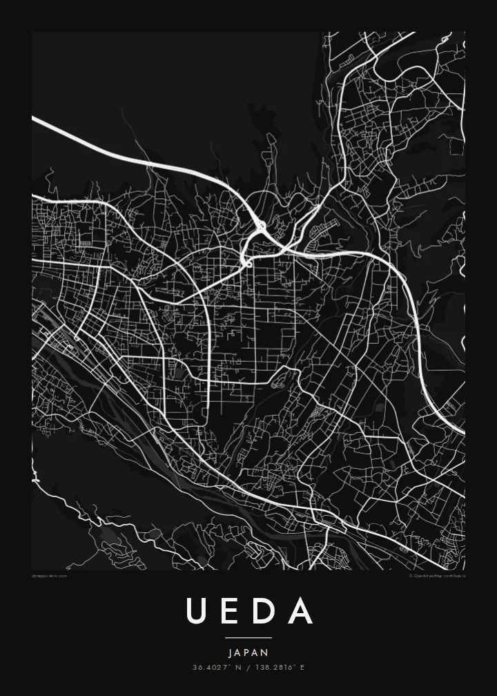
The castle site is a green block near the centre, and the trace of its moats and earthworks still shapes the streets around it.
Pousita mape faigofie · Japan
36.4027° N / 138.2816° E
A castle town in a mountain basin, with the Chikuma River curving along its southern edge and streets set around old fortifications



Taone e tasi, lagona e lima
Pau te tapaki o se style ke lavea i luga i te puipui. E tutasi te tau o style takitasi — telotele mo faaki, e aunoa io me fai ki faila HD.
 Pixel tonu · faila lolomi 24 × 36″
Manino ki te lomiga
Tenei se 100% mai te faila lolomi tonu. Poster takitasi — telotele, faaki io me download — e faite i luga i a matou server i te 300 DPI, e oko atu ki 7,200 × 10,800 pixel, ko ala e maofio ei mo maiga vaega foliki i luga i te lolomi 24 × 36″.
I te pakitala


Te mape
Ueda fills part of a wide basin in eastern Nagano, with mountains on every side. The Chikuma River curves along the south of the city, and its broad, braided channel is the strongest line on the map. North of the river, the older town spreads out from the site of Ueda Castle in a tighter grid, which loosens into farmland and residential streets towards the hills.
The castle is what made Ueda famous. Built by Sanada Masayuki, it held off Tokugawa armies twice, in 1585 and again in 1600, and the Sanada family remain a popular part of the city's identity. Today the castle grounds are a park, with rebuilt turrets and the old moat lines still visible in plan.
On an Ueda map poster, the park, the river and the rail lines that meet at Ueda Station, including the Hokuriku Shinkansen, form a clear frame. Further out to the south-west, the hot-spring village of Bessho Onsen sits at the edge of the basin.
The castle site is a green block near the centre, and the trace of its moats and earthworks still shapes the streets around it.
The wide river channel, with its gravel bars and bridges, runs along the southern side of the city and divides the basin in two.
Streets and fields stop where the terrain rises, so the city looks tightly enclosed, and that shows plainly in a minimalist print.
Fai ke fakatau ki a koe
Fakaopoopo se aso, se igoa io me se fuaiupu o koe, sui te sitaila, te lasi io me te tuuga.
Te preview fua e maulalo te malamalama kae iai se watermark. Poster telotele mo faila HD e faite i te 300 DPI, e oko atu ki 7,200 × 10,800 px, aunoa mo se watermark.
Kaia a Ueda
Ueda appeals to people who know its castle story, to those who studied or worked there, and to travellers who stopped between Tokyo and the Japan Alps. The map combines a samurai-era town plan with a river setting in one image.
The title, subtitle and coordinates line can all be changed, so you can mark a year in Nagano or a family connection. Then pick Classic black and white, Noir, Paper, Blueprint or Sand.
Otaina te poster Ueda| Lasi o te lomiga | Manino | Faila |
|---|---|---|
| 30 × 40 cm11.8 × 15.7″ | 3,543 × 4,724 px | PNG · PDF |
| 29.7 × 42 cm (A3)11.7 × 16.5″ | 3,508 × 4,961 px | PNG · PDF |
| 42 × 59.4 cm (A2)16.5 × 23.4″ | 4,961 × 7,016 px | PNG · PDF |
| 45.7 × 61 cm18 × 24″ | 5,400 × 7,200 px | PNG · PDF |
| 50 × 70 cm19.7 × 27.6″ | 5,906 × 8,268 px | PNG · PDF |
| 61 × 91.4 cm24 × 36″ | 7,200 × 10,800 px | PNG · PDF |
Ke fakatusa, a te ata fakataitai fua e 900 px te lautele, mo te fakailoga kae mo lau lavea i luga i te komipiuta. A faila HD e oko ki te 8× te manino i itu katoa kae lomi faka‵lei i te lasi katoa o te pousita.
Filifili se style i te pito i luga o te itulau, kae filifili Poster Telotele — se lasi mo se faaki manafai e manako koe — io me Faila Digital HD. E tasi te sitepu mo te checkout, kae ka fakafou te itulau o tau ota i te taimi e mafai ei te totogi.
E telotele i luga o te pepa vali gali 200 gsm i se tasi mai lasi e ono, mai te 30 × 40 cm ki te 24 × 36″. E kamata te poster telotele mai i te $39, kae aofia ei te uta.
Ioe. Filifili se faaki lakau maoli i te kulokula, tea, oak maoli io me lakau pogisa. E oo mai ki tioata e se malepe kae toka ke tautau. E kamata te poster faaki mai i te $99, kae aofia ei te uta.
E tuku fua ki fenua e 60+. A poloaiga taki tasi e ta ne te tauhaga e latalata mai i a matou tauhaga ta i fenua e 30+, kae e masani o aunoa i aso galue e 3–7. E mafai o salasala te tulaga mo te sukesuke i lalo o Aku poloaiga. I nisi fenua e 2–5 vaiaso, kae i mea e seki tuku atu ei matou, e fakailoa atu e te mea tafaoga i mua o te totogi.
Auina mai se ata i loto i te 14 aso mai te taimi e oko ei kae ka toe telotele fua ne matou io me toe totogi atu tau tupe.
Ioe. I te editor i te itulau tenei, sui te ulutala, te ulutala lalo mo te laina o coordinate ki so se mea e manako koe, kae filifili se style mo se lasi. Oga telotele, faaki mo digital e faigana katoa i tau tusiga tonu.
Mo te $9 ka maua ne koe faila PNG 300 DPI mo PDF fakatoka lolomi i lasi e ono katoa, aunoa mo se watermark, ke lolomi i so se koga. E se mautinoa koe? Download muamua se preview fua e iai te watermark.
