Canal network
Irrigation canals run through and around the city, drawing long lines across the map that link Urganch to the fields of the oasis and the river that feeds them.
Pousita mape faigofie · Uzbekistan
41.5518° N / 60.6314° E
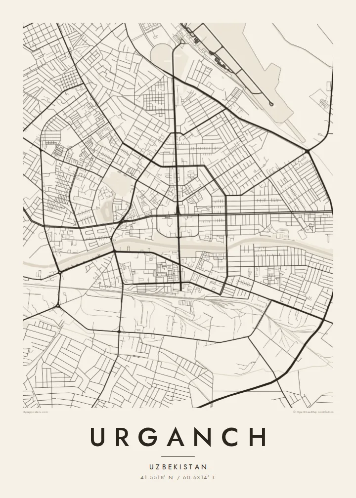
A Soviet-era grid set among irrigated fields and canals in the Khorezm oasis, near the lower reaches of the Amu Darya.




Taone e tasi, lagona e lima
Pau te tapaki o se style ke lavea i luga i te puipui. E tutasi te tau o style takitasi — telotele mo faaki, e aunoa io me fai ki faila HD.
 Pixel tonu · faila lolomi 24 × 36″
Manino ki te lomiga
Tenei se 100% mai te faila lolomi tonu. Poster takitasi — telotele, faaki io me download — e faite i luga i a matou server i te 300 DPI, e oko atu ki 7,200 × 10,800 pixel, ko ala e maofio ei mo maiga vaega foliki i luga i te lolomi 24 × 36″.
I te pakitala


Te mape
Urganch, often written Urgench, is the administrative centre of Uzbekistan's Xorazm Region, which occupies an oasis on the lower Amu Darya. The modern city was largely laid out in the twentieth century, and from above it reads as a regular grid of wide avenues and broad blocks. Around it, the land is divided by irrigation canals and field boundaries into a fine patchwork that stretches toward the river and the desert beyond.
The city should not be confused with Kunya-Urgench, the ancient Khwarazmian capital that lies across the border in Turkmenistan. Today's Urganch is best known as the gateway to Khiva, whose walled inner town, Itchan Kala, is a UNESCO World Heritage Site about 30 kilometres to the southwest. Cotton has long been the main crop of the surrounding oasis, fed by water drawn from the Amu Darya.
An Urganch map poster shows a city shaped by water in a dry landscape. Canals cut through and around the grid in long, gentle lines, and the fields outside create a texture of their own. Pulled back far enough, the frame can include the river to the north and east, turning the print into a portrait of the oasis rather than just the town.
Irrigation canals run through and around the city, drawing long lines across the map that link Urganch to the fields of the oasis and the river that feeds them.
The centre follows a twentieth-century plan of straight, generous avenues and large rectangular blocks, giving the core a strong geometric structure on the page.
The broad, braided course of the Amu Darya lies a short distance from the city, a pale ribbon that marks the edge of the irrigated Khorezm oasis.
Fai ke fakatau ki a koe
Fakaopoopo se aso, se igoa io me se fuaiupu o koe, sui te sitaila, te lasi io me te tuuga.
Te preview fua e maulalo te malamalama kae iai se watermark. Poster telotele mo faila HD e faite i te 300 DPI, e oko atu ki 7,200 × 10,800 px, aunoa mo se watermark.
Kaia a Urganch
For people from Xorazm, and for travellers who passed through on the way to Khiva, Urganch is a point of arrival and departure. Its map, with canals and fields around a clear grid, makes a thoughtful gift or a reminder of a long journey.
Personalise the title, subtitle and coordinates line, for instance with a family name or the date of a trip, and pick Classic black & white, Noir, Paper, Blueprint or Sand. A free watermarked preview lets you check the layout before buying.
Otaina te poster Urganch| Lasi o te lomiga | Manino | Faila |
|---|---|---|
| 30 × 40 cm11.8 × 15.7″ | 3,543 × 4,724 px | PNG · PDF |
| 29.7 × 42 cm (A3)11.7 × 16.5″ | 3,508 × 4,961 px | PNG · PDF |
| 42 × 59.4 cm (A2)16.5 × 23.4″ | 4,961 × 7,016 px | PNG · PDF |
| 45.7 × 61 cm18 × 24″ | 5,400 × 7,200 px | PNG · PDF |
| 50 × 70 cm19.7 × 27.6″ | 5,906 × 8,268 px | PNG · PDF |
| 61 × 91.4 cm24 × 36″ | 7,200 × 10,800 px | PNG · PDF |
Ke fakatusa, a te ata fakataitai fua e 900 px te lautele, mo te fakailoga kae mo lau lavea i luga i te komipiuta. A faila HD e oko ki te 8× te manino i itu katoa kae lomi faka‵lei i te lasi katoa o te pousita.
Filifili se style i te pito i luga o te itulau, kae filifili Poster Telotele — se lasi mo se faaki manafai e manako koe — io me Faila Digital HD. E tasi te sitepu mo te checkout, kae ka fakafou te itulau o tau ota i te taimi e mafai ei te totogi.
E telotele i luga o te pepa vali gali 200 gsm i se tasi mai lasi e ono, mai te 30 × 40 cm ki te 24 × 36″. E kamata te poster telotele mai i te $39, kae aofia ei te uta.
Ioe. Filifili se faaki lakau maoli i te kulokula, tea, oak maoli io me lakau pogisa. E oo mai ki tioata e se malepe kae toka ke tautau. E kamata te poster faaki mai i te $99, kae aofia ei te uta.
E tuku fua ki fenua e 60+. A poloaiga taki tasi e ta ne te tauhaga e latalata mai i a matou tauhaga ta i fenua e 30+, kae e masani o aunoa i aso galue e 3–7. E mafai o salasala te tulaga mo te sukesuke i lalo o Aku poloaiga. I nisi fenua e 2–5 vaiaso, kae i mea e seki tuku atu ei matou, e fakailoa atu e te mea tafaoga i mua o te totogi.
Auina mai se ata i loto i te 14 aso mai te taimi e oko ei kae ka toe telotele fua ne matou io me toe totogi atu tau tupe.
Ioe. I te editor i te itulau tenei, sui te ulutala, te ulutala lalo mo te laina o coordinate ki so se mea e manako koe, kae filifili se style mo se lasi. Oga telotele, faaki mo digital e faigana katoa i tau tusiga tonu.
Mo te $9 ka maua ne koe faila PNG 300 DPI mo PDF fakatoka lolomi i lasi e ono katoa, aunoa mo se watermark, ke lolomi i so se koga. E se mautinoa koe? Download muamua se preview fua e iai te watermark.
