Kiso River levees
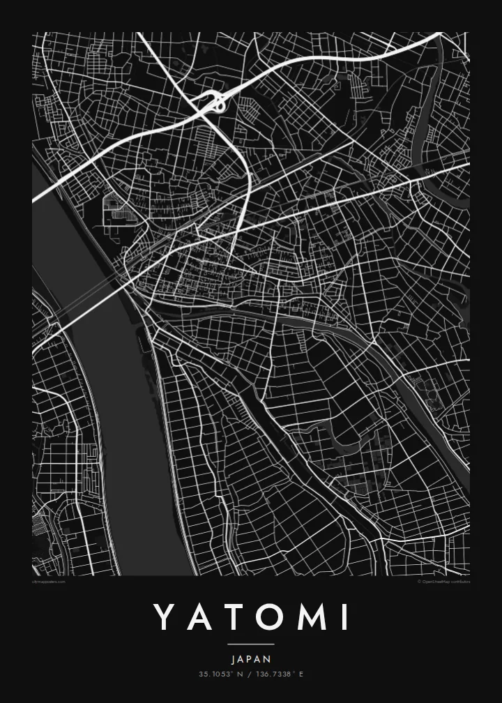
The wide river and its embankments run along the western edge of the city, a long, strong line separating Aichi from Mie.
Pousita mape faigofie · Japan
35.1053° N / 136.7338° E
A low-lying Aichi city on the Kiso River delta, laced with drainage channels, rice fields and goldfish ponds west of Nagoya.



Taone e tasi, lagona e lima
Pau te tapaki o se style ke lavea i luga i te puipui. E tutasi te tau o style takitasi — telotele mo faaki, e aunoa io me fai ki faila HD.
 Pixel tonu · faila lolomi 24 × 36″
Manino ki te lomiga
Tenei se 100% mai te faila lolomi tonu. Poster takitasi — telotele, faaki io me download — e faite i luga i a matou server i te 300 DPI, e oko atu ki 7,200 × 10,800 pixel, ko ala e maofio ei mo maiga vaega foliki i luga i te lolomi 24 × 36″.
I te pakitala


Te mape
Yatomi lies on the delta lands at the western edge of Aichi Prefecture, where the Kiso River forms the boundary with Mie. Much of the city was reclaimed from shallow bays and wetlands over centuries, and a large part of it sits at or below sea level. On a map this history appears as flat, carefully divided land crossed by embankments and drainage channels.
The street pattern is modest and practical, with residential districts clustered along main roads and rail lines, and the rest of the land given over to fields, ponds and waterways. Rivers and canals run roughly north to south toward Ise Bay, and the long embankments of the Kiso on the western side form one of the clearest lines in the composition.
Yatomi is widely known for goldfish farming, a tradition that has made it one of Japan's main producers, and the rectangular breeding ponds add a distinctive geometric texture to the landscape. A Yatomi map poster renders that water-shaped country in fine black lines, from the river levees to the patchwork of ponds and paddies around the town.
The wide river and its embankments run along the western edge of the city, a long, strong line separating Aichi from Mie.
Rectangular breeding ponds sit in neat rows among the fields, forming a repeating pattern that is specific to Yatomi and its goldfish trade.
Straight drainage channels and field boundaries divide land reclaimed from the bay, giving the southern part of the map a calm, ruled geometry.
Fai ke fakatau ki a koe
Fakaopoopo se aso, se igoa io me se fuaiupu o koe, sui te sitaila, te lasi io me te tuuga.
Te preview fua e maulalo te malamalama kae iai se watermark. Poster telotele mo faila HD e faite i te 300 DPI, e oko atu ki 7,200 × 10,800 px, aunoa mo se watermark.
Kaia a Yatomi
For people from Yatomi, and for anyone who knows the flat, watery country west of Nagoya, this map captures a landscape shaped entirely by human effort against water. It is quiet, precise and full of subtle detail.
Add a title, a subtitle such as a year or family name, and the coordinates line, then choose Classic black & white, Noir, Paper, Blueprint or Sand. The $9 download includes A3, A2 and four other sizes as 300 DPI PNG and PDF.
Otaina te poster Yatomi| Lasi o te lomiga | Manino | Faila |
|---|---|---|
| 30 × 40 cm11.8 × 15.7″ | 3,543 × 4,724 px | PNG · PDF |
| 29.7 × 42 cm (A3)11.7 × 16.5″ | 3,508 × 4,961 px | PNG · PDF |
| 42 × 59.4 cm (A2)16.5 × 23.4″ | 4,961 × 7,016 px | PNG · PDF |
| 45.7 × 61 cm18 × 24″ | 5,400 × 7,200 px | PNG · PDF |
| 50 × 70 cm19.7 × 27.6″ | 5,906 × 8,268 px | PNG · PDF |
| 61 × 91.4 cm24 × 36″ | 7,200 × 10,800 px | PNG · PDF |
Ke fakatusa, a te ata fakataitai fua e 900 px te lautele, mo te fakailoga kae mo lau lavea i luga i te komipiuta. A faila HD e oko ki te 8× te manino i itu katoa kae lomi faka‵lei i te lasi katoa o te pousita.
Filifili se style i te pito i luga o te itulau, kae filifili Poster Telotele — se lasi mo se faaki manafai e manako koe — io me Faila Digital HD. E tasi te sitepu mo te checkout, kae ka fakafou te itulau o tau ota i te taimi e mafai ei te totogi.
E telotele i luga o te pepa vali gali 200 gsm i se tasi mai lasi e ono, mai te 30 × 40 cm ki te 24 × 36″. E kamata te poster telotele mai i te $39, kae aofia ei te uta.
Ioe. Filifili se faaki lakau maoli i te kulokula, tea, oak maoli io me lakau pogisa. E oo mai ki tioata e se malepe kae toka ke tautau. E kamata te poster faaki mai i te $99, kae aofia ei te uta.
E tuku fua ki fenua e 60+. A poloaiga taki tasi e ta ne te tauhaga e latalata mai i a matou tauhaga ta i fenua e 30+, kae e masani o aunoa i aso galue e 3–7. E mafai o salasala te tulaga mo te sukesuke i lalo o Aku poloaiga. I nisi fenua e 2–5 vaiaso, kae i mea e seki tuku atu ei matou, e fakailoa atu e te mea tafaoga i mua o te totogi.
Auina mai se ata i loto i te 14 aso mai te taimi e oko ei kae ka toe telotele fua ne matou io me toe totogi atu tau tupe.
Ioe. I te editor i te itulau tenei, sui te ulutala, te ulutala lalo mo te laina o coordinate ki so se mea e manako koe, kae filifili se style mo se lasi. Oga telotele, faaki mo digital e faigana katoa i tau tusiga tonu.
Mo te $9 ka maua ne koe faila PNG 300 DPI mo PDF fakatoka lolomi i lasi e ono katoa, aunoa mo se watermark, ke lolomi i so se koga. E se mautinoa koe? Download muamua se preview fua e iai te watermark.
Koga pili
