Mangrove creeks
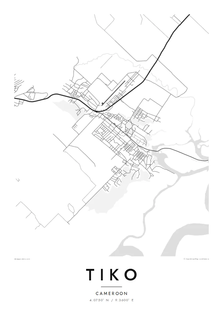
Tidal channels split the southern part of the map into many narrow fingers of land and water. The result is a detailed, organic pattern at the edge of the poster.
Simpol poster blong map · Cameroon
4.0750° N / 9.3600° E
A low coastal town among mangrove creeks near the Cameroon estuary, with plantation land spreading toward the mountain



Wan taon, faef filing
Klikim wan style blong luk hem antap long wol. Evri style i sem prais nomo — sapos yu prinim, putum insaed frem, o daonlodem olsem HD file.
 Trufala pixel · 24 × 36″ prin file
Klia blong prent
Hemia i wan 100% haf blong trufala prin file. Evri poster — sapos prinim, putum insaed frem, o daonlodem — mifala i wokem long server blong mifala long 300 DPI, kasem 7,200 × 10,800 pixel, mekem se nomata ol smol rod tu oli klia gud long wan 24 × 36″ prin.
Long wol


Map
Tiko lies on the coast of Cameroon's South-West Region, between Limbe and Douala. It sits on low ground near the wide estuary where several rivers meet the Gulf of Guinea. From above the southern edge of the map breaks up into mangrove creeks and tidal channels, and firmer land to the north carries the town and its roads.
Much of the surrounding land has long been used for large plantations of bananas, rubber and oil palm. On the map these show as broad, evenly divided blocks. The town itself is more irregular, with its streets clustered along the main road that links the coast to Buea and Douala.
Mount Cameroon rises to the northwest, one of the highest peaks in West Africa. Tiko sits on the gentle lower ground below it. A Tiko map poster shows that range of landscape in one frame: tangled creeks, planted fields and a town built along a road.
Tidal channels split the southern part of the map into many narrow fingers of land and water. The result is a detailed, organic pattern at the edge of the poster.
The plantations around town are laid out in large, regular parcels. On the map they add quiet geometry next to the looser town streets.
The main road runs through Tiko and links it to Limbe, Buea and Douala. It forms the spine along which most of the town grew.
Mekem i blong yu
Putum wan dei, wan nem o wan laen blong yu, jenisim stael, saes o saed.
Fri preview i lo-resolusen mo i gat watermak. Prin mo HD file oli wok long 300 DPI, kasem 7,200 × 10,800 px, i no gat watermak.
From wanem Tiko
For families from Fako and the South-West, a map of Tiko is a personal piece of home. It is also a striking design, with fine creeks on one side and a settled town on the other.
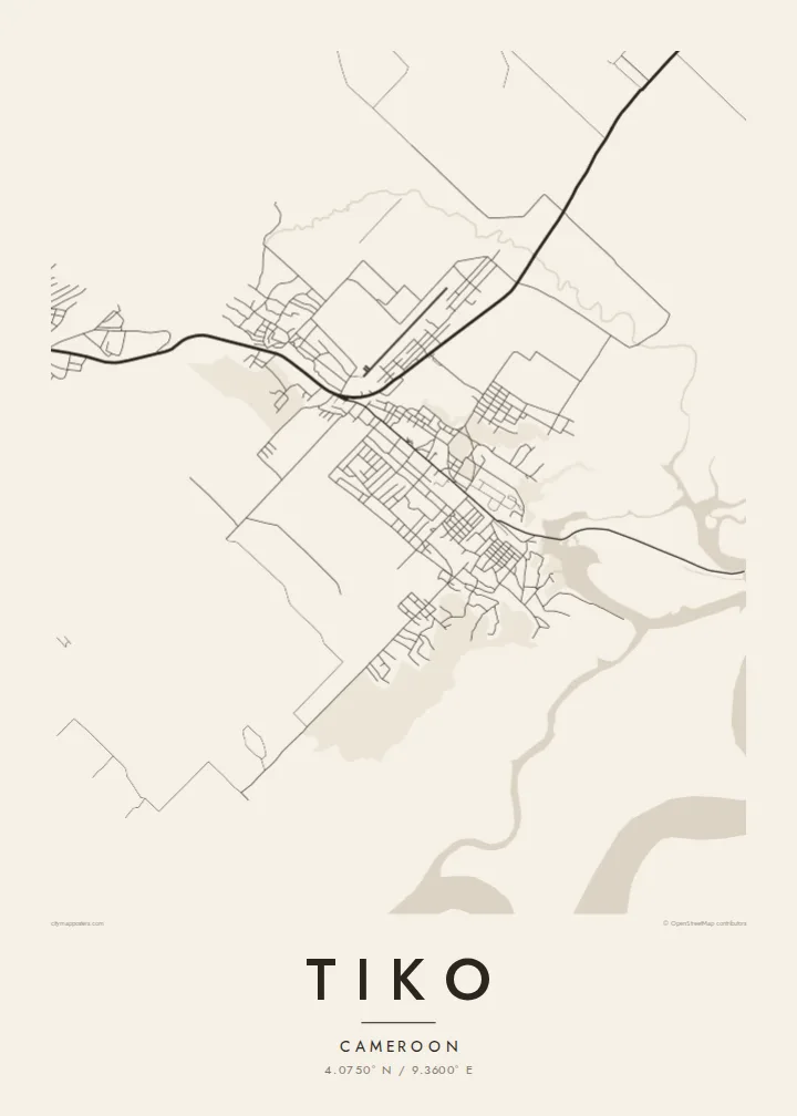
Give the poster your own title and a subtitle such as a family name or a year, and keep the coordinates. Choose from five styles: Classic black and white, Noir, Paper, Blueprint or Sand.
Odarem poster blong Tiko| Saes blong prent | Rezolusen | Ol fael |
|---|---|---|
| 30 × 40 cm (11.8 × 15.7″) | 3,543 × 4,724 px | PNG · PDF |
| 29.7 × 42 cm (A3, 11.7 × 16.5″) | 3,508 × 4,961 px | PNG · PDF |
| 42 × 59.4 cm (A2, 16.5 × 23.4″) | 4,961 × 7,016 px | PNG · PDF |
| 45.7 × 61 cm (18 × 24″) | 5,400 × 7,200 px | PNG · PDF |
| 50 × 70 cm (19.7 × 27.6″) | 5,906 × 8,268 px | PNG · PDF |
| 61 × 91.4 cm (24 × 36″) | 7,200 × 10,800 px | PNG · PDF |
Blong yu save komperem, fri priviu i 900 px long waed, i gat wotamak mo i blong skrin nomo. Ol HD fael oli gat kasem 8× moa rezolusen long evri saed mo oli prent klia long ful saes blong poster.
Jusum wan style antap long pej, biaen jusum Prinim Poster — wan saes mo, sapos yu wantem, wan frem — o Digital HD Files. Pemen i wan step nomo, mo pej blong oda blong yu i apdet stret taem pemen i pas.
Mifala i prinim long gudfala 200 gsm matte pepa, long wan long 6 saes, statem long 30 × 40 cm kasem 24 × 36″. Prin poster i statem long $39, sipin i insaed finis.
Yes. Jusum wan strong wud frem long kala blak, waet, natural oak, o tudak wud. I gat glas we i no save brok isi, mo i rere blong hangem stret. Poster wetem frem i statem long $99, sipin i insaed finis.
Delivri blong poster i fri long olgeta ples long wol. Wan wan poster i prin long wan long ol prin patna blong mifala we i kolosap moa long yu, long moa long 30 kantri, mo bambae i kasem yu long 3–7 wokdei. Yu save lukluk stetes mo trakin long My Orders. Sam kantri i tekem 2–5 wik, mo long ol ples we mifala i no save sendem yet, saet i talem yu bifo yu pem.
Sendem wan foto long mifala insaed 14 dei afta i kasem yu, mo mifala bae i prinim wan niufala fri o givim bak mane blong yu.
Yes. Long editor long pej ya, jenisim taetol, sabtaetol, mo laen blong koordinet i go long wanem yu wantem, mo jusum wan style mo saes. Prin, frem, mo digital oda oli yusum stret design blong yu.
Long $9 yu kasem 300 DPI PNG mo PDF file we i rere blong prinim, long evri 6 saes, i no gat watermak, mo yu save prinim long enisave ples. Yu no sua yet? Daonlodem wan fri preview wetem watermak fastaem.
Klosap
