Hilly terrain
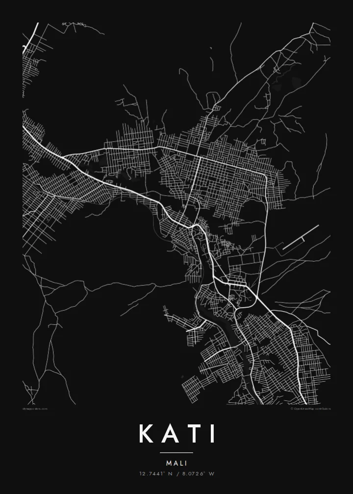
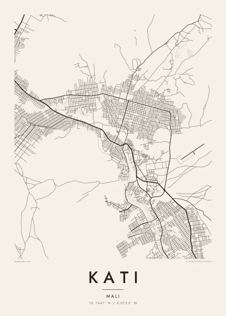
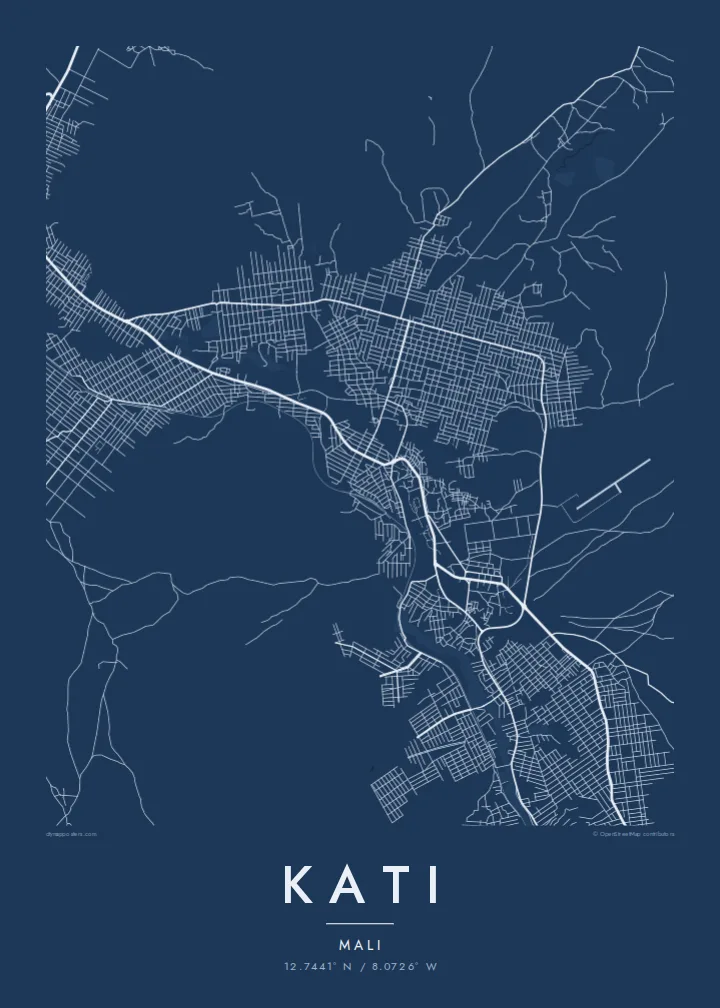
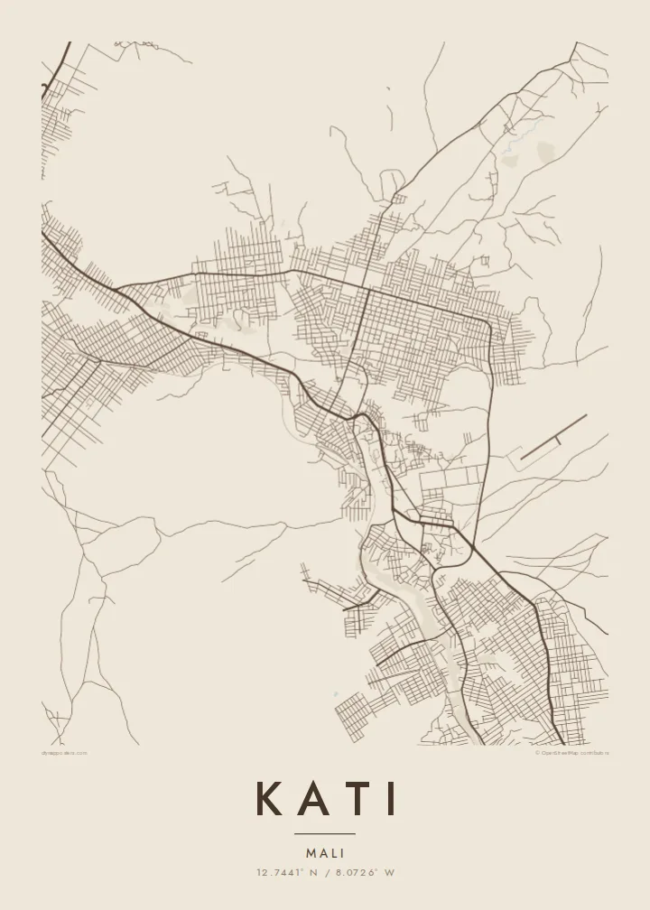
Kati sits among rocky hills above the Niger valley. On the poster, streets bend around the high ground and leave open spaces where slopes are steep.
Pòster de mapa minimalista · Mali
12.7441° N / 8.0726° W
A hill town just northwest of Bamako, its streets spread across rocky slopes and cut by the old railway line.

Una ciutat, cinc ambients
Toca un estil per veure com queda a la paret. Tots els estils tenen el mateix preu, ja sigui imprès, emmarcat o en fitxers HD.
 Píxels reals · fitxer d'impressió de 24 × 36″
Nitidesa d'impressió
Aquesta és una retallada al 100% del fitxer d'impressió real. Cada pòster —imprès, emmarcat o descarregat— es genera als nostres servidors a 300 DPI, fins a 7,200 × 10,800 píxels, de manera que fins i tot els carrers més petits es vegin nítids en una impressió de 24 × 36″.
A la paret


El mapa
Kati lies about fifteen kilometres northwest of Bamako, on the higher ground above the Niger valley. From above, the town spreads across rocky hills and plateaus, and the street pattern follows the terrain, with denser blocks in the lower areas and scattered roads on the slopes. The railway from Bamako toward Dakar passes through the town, drawing a long line across the map.
Kati is the administrative centre of the surrounding cercle and is home to Mali's main military camp, which has made it a significant town in the country's recent history. Its proximity to Bamako means many residents commute to the capital, and the road between the two towns is one of the busiest in the region.
A Kati map poster shows a town shaped by its hills: roads winding around high ground, open spaces where the terrain is too steep to build, and the straight line of the railway crossing through. It is a distinctive composition for a place closely tied to the capital yet clearly separate from it.
Kati sits among rocky hills above the Niger valley. On the poster, streets bend around the high ground and leave open spaces where slopes are steep.
The historic line toward Dakar passes through the town, drawing a long straight stroke across the map.
The main road heads southeast toward the capital, linking the two towns and forming a clear axis on the map.
Fes-lo teu
Afegeix una data, un nom o una frase pròpia, i canvia l'estil, la mida o l'orientació.
La previsualització gratuïta és de baixa resolució i porta marca d'aigua. Les impressions i els fitxers HD es generen a 300 DPI, fins a 7,200 × 10,800 px, sense marca d'aigua.
Per què Kati
Kati is home to many families and military personnel with ties across Mali and abroad. A map of the town is a personal way to remember a posting, a childhood or a family house on the hills above Bamako.
Choose a style (Classic black & white, Noir, Paper, Blueprint or Sand) and personalise the title, subtitle and coordinates, perhaps with a name or a year. A free 900 px preview is available, and the HD files are $9.
Demana el pòster de Kati| Mida d'impressió | Resolució | Fitxers |
|---|---|---|
| 30 × 40 cm (11.8 × 15.7″) | 3,543 × 4,724 px | PNG · PDF |
| 29.7 × 42 cm (A3, 11.7 × 16.5″) | 3,508 × 4,961 px | PNG · PDF |
| 42 × 59.4 cm (A2, 16.5 × 23.4″) | 4,961 × 7,016 px | PNG · PDF |
| 45.7 × 61 cm (18 × 24″) | 5,400 × 7,200 px | PNG · PDF |
| 50 × 70 cm (19.7 × 27.6″) | 5,906 × 8,268 px | PNG · PDF |
| 61 × 91.4 cm (24 × 36″) | 7,200 × 10,800 px | PNG · PDF |
Per comparar, la previsualització gratuïta fa 900 px d'amplada, porta marca d'aigua i està pensada per a pantalles. Els fitxers HD tenen fins a 8 vegades més resolució en cada direcció i s'imprimeixen perfectament a mida de pòster completa.
Tria un estil a la part superior de la pàgina i, després, selecciona Pòster imprès —una mida i, si vols, un marc— o Fitxers digitals HD. El pagament es fa en un sol pas i la pàgina de la teva comanda s'actualitza tan bon punt es confirma el pagament.
S'imprimeix en paper mat premium de 200 g/m² en una de sis mides, des de 30 × 40 cm fins a 24 × 36″. Els pòsters impresos comencen a {printFrom}, amb l'enviament inclòs.
Sí. Tria un marc de fusta massissa en negre, blanc, roure natural o fusta fosca. Inclou un vidre irrompible i està llest per penjar. Els pòsters emmarcats comencen a {framedFrom}, amb l'enviament inclòs.
L'enviament és gratuït a tot el món. Cada pòster s'imprimeix al soci d'impressió més proper d'entre més de 30 països i normalment arriba en 3–7 dies laborables. Pots seguir l'estat i el seguiment a Les meves comandes.
Envia'ns una foto dins dels 14 dies posteriors a la recepció i te'l tornarem a imprimir gratuïtament o et retornarem els diners.
Sí. A l'editor d'aquesta pàgina pots canviar el títol, el subtítol i la línia de coordenades pel que vulguis, i triar un estil i una mida. Les comandes impreses, emmarcades i digitals fan servir exactament el teu disseny.
Per $9 obtens fitxers PNG a 300 DPI i PDF llestos per imprimir en les sis mides, sense marca d'aigua, per imprimir on vulguis. Encara no ho tens clar? Descarrega abans una previsualització gratuïta amb marca d'aigua.
