Überlinger See
The long, narrow northwestern arm reaches deep into the German shore. This slender finger of water gives the lake its distinctive asymmetric outline.
Pòster de mapa minimalista · Alemanya
47.6478° N / 9.3063° E
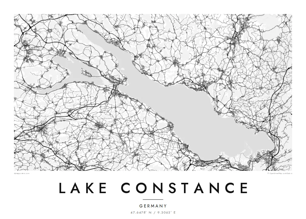
A broad lake shared by Germany, Austria and Switzerland, branching at its western end into slender arms and islands.


Una ciutat, cinc ambients
Toca un estil per veure com queda a la paret. Tots els estils tenen el mateix preu, ja sigui imprès, emmarcat o en fitxers HD.
 Píxels reals · fitxer d'impressió de 24 × 36″
Nitidesa d'impressió
Aquesta és una retallada al 100% del fitxer d'impressió real. Cada pòster —imprès, emmarcat o descarregat— es genera als nostres servidors a 300 DPI, fins a 7,200 × 10,800 píxels, de manera que fins i tot els carrers més petits es vegin nítids en una impressió de 24 × 36″.
A la paret


El mapa
Lake Constance, the Bodensee, lies at the northern edge of the Alps where Germany, Austria and Switzerland meet. Its main body, the Obersee, is a wide basin running from Bregenz in the southeast to the Überlinger See in the northwest. A separate lower lake, the Untersee, lies beyond the city of Konstanz, with a short stretch of the Rhine between the two.
The Rhine enters the lake near Bregenz and leaves at the western end, continuing toward the Rhine Falls. Unusually, the three countries have never agreed on a precise border through the Obersee, so much of the open water has no fixed dividing line. Around the shore, Lindau, Friedrichshafen, Meersburg, Konstanz and Bregenz form a ring of harbour towns.
The islands add detail to the outline. Lindau's old town sits on an island linked to the shore, Mainau is known for its gardens, and Reichenau, with its early medieval monasteries, is a UNESCO World Heritage site. A Lake Constance map poster shows the shores of all three countries together, framed around a single body of water.
The long, narrow northwestern arm reaches deep into the German shore. This slender finger of water gives the lake its distinctive asymmetric outline.
At the eastern end, Lindau's historic centre occupies a small island joined to the mainland by a road bridge and a railway embankment.
Konstanz sits where the Obersee narrows into the Rhine, which flows briefly as a river before widening into the Untersee around the island of Reichenau.
Fes-lo teu
Afegeix una data, un nom o una frase pròpia, i canvia l'estil, la mida o l'orientació.
La previsualització gratuïta és de baixa resolució i porta marca d'aigua. Les impressions i els fitxers HD es generen a 300 DPI, fins a 7,200 × 10,800 px, sense marca d'aigua.
Per què Lake Constance
Lake Constance is a shared home for people in three countries and a regular destination for cycling tours, sailing and summer holidays. A map of the whole lake connects every harbour, which makes it a fitting gift for anyone who knows its shores.
Personalise the title and subtitle, perhaps with Bodensee or a town name and a date, and choose from Classic black & white, Noir, Paper, Blueprint and Sand. The HD files cost $9 for all six sizes, and printed posters ship from partners in more than 30 countries.
Demana el pòster de Lake Constance| Mida d'impressió | Resolució | Fitxers |
|---|---|---|
| 30 × 40 cm (11.8 × 15.7″) | 3,543 × 4,724 px | PNG · PDF |
| 29.7 × 42 cm (A3, 11.7 × 16.5″) | 3,508 × 4,961 px | PNG · PDF |
| 42 × 59.4 cm (A2, 16.5 × 23.4″) | 4,961 × 7,016 px | PNG · PDF |
| 45.7 × 61 cm (18 × 24″) | 5,400 × 7,200 px | PNG · PDF |
| 50 × 70 cm (19.7 × 27.6″) | 5,906 × 8,268 px | PNG · PDF |
| 61 × 91.4 cm (24 × 36″) | 7,200 × 10,800 px | PNG · PDF |
Per comparar, la previsualització gratuïta fa 900 px d'amplada, porta marca d'aigua i està pensada per a pantalles. Els fitxers HD tenen fins a 8 vegades més resolució en cada direcció i s'imprimeixen perfectament a mida de pòster completa.
Tria un estil a la part superior de la pàgina i, després, selecciona Pòster imprès —una mida i, si vols, un marc— o Fitxers digitals HD. El pagament es fa en un sol pas i la pàgina de la teva comanda s'actualitza tan bon punt es confirma el pagament.
S'imprimeix en paper mat premium de 200 g/m² en una de sis mides, des de 30 × 40 cm fins a 24 × 36″. Els pòsters impresos comencen a $39, amb l'enviament inclòs.
Sí. Tria un marc de fusta massissa en negre, blanc, roure natural o fusta fosca. Inclou un vidre irrompible i està llest per penjar. Els pòsters emmarcats comencen a $99, amb l'enviament inclòs.
L'enviament és gratuït a tot el món. Cada pòster l'imprimeix el soci d'impressió més proper dels nostres, en més de 30 països, i normalment arriba en 3–7 dies feiners. Pots seguir l'estat i el seguiment a Les meves comandes. Alguns països triguen entre 2 i 5 setmanes, i si encara no enviem a un país, el web t'ho avisa abans de pagar.
Envia'ns una foto dins dels 14 dies posteriors a la recepció i te'l tornarem a imprimir gratuïtament o et retornarem els diners.
Sí. A l'editor d'aquesta pàgina pots canviar el títol, el subtítol i la línia de coordenades pel que vulguis, i triar un estil i una mida. Les comandes impreses, emmarcades i digitals fan servir exactament el teu disseny.
Per $9 obtens fitxers PNG a 300 DPI i PDF llestos per imprimir en les sis mides, sense marca d'aigua, per imprimir on vulguis. Encara no ho tens clar? Descarrega abans una previsualització gratuïta amb marca d'aigua.
A prop
