Ajinkyatara fort hill
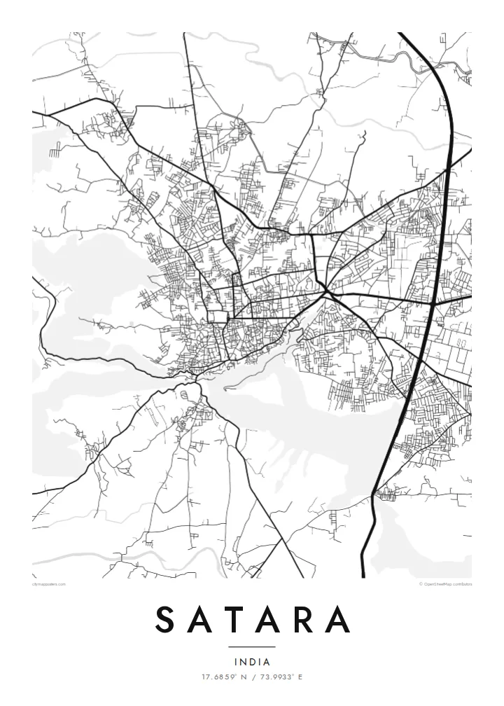
The fort's plateau rises right beside the town. On the map the streets thin out and bend around its slopes, leaving a clear open shape that anchors the whole composition.
Pòster de mapa minimalista · Índia
17.6859° N / 73.9933° E
A hill-ringed Deccan town between the Krishna and Venna rivers, with a fort ridge rising directly above its streets


Una ciutat, cinc ambients
Toca un estil per veure com queda a la paret. Tots els estils tenen el mateix preu, ja sigui imprès, emmarcat o en fitxers HD.
 Píxels reals · fitxer d'impressió de 24 × 36″
Nitidesa d'impressió
Aquesta és una retallada al 100% del fitxer d'impressió real. Cada pòster —imprès, emmarcat o descarregat— es genera als nostres servidors a 300 DPI, fins a 7,200 × 10,800 píxels, de manera que fins i tot els carrers més petits es vegin nítids en una impressió de 24 × 36″.
A la paret


El mapa
Satara sits in a bowl of the Western Ghats foothills, close to where the Venna joins the Krishna. From above, the town spreads across fairly level ground and stops where the slopes begin, so the edges of its street network follow the contours of the hills around it. Ajinkyatara, the fort that overlooks the city, shows on the map as a flat-topped ridge pressing against the edge of town.
Satara matters in Maratha history. In the eighteenth century it was the seat of the Chhatrapati line descended from Shivaji. The older quarters still have the dense, irregular lanes of a courtly town rather than a planned grid. Newer neighbourhoods and the main highway corridor spread outward in straighter lines, so the map has two distinct textures side by side.
A Satara map poster also has room for the landscape beyond the town. To the west, the Kaas plateau, known for the wildflowers that cover it after the monsoon, sits high on the escarpment, and roads climb toward it in tight switchbacks. Drawn in fine black lines, the river, the fort hill and the winding ghat roads make a composition that is clearly tied to its terrain.
The fort's plateau rises right beside the town. On the map the streets thin out and bend around its slopes, leaving a clear open shape that anchors the whole composition.
Two rivers meet near the city. Their curving channels add soft, organic lines to the map, a counterpoint to the compact and busy street pattern of the town itself.
Roads heading west toward the Sahyadri escarpment fold into tight hairpins as they climb, a pattern that reads almost like handwriting when printed in thin black line.
Fes-lo teu
Afegeix una data, un nom o una frase pròpia, i canvia l'estil, la mida o l'orientació.
La previsualització gratuïta és de baixa resolució i porta marca d'aigua. Les impressions i els fitxers HD es generen a 300 DPI, fins a 7,200 × 10,800 px, sense marca d'aigua.
Per què Satara
For people from Satara, and for those who have passed through on the way to the Kaas plateau or Mahabaleshwar, this map shows a familiar geography of fort, river and hills. It works as a quiet reminder of home, of student years, or of a monsoon trek.
You can set your own title, subtitle and coordinates line, adding a family name or a date, and choose from five styles: Classic black & white, Noir, Paper, Blueprint or Sand. You can download HD files for $9 or order a matte print with an optional wooden frame.
Demana el pòster de Satara| Mida d'impressió | Resolució | Fitxers |
|---|---|---|
| 30 × 40 cm (11.8 × 15.7″) | 3,543 × 4,724 px | PNG · PDF |
| 29.7 × 42 cm (A3, 11.7 × 16.5″) | 3,508 × 4,961 px | PNG · PDF |
| 42 × 59.4 cm (A2, 16.5 × 23.4″) | 4,961 × 7,016 px | PNG · PDF |
| 45.7 × 61 cm (18 × 24″) | 5,400 × 7,200 px | PNG · PDF |
| 50 × 70 cm (19.7 × 27.6″) | 5,906 × 8,268 px | PNG · PDF |
| 61 × 91.4 cm (24 × 36″) | 7,200 × 10,800 px | PNG · PDF |
Per comparar, la previsualització gratuïta fa 900 px d'amplada, porta marca d'aigua i està pensada per a pantalles. Els fitxers HD tenen fins a 8 vegades més resolució en cada direcció i s'imprimeixen perfectament a mida de pòster completa.
Tria un estil a la part superior de la pàgina i, després, selecciona Pòster imprès —una mida i, si vols, un marc— o Fitxers digitals HD. El pagament es fa en un sol pas i la pàgina de la teva comanda s'actualitza tan bon punt es confirma el pagament.
S'imprimeix en paper mat premium de 200 g/m² en una de sis mides, des de 30 × 40 cm fins a 24 × 36″. Els pòsters impresos comencen a {printFrom}, amb l'enviament inclòs.
Sí. Tria un marc de fusta massissa en negre, blanc, roure natural o fusta fosca. Inclou un vidre irrompible i està llest per penjar. Els pòsters emmarcats comencen a {framedFrom}, amb l'enviament inclòs.
L'enviament és gratuït a tot el món. Cada pòster l'imprimeix el soci d'impressió més proper dels nostres, en més de 30 països, i normalment arriba en 3–7 dies feiners. Pots seguir l'estat i el seguiment a Les meves comandes. Alguns països triguen entre 2 i 5 setmanes, i si encara no enviem a un país, el web t'ho avisa abans de pagar.
Envia'ns una foto dins dels 14 dies posteriors a la recepció i te'l tornarem a imprimir gratuïtament o et retornarem els diners.
Sí. A l'editor d'aquesta pàgina pots canviar el títol, el subtítol i la línia de coordenades pel que vulguis, i triar un estil i una mida. Les comandes impreses, emmarcades i digitals fan servir exactament el teu disseny.
Per $9 obtens fitxers PNG a 300 DPI i PDF llestos per imprimir en les sis mides, sense marca d'aigua, per imprimir on vulguis. Encara no ho tens clar? Descarrega abans una previsualització gratuïta amb marca d'aigua.
