Cliff-bound coastline
The shoreline is mostly steep rock, with only a few inlets where boats can approach. On the poster the edge of the island appears sharp and irregular, giving the landmass a clear, almost sculpted outline.
Minimalistlik kaardiplakat · Kreeka
35.8644° N / 23.2989° E
A small, steep-sided island between Kythera and Crete, its rocky outline broken by a few coves and a single harbour.


Üks linn, viis meeleolu
Puuduta stiili, et näha seda seinal. Kõik stiilid maksavad sama — trükituna, raamis või HD-failidena.
 Tegelikud pikslid · 24 × 36″ trükifail
Trükiteravus
See on 100% väljalõige tegelikust trükifailist. Iga poster — trükituna, raamis või allalaaditud — renderdatakse meie serverites 300 DPI juures, kuni 7,200 × 10,800 pikslini, nii et isegi kõige väiksemad teed püsivad 24 × 36″ trükisel teravad.
Seinal


Kaart
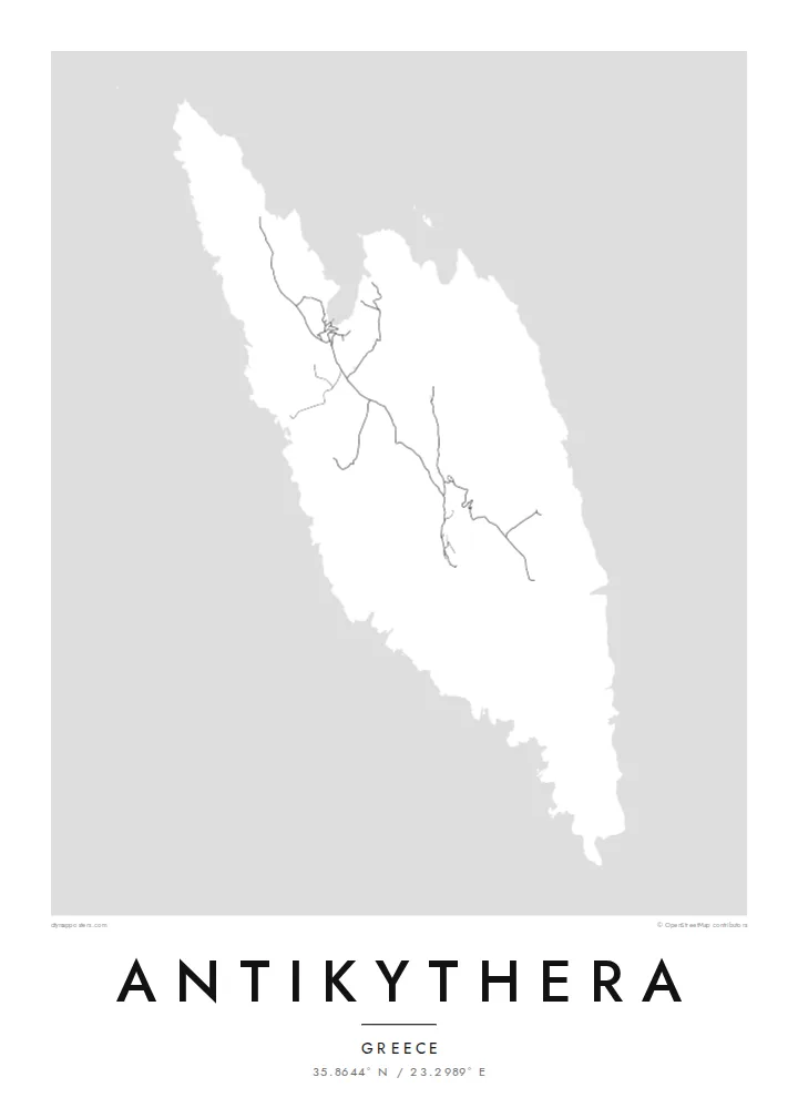
Antikythera sits alone in the strait between Kythera and Crete, a compact wedge of limestone with very little flat ground. From above, the island reads as a rough, elongated shape fringed by cliffs, with a handful of tracks threading between a small harbour settlement and scattered hamlets. The sea takes up most of the frame, and the land becomes a single pale form surrounded by open water.
The island is known worldwide for what was found just offshore. At the start of the twentieth century, sponge divers came across an ancient shipwreck here, and among its cargo was the Antikythera mechanism, a geared bronze device often described as the oldest known analogue computer. The object is now kept in the National Archaeological Museum in Athens, but its name will always point back to this coastline.
An Antikythera map poster is an exercise in restraint. There is no dense grid to fill the paper, only a coastline, a thin network of roads and the contour of the island against a wide field of white or black. The result is quiet and graphic, a shape that people who know the island tend to recognise at once, and that others find simply striking.
The shoreline is mostly steep rock, with only a few inlets where boats can approach. On the poster the edge of the island appears sharp and irregular, giving the landmass a clear, almost sculpted outline.
A small sheltered cove on the northern side serves as the island's port and its link to the ferries. It is where the few roads converge, which makes it the natural focal point of the map.
The waters off the island hold the wreck that yielded the famous mechanism. Nothing marks the spot on a street map, yet the empty sea around the coast carries that story for anyone who knows it.
Tee see enda omaks
Lisa kuupäev, nimi või oma tekst, vaheta stiili, suurust või suunda.
Tasuta eelvaade on madala eraldusvõimega ja veetempliga. Trükised ja HD-failid renderdatakse 300 DPI juures, kuni 7,200 × 10,800 px, ilma veetempliteta.
Miks Antikythera
Antikythera appeals to people who care about the history of science, to divers and sailors, and to anyone who has made the long ferry crossing to reach it. The poster is less about streets than about one island standing alone in open sea, a small object with an outsized story.
You can add your own title and subtitle, such as the date of a visit or a line about the mechanism, and adjust the coordinates line. Choose from Classic black & white, Noir, Paper, Blueprint or Sand; Blueprint suits the scientific theme particularly well. Download HD files for $9 or order a printed poster.
Telli Antikythera poster| Trükisuurus | Eraldusvõime | Failid |
|---|---|---|
| 30 × 40 cm11.8 × 15.7″ | 3,543 × 4,724 px | PNG · PDF |
| 29.7 × 42 cm (A3)11.7 × 16.5″ | 3,508 × 4,961 px | PNG · PDF |
| 42 × 59.4 cm (A2)16.5 × 23.4″ | 4,961 × 7,016 px | PNG · PDF |
| 45.7 × 61 cm18 × 24″ | 5,400 × 7,200 px | PNG · PDF |
| 50 × 70 cm19.7 × 27.6″ | 5,906 × 8,268 px | PNG · PDF |
| 61 × 91.4 cm24 × 36″ | 7,200 × 10,800 px | PNG · PDF |
Võrdluseks: tasuta eelvaade on 900 px lai, vesimärgiga ja mõeldud ekraanil vaatamiseks. HD-failidel on kuni 8× suurem eraldusvõime mõlemas suunas ja need prinditakse puhtalt ka täissuuruses plakatina.
Vali lehe ülaosas stiil ja seejärel Trükitud poster — suurus ja soovi korral raam — või Digitaalsed HD-failid. Tellimuse vormistamine võtab ühe sammu ning tellimuse leht uueneb kohe, kui makse on läbi läinud.
See trükitakse kvaliteetsele 200 gsm mattpaberile ühes kuuest suurusest, alates 30 × 40 cm kuni 24 × 36″. Trükitud postrite hind algab $39, tarne on hinnas sees.
Jah. Vali täispuidust raam mustas, valges, naturaalses tammes või tumedas puidutoonis. Raamiga kaasneb purunemiskindel klaas ning see on kohe seinale riputamiseks valmis. Raamitud postrite hind algab $99, tarne on hinnas sees.
Saatmine on tasuta 60+ riiki. Iga plakati prindib meie lähim trükipartner enam kui 30 riigis ning see jõuab tavaliselt kohale 3–7 tööpäevaga. Tellimuse staatust ja jälgimiskoodi näed jaotises Minu tellimused. Mõnda riiki saadetakse 2–5 nädalat ning kui me kuhugi veel ei saada, annab sait sellest teada enne maksmist.
Saada meile foto 14 päeva jooksul pärast kohaletoimetamist ning me trükime posteri tasuta uuesti või tagastame raha.
Jah. Selle lehe redaktoris saad muuta pealkirja, alapealkirja ja koordinaatide rida enda soovi järgi ning valida stiili ja suuruse. Nii trükitud, raamitud kui ka digitaalsed tellimused kasutavad täpselt sinu kujundust.
$9 eest saad 300 DPI PNG- ja trükivalmis PDF-failid kõigis kuues suuruses, ilma veetempliteta, et trükkida kus iganes. Ei ole veel kindel? Laadi enne alla tasuta veetempliga eelvaade.
Läheduses
