Château Raoul
The castle overlooking the Indre marks the town's point of origin, and the tight streets of the old centre spread outward from near its walls.
Minimalistlik kaardiplakat · Prantsusmaa
46.8125° N / 1.6936° E
A Berry market town on the Indre, with a castle-born centre, a river through meadows and forest to the south.


Üks linn, viis meeleolu
Puuduta stiili, et näha seda seinal. Kõik stiilid maksavad sama — trükituna, raamis või HD-failidena.
 Tegelikud pikslid · 24 × 36″ trükifail
Trükiteravus
See on 100% väljalõige tegelikust trükifailist. Iga poster — trükituna, raamis või allalaaditud — renderdatakse meie serverites 300 DPI juures, kuni 7,200 × 10,800 pikslini, nii et isegi kõige väiksemad teed püsivad 24 × 36″ trükisel teravad.
Seinal


Kaart
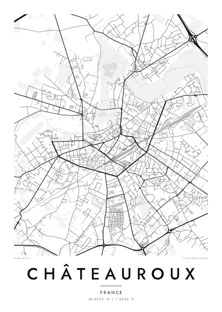
Châteauroux is the prefecture of the Indre department in central France. The town grew around a castle founded above the Indre by the lords of Déols, and its name recalls that origin. On a map the old centre is a knot of short, irregular streets near the river, surrounded by boulevards and later districts laid out in wider blocks.
The Indre winds past the centre through green meadows, with Déols across the water and the Forest of Châteauroux spreading to the south. The area is closely associated with the writer George Sand, whose house at Nohant lies not far away. A former American air base, now Châteauroux-Centre airport, sits to the north.
A Châteauroux map poster shows a classic French provincial layout: a dense historic core, a ring of boulevards, avenues radiating outward and a river that brings in curves and open space. At larger sizes the edges of the forest and the long airport runway appear, adding texture to a town that looks balanced and orderly from above.
The castle overlooking the Indre marks the town's point of origin, and the tight streets of the old centre spread outward from near its walls.
The river and its green banks form a soft, winding band beside the centre, separating Châteauroux from Déols on the far side.
A large state forest lies just south of town, where the streets stop and long straight forest roads continue into the trees.
Tee see enda omaks
Lisa kuupäev, nimi või oma tekst, vaheta stiili, suurust või suunda.
Tasuta eelvaade on madala eraldusvõimega ja veetempliga. Trükised ja HD-failid renderdatakse 300 DPI juures, kuni 7,200 × 10,800 px, ilma veetempliteta.
Miks Châteauroux
Châteauroux is a town people leave for Paris and return to often, or one they discover through George Sand and the Berry countryside. The map is a clear, understated portrait for either kind of attachment.
The title, subtitle and coordinates line can be personalised, so the print can mark a street, a family name or a date. Five styles are available, and printed posters ship from partners in more than 30 countries.
Telli Châteauroux poster| Trükisuurus | Eraldusvõime | Failid |
|---|---|---|
| 30 × 40 cm (11.8 × 15.7″) | 3,543 × 4,724 px | PNG · PDF |
| 29.7 × 42 cm (A3, 11.7 × 16.5″) | 3,508 × 4,961 px | PNG · PDF |
| 42 × 59.4 cm (A2, 16.5 × 23.4″) | 4,961 × 7,016 px | PNG · PDF |
| 45.7 × 61 cm (18 × 24″) | 5,400 × 7,200 px | PNG · PDF |
| 50 × 70 cm (19.7 × 27.6″) | 5,906 × 8,268 px | PNG · PDF |
| 61 × 91.4 cm (24 × 36″) | 7,200 × 10,800 px | PNG · PDF |
Võrdluseks: tasuta eelvaade on 900 px lai, vesimärgiga ja mõeldud ekraanil vaatamiseks. HD-failidel on kuni 8× suurem eraldusvõime mõlemas suunas ja need prinditakse puhtalt ka täissuuruses plakatina.
Vali lehe ülaosas stiil ja seejärel Trükitud poster — suurus ja soovi korral raam — või Digitaalsed HD-failid. Tellimuse vormistamine võtab ühe sammu ning tellimuse leht uueneb kohe, kui makse on läbi läinud.
See trükitakse kvaliteetsele 200 gsm mattpaberile ühes kuuest suurusest, alates 30 × 40 cm kuni 24 × 36″. Trükitud postrite hind algab $39, tarne on hinnas sees.
Jah. Vali täispuidust raam mustas, valges, naturaalses tammes või tumedas puidutoonis. Raamiga kaasneb purunemiskindel klaas ning see on kohe seinale riputamiseks valmis. Raamitud postrite hind algab $99, tarne on hinnas sees.
Kohaletoimetamine on kogu maailmas tasuta. Iga plakati prindib meie lähim trükipartner enam kui 30 riigis ja see jõuab kohale tavaliselt 3–7 tööpäevaga. Staatust ja jälgimiskoodi näed jaotises Minu tellimused. Mõnda riiki toimetatakse 2–5 nädalat ning kui kuhugi veel ei saada, annab sait sellest teada enne maksmist.
Saada meile foto 14 päeva jooksul pärast kohaletoimetamist ning me trükime posteri tasuta uuesti või tagastame raha.
Jah. Selle lehe redaktoris saad muuta pealkirja, alapealkirja ja koordinaatide rida enda soovi järgi ning valida stiili ja suuruse. Nii trükitud, raamitud kui ka digitaalsed tellimused kasutavad täpselt sinu kujundust.
$9 eest saad 300 DPI PNG- ja trükivalmis PDF-failid kõigis kuues suuruses, ilma veetempliteta, et trükkida kus iganes. Ei ole veel kindel? Laadi enne alla tasuta veetempliga eelvaade.
Läheduses
