Lake Amatitlán
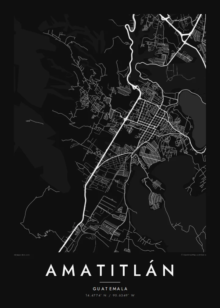
The lake's elongated body of water dominates the composition. Its shoreline curves and bays form a large, calm shape against which the streets read clearly.
پوستر نقشه مینیمال · گواتمالا
14.4774° N / 90.6349° W
A lakeside town at the edge of Lake Amatitlán, its streets meeting the water with volcanic slopes rising beyond



یک شهر، پنج حالوهوا
روی یک سبک ضربه بزنید تا آن را روی دیوار ببینید. همه سبکها قیمت یکسانی دارند — چاپی، قابشده یا فایلهای HD.
 پیکسل واقعی · فایل چاپی ۲۴ × ۳۶ اینچ
وضوح چاپی
این یک برش ۱۰۰٪ از فایل چاپی واقعی است. هر پوستر — چاپی، قابشده یا دانلودی — روی سرورهای ما با کیفیت 300 DPI و تا 7,200 × 10,800 پیکسل رندر میشود، به همین دلیل حتی ریزترین خیابانها هم روی چاپ ۲۴ × ۳۶ اینچ واضح میمانند.
روی دیوار


نقشه
Amatitlán sits on the shore of the lake that shares its name, in a volcanic basin south of Guatemala City. The lake fills most of any wider map of the area. Its long, curving outline is the first thing the eye follows, and the town's streets approach it from the land side. The capital lies a short drive to the north, close enough that the lake has long served as a place for weekend escapes.
The water drains out through the Río Michatoya, which leaves the basin and runs south toward the Pacific lowlands. To the south, the ground rises toward Pacaya, one of the most active volcanoes in Central America. On a map these features frame the town: water on one side, rising contours on another, and a road network stretching back toward the city.
The older part of Amatitlán keeps the compact block pattern found in many towns of colonial origin in Guatemala. Beyond it, newer neighbourhoods follow the terrain more loosely. An Amatitlán map poster combines both scales, with the tight town centre and the wide sweep of the lake, so that the town's relationship to its water stays in focus.
The lake's elongated body of water dominates the composition. Its shoreline curves and bays form a large, calm shape against which the streets read clearly.
The river leaving the lake is a thin line heading south. It is a small detail that shows how the basin connects to the lowlands below.
A tight grid of blocks marks the historic core near the shore. It contrasts with the looser streets that climb the surrounding slopes.
شخصیسازی کنید
یک تاریخ، یک نام یا جملهای از خودتان اضافه کنید و سبک، اندازه یا جهت را تغییر دهید.
پیشنمایش رایگان کیفیت پایین و دارای واترمارک است. نسخههای چاپی و فایلهای HD با کیفیت 300 DPI، تا 7,200 × 10,800 پیکسل و بدون واترمارک رندر میشوند.
چرا Amatitlán
The map works well for people who grew up by the lake, spent family weekends there, or trace their roots to the Guatemala City region. Change the title to Amatitlán or Lago de Amatitlán, add a year in the subtitle, and keep the coordinates for a quiet, exact touch.
Blueprint shows the lake as a deep field with fine white lines around it. Classic black & white keeps things simple and graphic. Each $9 download includes 300 DPI PNG and print-ready PDF files in six sizes. A framed matte print ships from partners in more than 30 countries.
سفارش پوستر Amatitlán| اندازه چاپ | وضوح | فایلها |
|---|---|---|
| 30 × 40 cm (11.8 × 15.7″) | 3,543 × 4,724 px | PNG · PDF |
| 29.7 × 42 cm (A3, 11.7 × 16.5″) | 3,508 × 4,961 px | PNG · PDF |
| 42 × 59.4 cm (A2, 16.5 × 23.4″) | 4,961 × 7,016 px | PNG · PDF |
| 45.7 × 61 cm (18 × 24″) | 5,400 × 7,200 px | PNG · PDF |
| 50 × 70 cm (19.7 × 27.6″) | 5,906 × 8,268 px | PNG · PDF |
| 61 × 91.4 cm (24 × 36″) | 7,200 × 10,800 px | PNG · PDF |
برای مقایسه، پیشنمایش رایگان ۹۰۰ پیکسل عرض دارد، واترمارکدار است و برای نمایش روی صفحه در نظر گرفته شده. فایلهای HD در هر جهت تا ۸ برابر وضوح بیشتری دارند و در اندازه کامل پوستر بهخوبی چاپ میشوند.
یک سبک را از بالای صفحه انتخاب کنید، سپس پوستر چاپی — یک اندازه و در صورت تمایل یک قاب — یا فایلهای دیجیتال HD را انتخاب کنید. پرداخت فقط یک مرحله دارد و صفحه سفارش شما به محض تکمیل پرداخت بهروزرسانی میشود.
روی کاغذ مات پرمیوم ۲۰۰ گرمی و در یکی از شش اندازه، از ۳۰ × ۴۰ سانتیمتر تا ۲۴ × ۳۶ اینچ، چاپ میشود. قیمت پوسترهای چاپی از {printFrom} شروع میشود و هزینه ارسال هم شامل آن است.
بله. یک قاب چوب طبیعی به رنگ مشکی، سفید، بلوط طبیعی یا چوب تیره انتخاب کنید. این قاب با شیشه ضدشکست عرضه میشود و آماده نصب است. قیمت پوسترهای قابشده از {framedFrom} شروع میشود و هزینه ارسال هم شامل آن است.
ارسال در سراسر جهان رایگان است. هر پوستر توسط نزدیکترین شریک چاپ ما در بیش از ۳۰ کشور چاپ میشود و معمولاً طی ۳ تا ۷ روز کاری میرسد. میتوانید وضعیت و رهگیری سفارش را در بخش سفارشهای من دنبال کنید.
ظرف ۱۴ روز از تحویل، یک عکس برای ما بفرستید تا آن را بهصورت رایگان دوباره چاپ کنیم یا هزینهتان را بازگردانیم.
بله. در ویرایشگر همین صفحه، عنوان، زیرعنوان و خط مختصات را به دلخواه تغییر دهید و یک سبک و اندازه انتخاب کنید. سفارشهای چاپی، قابشده و دیجیتال همگی دقیقاً از طرح شما استفاده میکنند.
با $9 فایلهای PNG با کیفیت 300 DPI و فایلهای PDF آماده چاپ را در هر شش اندازه، بدون واترمارک، دریافت میکنید تا هر جا خواستید چاپ کنید. هنوز مطمئن نیستید؟ ابتدا یک پیشنمایش رایگان با واترمارک دانلود کنید.
