Castries Harbour
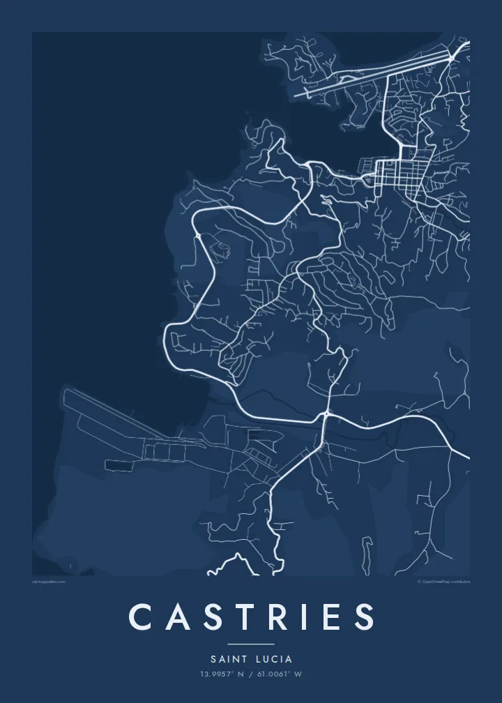
A long, sheltered inlet reaching deep into the island, its shores lined with quays and cruise berths. It gives the map a central, unmistakable form.
پوستر نقشه مینیمال · سنت لوسیا
13.9957° N / 61.0061° W
A deep, sheltered harbour on Saint Lucia's northwest coast, ringed by hills, a small airport and a compact rebuilt centre.



یک شهر، پنج حالوهوا
روی یک سبک ضربه بزنید تا آن را روی دیوار ببینید. همه سبکها قیمت یکسانی دارند — چاپی، قابشده یا فایلهای HD.
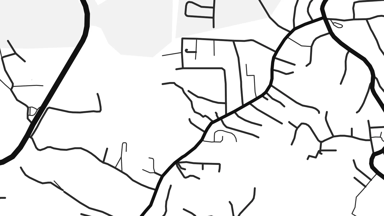 پیکسل واقعی · فایل چاپی ۲۴ × ۳۶ اینچ
وضوح چاپی
این یک برش ۱۰۰٪ از فایل چاپی واقعی است. هر پوستر — چاپی، قابشده یا دانلودی — روی سرورهای ما با کیفیت 300 DPI و تا 7,200 × 10,800 پیکسل رندر میشود، به همین دلیل حتی ریزترین خیابانها هم روی چاپ ۲۴ × ۳۶ اینچ واضح میمانند.
روی دیوار


نقشه
Castries is built around one of the best natural harbours in the Caribbean, a long inlet on the northwest coast of Saint Lucia that reaches deep into the land. On a map, the water is the centre of everything. The town wraps around the head of the harbour, quays line both sides, and steep hills rise immediately behind the streets.
The downtown grid is compact and regular, partly because the town was rebuilt after a series of fires, the most destructive in 1948. At its heart is Derek Walcott Square, named after the Nobel Prize-winning poet who was born here. It forms an open block among the streets. Morne Fortune rises above the town to the south, with roads winding up its slopes.
On the northern side of the harbour, the Vigie peninsula carries the runway of George F. L. Charles Airport almost to the sea, and cruise ships berth along the quays. A Castries map poster shows the inlet, the grid and the surrounding high ground together. The result is a clear, balanced composition built around one strong shape of water.
A long, sheltered inlet reaching deep into the island, its shores lined with quays and cruise berths. It gives the map a central, unmistakable form.
The main square of the downtown grid, named after the poet. It appears as a small open block among the regular streets rebuilt after the fires.
North of the harbour, a low peninsula holds the city airport's runway and a stretch of coast. It forms a strong straight line in the upper part of the map.
شخصیسازی کنید
یک تاریخ، یک نام یا جملهای از خودتان اضافه کنید و سبک، اندازه یا جهت را تغییر دهید.
پیشنمایش رایگان کیفیت پایین و دارای واترمارک است. نسخههای چاپی و فایلهای HD با کیفیت 300 DPI، تا 7,200 × 10,800 پیکسل و بدون واترمارک رندر میشوند.
چرا Castries
Saint Lucians abroad, couples who married on the island and visitors who arrived by sea often want to keep Castries close. The harbour gives the poster a natural focus, and the hills around it add depth without clutter.
You can personalise the title and subtitle, add a wedding or travel date, and adjust the coordinates line. Choose one of five styles: Classic black & white, Noir, Paper, Blueprint or Sand. Download the $9 HD files or order a printed poster.
سفارش پوستر Castries| اندازه چاپ | وضوح | فایلها |
|---|---|---|
| 30 × 40 cm (11.8 × 15.7″) | 3,543 × 4,724 px | PNG · PDF |
| 29.7 × 42 cm (A3, 11.7 × 16.5″) | 3,508 × 4,961 px | PNG · PDF |
| 42 × 59.4 cm (A2, 16.5 × 23.4″) | 4,961 × 7,016 px | PNG · PDF |
| 45.7 × 61 cm (18 × 24″) | 5,400 × 7,200 px | PNG · PDF |
| 50 × 70 cm (19.7 × 27.6″) | 5,906 × 8,268 px | PNG · PDF |
| 61 × 91.4 cm (24 × 36″) | 7,200 × 10,800 px | PNG · PDF |
برای مقایسه، پیشنمایش رایگان ۹۰۰ پیکسل عرض دارد، واترمارکدار است و برای نمایش روی صفحه در نظر گرفته شده. فایلهای HD در هر جهت تا ۸ برابر وضوح بیشتری دارند و در اندازه کامل پوستر بهخوبی چاپ میشوند.
یک سبک را از بالای صفحه انتخاب کنید، سپس پوستر چاپی — یک اندازه و در صورت تمایل یک قاب — یا فایلهای دیجیتال HD را انتخاب کنید. پرداخت فقط یک مرحله دارد و صفحه سفارش شما به محض تکمیل پرداخت بهروزرسانی میشود.
روی کاغذ مات پرمیوم ۲۰۰ گرمی و در یکی از شش اندازه، از ۳۰ × ۴۰ سانتیمتر تا ۲۴ × ۳۶ اینچ، چاپ میشود. قیمت پوسترهای چاپی از {printFrom} شروع میشود و هزینه ارسال هم شامل آن است.
بله. یک قاب چوب طبیعی به رنگ مشکی، سفید، بلوط طبیعی یا چوب تیره انتخاب کنید. این قاب با شیشه ضدشکست عرضه میشود و آماده نصب است. قیمت پوسترهای قابشده از {framedFrom} شروع میشود و هزینه ارسال هم شامل آن است.
ارسال در سراسر جهان رایگان است. هر پوستر توسط نزدیکترین شریک چاپ ما در بیش از ۳۰ کشور چاپ میشود و معمولاً طی ۳ تا ۷ روز کاری میرسد. میتوانید وضعیت و رهگیری سفارش را در بخش سفارشهای من دنبال کنید.
ظرف ۱۴ روز از تحویل، یک عکس برای ما بفرستید تا آن را بهصورت رایگان دوباره چاپ کنیم یا هزینهتان را بازگردانیم.
بله. در ویرایشگر همین صفحه، عنوان، زیرعنوان و خط مختصات را به دلخواه تغییر دهید و یک سبک و اندازه انتخاب کنید. سفارشهای چاپی، قابشده و دیجیتال همگی دقیقاً از طرح شما استفاده میکنند.
با $9 فایلهای PNG با کیفیت 300 DPI و فایلهای PDF آماده چاپ را در هر شش اندازه، بدون واترمارک، دریافت میکنید تا هر جا خواستید چاپ کنید. هنوز مطمئن نیستید؟ ابتدا یک پیشنمایش رایگان با واترمارک دانلود کنید.
