Prairie grid
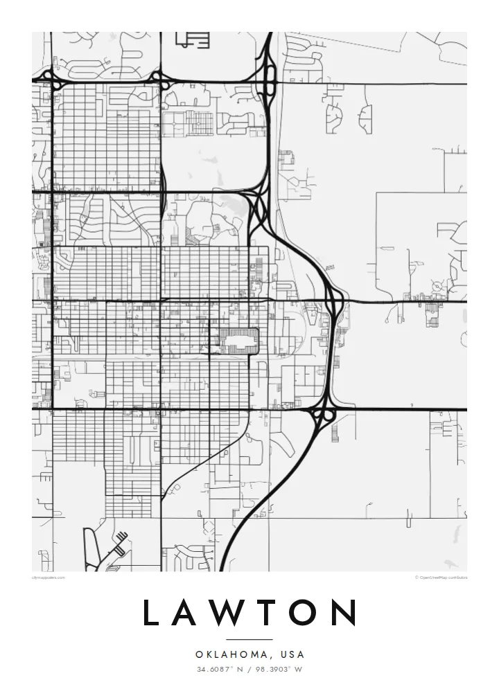
Numbered streets and avenues run north–south and east–west across flat land. They form one of the clearest and most regular urban grids in the southern Plains.
پوستر نقشه مینیمال · ایالات متحده
34.6087° N / 98.3903° W
A southwest Oklahoma city laid out on a prairie grid, beside Fort Sill and the rising Wichita Mountains.


یک شهر، پنج حالوهوا
روی یک سبک ضربه بزنید تا آن را روی دیوار ببینید. همه سبکها قیمت یکسانی دارند — چاپی، قابشده یا فایلهای HD.
 پیکسل واقعی · فایل چاپی ۲۴ × ۳۶ اینچ
وضوح چاپی
این یک برش ۱۰۰٪ از فایل چاپی واقعی است. هر پوستر — چاپی، قابشده یا دانلودی — روی سرورهای ما با کیفیت 300 DPI و تا 7,200 × 10,800 پیکسل رندر میشود، به همین دلیل حتی ریزترین خیابانها هم روی چاپ ۲۴ × ۳۶ اینچ واضح میمانند.
روی دیوار


نقشه
Lawton was founded in 1901, when land from the former Kiowa, Comanche and Apache reservation was opened to settlement by lottery. The town was surveyed quickly on open prairie, and its map still reflects that origin. A clear grid of numbered streets and avenues, aligned to the compass, stretches out from the original town site.
Fort Sill, a large U.S. Army post established in 1869, lies directly north of the city and covers a large area on the map with its own roads, ranges and buildings. To the northwest the Wichita Mountains rise from the plains, home to a national wildlife refuge. Lakes and creeks add curved lines to the otherwise straight pattern.
A Lawton map poster sets a disciplined city grid against wide, open military land and the edge of the mountains. The contrast between the dense, regular streets and the sparse areas beyond gives the composition a strong structure. It is a meaningful piece for Army families who passed through Fort Sill and for people who grew up in the city itself.
Numbered streets and avenues run north–south and east–west across flat land. They form one of the clearest and most regular urban grids in the southern Plains.
The historic Army post occupies a large area north of the city. On the map it appears as a quieter zone with its own internal roads and wide open training ground.
To the northwest, the granite hills of the Wichita Mountains rise from the prairie. They add rugged, irregular ground and lakes at the edge of a wider composition.
شخصیسازی کنید
یک تاریخ، یک نام یا جملهای از خودتان اضافه کنید و سبک، اندازه یا جهت را تغییر دهید.
پیشنمایش رایگان کیفیت پایین و دارای واترمارک است. نسخههای چاپی و فایلهای HD با کیفیت 300 DPI، تا 7,200 × 10,800 پیکسل و بدون واترمارک رندر میشوند.
چرا Lawton
Lawton means a great deal to the many service members stationed at Fort Sill over the years, as well as to families with deep Comanche County roots. A map poster marks a posting, a hometown or a first house in a plain, lasting way.
Personalise the title, subtitle and coordinates line, perhaps with the years of a posting. Choose Classic black & white, Noir, Paper, Blueprint or Sand. Download HD files for $9, or order a matte printed poster with an optional wooden frame.
سفارش پوستر Lawton| اندازه چاپ | وضوح | فایلها |
|---|---|---|
| 30 × 40 cm (11.8 × 15.7″) | 3,543 × 4,724 px | PNG · PDF |
| 29.7 × 42 cm (A3, 11.7 × 16.5″) | 3,508 × 4,961 px | PNG · PDF |
| 42 × 59.4 cm (A2, 16.5 × 23.4″) | 4,961 × 7,016 px | PNG · PDF |
| 45.7 × 61 cm (18 × 24″) | 5,400 × 7,200 px | PNG · PDF |
| 50 × 70 cm (19.7 × 27.6″) | 5,906 × 8,268 px | PNG · PDF |
| 61 × 91.4 cm (24 × 36″) | 7,200 × 10,800 px | PNG · PDF |
برای مقایسه، پیشنمایش رایگان ۹۰۰ پیکسل عرض دارد، واترمارکدار است و برای نمایش روی صفحه در نظر گرفته شده. فایلهای HD در هر جهت تا ۸ برابر وضوح بیشتری دارند و در اندازه کامل پوستر بهخوبی چاپ میشوند.
یک سبک را از بالای صفحه انتخاب کنید، سپس پوستر چاپی — یک اندازه و در صورت تمایل یک قاب — یا فایلهای دیجیتال HD را انتخاب کنید. پرداخت فقط یک مرحله دارد و صفحه سفارش شما به محض تکمیل پرداخت بهروزرسانی میشود.
روی کاغذ مات پرمیوم ۲۰۰ گرمی و در یکی از شش اندازه، از ۳۰ × ۴۰ سانتیمتر تا ۲۴ × ۳۶ اینچ، چاپ میشود. قیمت پوسترهای چاپی از $39 شروع میشود و هزینه ارسال هم شامل آن است.
بله. یک قاب چوب طبیعی به رنگ مشکی، سفید، بلوط طبیعی یا چوب تیره انتخاب کنید. این قاب با شیشه ضدشکست عرضه میشود و آماده نصب است. قیمت پوسترهای قابشده از $99 شروع میشود و هزینه ارسال هم شامل آن است.
ارسال در سراسر جهان رایگان است. هر پوستر توسط نزدیکترین شریک چاپ ما، از میان شرکای ما در بیش از ۳۰ کشور، چاپ میشود و معمولاً ظرف ۳ تا ۷ روز کاری میرسد. وضعیت سفارش و کد رهگیری را میتوانید در «سفارشهای من» ببینید. ارسال به چند کشور ۲ تا ۵ هفته طول میکشد و اگر هنوز به کشوری ارسال نداشته باشیم، سایت پیش از پرداخت به شما اطلاع میدهد.
ظرف ۱۴ روز از تحویل، یک عکس برای ما بفرستید تا آن را بهصورت رایگان دوباره چاپ کنیم یا هزینهتان را بازگردانیم.
بله. در ویرایشگر همین صفحه، عنوان، زیرعنوان و خط مختصات را به دلخواه تغییر دهید و یک سبک و اندازه انتخاب کنید. سفارشهای چاپی، قابشده و دیجیتال همگی دقیقاً از طرح شما استفاده میکنند.
با $9 فایلهای PNG با کیفیت 300 DPI و فایلهای PDF آماده چاپ را در هر شش اندازه، بدون واترمارک، دریافت میکنید تا هر جا خواستید چاپ کنید. هنوز مطمئن نیستید؟ ابتدا یک پیشنمایش رایگان با واترمارک دانلود کنید.
