The coastal road
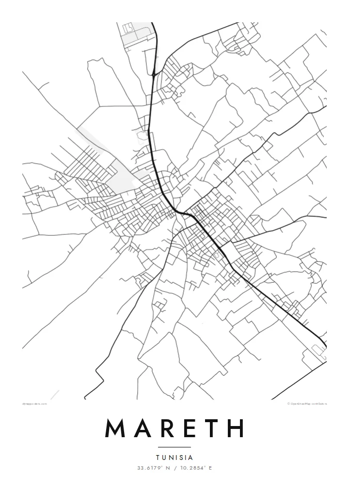
A main north–south route runs through Mareth, linking it to Gabès and the south. On the poster it becomes the strongest single line, and the rest of the town is arranged along it.
پوستر نقشه مینیمال · تونس
33.6179° N / 10.2854° E
A low oasis town on the coastal plain of southern Tunisia, its streets gathered between palm gardens, a dry riverbed and the open road north.

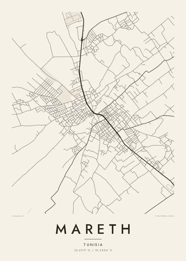


یک شهر، پنج حالوهوا
روی یک سبک ضربه بزنید تا آن را روی دیوار ببینید. همه سبکها قیمت یکسانی دارند — چاپی، قابشده یا فایلهای HD.
 پیکسل واقعی · فایل چاپی ۲۴ × ۳۶ اینچ
وضوح چاپی
این یک برش ۱۰۰٪ از فایل چاپی واقعی است. هر پوستر — چاپی، قابشده یا دانلودی — روی سرورهای ما با کیفیت 300 DPI و تا 7,200 × 10,800 پیکسل رندر میشود، به همین دلیل حتی ریزترین خیابانها هم روی چاپ ۲۴ × ۳۶ اینچ واضح میمانند.
روی دیوار


نقشه
Mareth sits a short distance inland from the Gulf of Gabès, on the flat strip of land between the sea and the Matmata hills. From above, the town is a loose cluster of streets set among cultivated plots and palm groves, with the main road running through it. Around the edge, the pattern thins into field boundaries and scattered buildings instead of stopping at a hard line.
The name is best known from the Second World War. Before the war, French engineers built the Mareth Line, a chain of fortifications running from the coast to the hills. In March 1943 it was the scene of heavy fighting between the British Eighth Army and Axis forces. The Wadi Zigzaou, a natural obstacle in that defensive line, still cuts across the landscape near the town.
A Mareth map poster turns this quiet geography into line work: the through-road, the tight grain of the older lanes and the looser pattern of streets and plots around them. Water shows up on a map here in a particular way. It follows seasonal wadis, not rivers, and the poster keeps those faint channels next to the denser street network.
A main north–south route runs through Mareth, linking it to Gabès and the south. On the poster it becomes the strongest single line, and the rest of the town is arranged along it.
This seasonal watercourse near the town was part of the Mareth Line's defences in 1943. On a map it reads as a thin, winding channel through otherwise flat ground.
Where the streets end, garden plots and palm groves take over. The grid loosens into irregular parcels, which gives the poster a soft, uneven border and no sharp city limit.
شخصیسازی کنید
یک تاریخ، یک نام یا جملهای از خودتان اضافه کنید و سبک، اندازه یا جهت را تغییر دهید.
پیشنمایش رایگان کیفیت پایین و دارای واترمارک است. نسخههای چاپی و فایلهای HD با کیفیت 300 DPI، تا 7,200 × 10,800 پیکسل و بدون واترمارک رندر میشوند.
چرا Mareth
For some people Mareth is home or a family town in the Gabès region. For others it is a name from military history they have read about or visited. A map of it is a plain, unsentimental way to keep that connection on the wall, drawn from the street pattern itself.
You can personalise the title, subtitle and coordinates line, for example with a family name or a year that matters. Choose from five styles: Classic black & white, Noir, Paper, Blueprint or Sand. Sand suits the southern Tunisian setting especially well.
سفارش پوستر Mareth| اندازه چاپ | وضوح | فایلها |
|---|---|---|
| 30 × 40 cm (11.8 × 15.7″) | 3,543 × 4,724 px | PNG · PDF |
| 29.7 × 42 cm (A3, 11.7 × 16.5″) | 3,508 × 4,961 px | PNG · PDF |
| 42 × 59.4 cm (A2, 16.5 × 23.4″) | 4,961 × 7,016 px | PNG · PDF |
| 45.7 × 61 cm (18 × 24″) | 5,400 × 7,200 px | PNG · PDF |
| 50 × 70 cm (19.7 × 27.6″) | 5,906 × 8,268 px | PNG · PDF |
| 61 × 91.4 cm (24 × 36″) | 7,200 × 10,800 px | PNG · PDF |
برای مقایسه، پیشنمایش رایگان ۹۰۰ پیکسل عرض دارد، واترمارکدار است و برای نمایش روی صفحه در نظر گرفته شده. فایلهای HD در هر جهت تا ۸ برابر وضوح بیشتری دارند و در اندازه کامل پوستر بهخوبی چاپ میشوند.
یک سبک را از بالای صفحه انتخاب کنید، سپس پوستر چاپی — یک اندازه و در صورت تمایل یک قاب — یا فایلهای دیجیتال HD را انتخاب کنید. پرداخت فقط یک مرحله دارد و صفحه سفارش شما به محض تکمیل پرداخت بهروزرسانی میشود.
روی کاغذ مات پرمیوم ۲۰۰ گرمی و در یکی از شش اندازه، از ۳۰ × ۴۰ سانتیمتر تا ۲۴ × ۳۶ اینچ، چاپ میشود. قیمت پوسترهای چاپی از {printFrom} شروع میشود و هزینه ارسال هم شامل آن است.
بله. یک قاب چوب طبیعی به رنگ مشکی، سفید، بلوط طبیعی یا چوب تیره انتخاب کنید. این قاب با شیشه ضدشکست عرضه میشود و آماده نصب است. قیمت پوسترهای قابشده از {framedFrom} شروع میشود و هزینه ارسال هم شامل آن است.
ارسال در سراسر جهان رایگان است. هر پوستر توسط نزدیکترین شریک چاپ ما در بیش از ۳۰ کشور چاپ میشود و معمولاً طی ۳ تا ۷ روز کاری میرسد. میتوانید وضعیت و رهگیری سفارش را در بخش سفارشهای من دنبال کنید.
ظرف ۱۴ روز از تحویل، یک عکس برای ما بفرستید تا آن را بهصورت رایگان دوباره چاپ کنیم یا هزینهتان را بازگردانیم.
بله. در ویرایشگر همین صفحه، عنوان، زیرعنوان و خط مختصات را به دلخواه تغییر دهید و یک سبک و اندازه انتخاب کنید. سفارشهای چاپی، قابشده و دیجیتال همگی دقیقاً از طرح شما استفاده میکنند.
با $9 فایلهای PNG با کیفیت 300 DPI و فایلهای PDF آماده چاپ را در هر شش اندازه، بدون واترمارک، دریافت میکنید تا هر جا خواستید چاپ کنید. هنوز مطمئن نیستید؟ ابتدا یک پیشنمایش رایگان با واترمارک دانلود کنید.
