Museum Island
The northern end of the Spree island holds five major museums between two arms of the river. It is a compact shape, recognizable on any map of Berlin.
پوستر نقشه مینیمال · آلمان
52.5222° N / 13.3977° E
The Spree splits around Museum Island while Unter den Linden draws a straight line west to the Brandenburg Gate.


یک شهر، پنج حالوهوا
روی یک سبک ضربه بزنید تا آن را روی دیوار ببینید. همه سبکها قیمت یکسانی دارند — چاپی، قابشده یا فایلهای HD.
 پیکسل واقعی · فایل چاپی ۲۴ × ۳۶ اینچ
وضوح چاپی
این یک برش ۱۰۰٪ از فایل چاپی واقعی است. هر پوستر — چاپی، قابشده یا دانلودی — روی سرورهای ما با کیفیت 300 DPI و تا 7,200 × 10,800 پیکسل رندر میشود، به همین دلیل حتی ریزترین خیابانها هم روی چاپ ۲۴ × ۳۶ اینچ واضح میمانند.
روی دیوار


نقشه
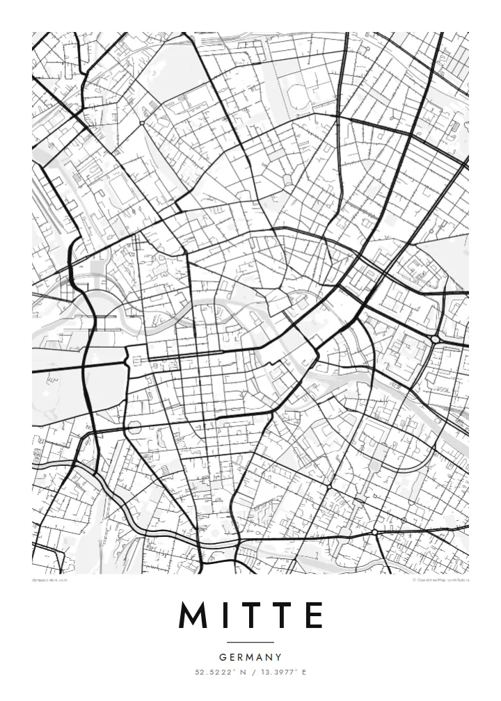
Mitte is Berlin's historic core, and its map is organized around the Spree. The river divides into two arms here, enclosing an island whose northern tip holds Museum Island, a UNESCO World Heritage ensemble of five museums. West of the water, Unter den Linden runs in a broad straight line to the Brandenburg Gate and the Tiergarten. Friedrichstraße crosses it on a long north–south axis.
East of the river, the plan changes. Alexanderplatz opens as a large irregular space beneath the television tower, completed in 1969, and wide postwar boulevards replace the older baroque grid. The Berlin Wall ran along much of Mitte's western and southern edges. You can still trace its former line where newer buildings fill strips that once stood empty.
A Mitte map poster brings these layers together on one sheet: the curving river, the ordered blocks of Friedrichstadt south of Unter den Linden, squares such as Gendarmenmarkt, and the looser plan around Alexanderplatz. The center of the image is dense and opens toward the park on one side, which gives the composition a natural sense of weight.
The northern end of the Spree island holds five major museums between two arms of the river. It is a compact shape, recognizable on any map of Berlin.
A wide tree-lined boulevard runs from the island west to the Brandenburg Gate. It is one of the clearest straight lines in the city.
Within the Friedrichstadt grid, this square framed by two domed churches and a concert hall stands out as a precise open rectangle among regular blocks.
شخصیسازی کنید
یک تاریخ، یک نام یا جملهای از خودتان اضافه کنید و سبک، اندازه یا جهت را تغییر دهید.
پیشنمایش رایگان کیفیت پایین و دارای واترمارک است. نسخههای چاپی و فایلهای HD با کیفیت 300 DPI، تا 7,200 × 10,800 پیکسل و بدون واترمارک رندر میشوند.
چرا Mitte
Mitte is where many visitors first meet Berlin, and where many residents work, study or first settle. Its map carries the city's divided past without spelling it out, which makes it a thoughtful piece for a wall.
You can personalize the title and subtitle with a year or an address, and keep or edit the coordinates. Choose one of five styles. Blueprint suits the river and the grid especially well. Download the files for $9 or order a printed poster.
سفارش پوستر Mitte| اندازه چاپ | وضوح | فایلها |
|---|---|---|
| 30 × 40 cm (11.8 × 15.7″) | 3,543 × 4,724 px | PNG · PDF |
| 29.7 × 42 cm (A3, 11.7 × 16.5″) | 3,508 × 4,961 px | PNG · PDF |
| 42 × 59.4 cm (A2, 16.5 × 23.4″) | 4,961 × 7,016 px | PNG · PDF |
| 45.7 × 61 cm (18 × 24″) | 5,400 × 7,200 px | PNG · PDF |
| 50 × 70 cm (19.7 × 27.6″) | 5,906 × 8,268 px | PNG · PDF |
| 61 × 91.4 cm (24 × 36″) | 7,200 × 10,800 px | PNG · PDF |
برای مقایسه، پیشنمایش رایگان ۹۰۰ پیکسل عرض دارد، واترمارکدار است و برای نمایش روی صفحه در نظر گرفته شده. فایلهای HD در هر جهت تا ۸ برابر وضوح بیشتری دارند و در اندازه کامل پوستر بهخوبی چاپ میشوند.
یک سبک را از بالای صفحه انتخاب کنید، سپس پوستر چاپی — یک اندازه و در صورت تمایل یک قاب — یا فایلهای دیجیتال HD را انتخاب کنید. پرداخت فقط یک مرحله دارد و صفحه سفارش شما به محض تکمیل پرداخت بهروزرسانی میشود.
روی کاغذ مات پرمیوم ۲۰۰ گرمی و در یکی از شش اندازه، از ۳۰ × ۴۰ سانتیمتر تا ۲۴ × ۳۶ اینچ، چاپ میشود. قیمت پوسترهای چاپی از {printFrom} شروع میشود و هزینه ارسال هم شامل آن است.
بله. یک قاب چوب طبیعی به رنگ مشکی، سفید، بلوط طبیعی یا چوب تیره انتخاب کنید. این قاب با شیشه ضدشکست عرضه میشود و آماده نصب است. قیمت پوسترهای قابشده از {framedFrom} شروع میشود و هزینه ارسال هم شامل آن است.
ارسال در سراسر جهان رایگان است. هر پوستر توسط نزدیکترین شریک چاپ ما در بیش از ۳۰ کشور چاپ میشود و معمولاً طی ۳ تا ۷ روز کاری میرسد. میتوانید وضعیت و رهگیری سفارش را در بخش سفارشهای من دنبال کنید.
ظرف ۱۴ روز از تحویل، یک عکس برای ما بفرستید تا آن را بهصورت رایگان دوباره چاپ کنیم یا هزینهتان را بازگردانیم.
بله. در ویرایشگر همین صفحه، عنوان، زیرعنوان و خط مختصات را به دلخواه تغییر دهید و یک سبک و اندازه انتخاب کنید. سفارشهای چاپی، قابشده و دیجیتال همگی دقیقاً از طرح شما استفاده میکنند.
با $9 فایلهای PNG با کیفیت 300 DPI و فایلهای PDF آماده چاپ را در هر شش اندازه، بدون واترمارک، دریافت میکنید تا هر جا خواستید چاپ کنید. هنوز مطمئن نیستید؟ ابتدا یک پیشنمایش رایگان با واترمارک دانلود کنید.
