Railway junction
Tracks and yards cut through the town and link it to Jabalpur, Prayagraj and Rewa. On the poster the rail corridor is a dominant line that divides the street pattern into distinct parts.
پوستر نقشه مینیمال · هند
24.5773° N / 80.8272° E
A railway town on the Vindhyan plateau, its streets gathered around a junction and edged by quarries and cement works.



یک شهر، پنج حالوهوا
روی یک سبک ضربه بزنید تا آن را روی دیوار ببینید. همه سبکها قیمت یکسانی دارند — چاپی، قابشده یا فایلهای HD.
 پیکسل واقعی · فایل چاپی ۲۴ × ۳۶ اینچ
وضوح چاپی
این یک برش ۱۰۰٪ از فایل چاپی واقعی است. هر پوستر — چاپی، قابشده یا دانلودی — روی سرورهای ما با کیفیت 300 DPI و تا 7,200 × 10,800 پیکسل رندر میشود، به همین دلیل حتی ریزترین خیابانها هم روی چاپ ۲۴ × ۳۶ اینچ واضح میمانند.
روی دیوار


نقشه
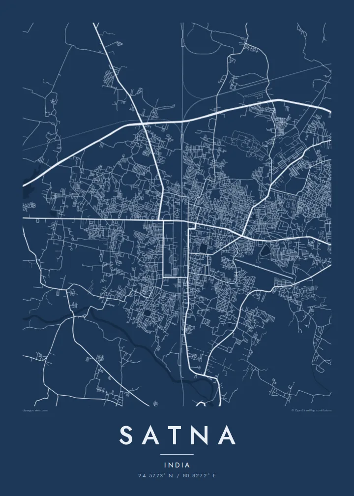
Satna is a district headquarters in the north-east of Madhya Pradesh, not far from the border with Uttar Pradesh. Its map is organised by the railway: the main line between Jabalpur and Prayagraj passes through, with a branch toward Rewa, and the older bazaar streets cluster close to the station while newer colonies spread across open, gently sloping land beyond.
The town is best known for cement. The limestone of the surrounding Vindhyan rocks has supported several large cement plants, and the industry shapes the edges of the map with works, rail sidings and quarry pits. Satna also serves as a gateway to the pilgrim towns of Chitrakoot and Maihar, both reached by road or rail from here.
A Satna map poster shows a practical, working town rather than a monument city. In line form, the rail corridor becomes a strong axis, the bazaar lanes near the station tighten into a dense knot, and the outskirts open into widely spaced roads, with the small Satna River and its side channels marking the lower ground.
Tracks and yards cut through the town and link it to Jabalpur, Prayagraj and Rewa. On the poster the rail corridor is a dominant line that divides the street pattern into distinct parts.
The small river that gives the town its name winds past the built-up area. Its irregular course provides a soft natural line alongside the straighter roads and rail tracks.
Around the town, plants, rail sidings and quarries leave large geometric shapes in the landscape. They appear on the map as open blocks and spurs at the margins of the built-up area.
شخصیسازی کنید
یک تاریخ، یک نام یا جملهای از خودتان اضافه کنید و سبک، اندازه یا جهت را تغییر دهید.
پیشنمایش رایگان کیفیت پایین و دارای واترمارک است. نسخههای چاپی و فایلهای HD با کیفیت 300 DPI، تا 7,200 × 10,800 پیکسل و بدون واترمارک رندر میشوند.
چرا Satna
Satna means a lot to people whose working lives turned on the cement plants or the railway, and to families who passed through on the way to Chitrakoot or Maihar. The map offers a quiet, precise record of a town that is often seen only from a train window.
Put your own words in the title and subtitle, perhaps a colony name or the year you moved there, and adjust the coordinates line. Select one of five styles, check the free watermarked preview, then buy $9 HD files as 300 DPI PNG and print-ready PDF in six sizes.
سفارش پوستر Satna| اندازه چاپ | وضوح | فایلها |
|---|---|---|
| 30 × 40 cm (11.8 × 15.7″) | 3,543 × 4,724 px | PNG · PDF |
| 29.7 × 42 cm (A3, 11.7 × 16.5″) | 3,508 × 4,961 px | PNG · PDF |
| 42 × 59.4 cm (A2, 16.5 × 23.4″) | 4,961 × 7,016 px | PNG · PDF |
| 45.7 × 61 cm (18 × 24″) | 5,400 × 7,200 px | PNG · PDF |
| 50 × 70 cm (19.7 × 27.6″) | 5,906 × 8,268 px | PNG · PDF |
| 61 × 91.4 cm (24 × 36″) | 7,200 × 10,800 px | PNG · PDF |
برای مقایسه، پیشنمایش رایگان ۹۰۰ پیکسل عرض دارد، واترمارکدار است و برای نمایش روی صفحه در نظر گرفته شده. فایلهای HD در هر جهت تا ۸ برابر وضوح بیشتری دارند و در اندازه کامل پوستر بهخوبی چاپ میشوند.
یک سبک را از بالای صفحه انتخاب کنید، سپس پوستر چاپی — یک اندازه و در صورت تمایل یک قاب — یا فایلهای دیجیتال HD را انتخاب کنید. پرداخت فقط یک مرحله دارد و صفحه سفارش شما به محض تکمیل پرداخت بهروزرسانی میشود.
روی کاغذ مات پرمیوم ۲۰۰ گرمی و در یکی از شش اندازه، از ۳۰ × ۴۰ سانتیمتر تا ۲۴ × ۳۶ اینچ، چاپ میشود. قیمت پوسترهای چاپی از {printFrom} شروع میشود و هزینه ارسال هم شامل آن است.
بله. یک قاب چوب طبیعی به رنگ مشکی، سفید، بلوط طبیعی یا چوب تیره انتخاب کنید. این قاب با شیشه ضدشکست عرضه میشود و آماده نصب است. قیمت پوسترهای قابشده از {framedFrom} شروع میشود و هزینه ارسال هم شامل آن است.
ارسال در سراسر جهان رایگان است. هر پوستر توسط نزدیکترین شریک چاپ ما در بیش از ۳۰ کشور چاپ میشود و معمولاً طی ۳ تا ۷ روز کاری میرسد. میتوانید وضعیت و رهگیری سفارش را در بخش سفارشهای من دنبال کنید.
ظرف ۱۴ روز از تحویل، یک عکس برای ما بفرستید تا آن را بهصورت رایگان دوباره چاپ کنیم یا هزینهتان را بازگردانیم.
بله. در ویرایشگر همین صفحه، عنوان، زیرعنوان و خط مختصات را به دلخواه تغییر دهید و یک سبک و اندازه انتخاب کنید. سفارشهای چاپی، قابشده و دیجیتال همگی دقیقاً از طرح شما استفاده میکنند.
با $9 فایلهای PNG با کیفیت 300 DPI و فایلهای PDF آماده چاپ را در هر شش اندازه، بدون واترمارک، دریافت میکنید تا هر جا خواستید چاپ کنید. هنوز مطمئن نیستید؟ ابتدا یک پیشنمایش رایگان با واترمارک دانلود کنید.
