Ring road
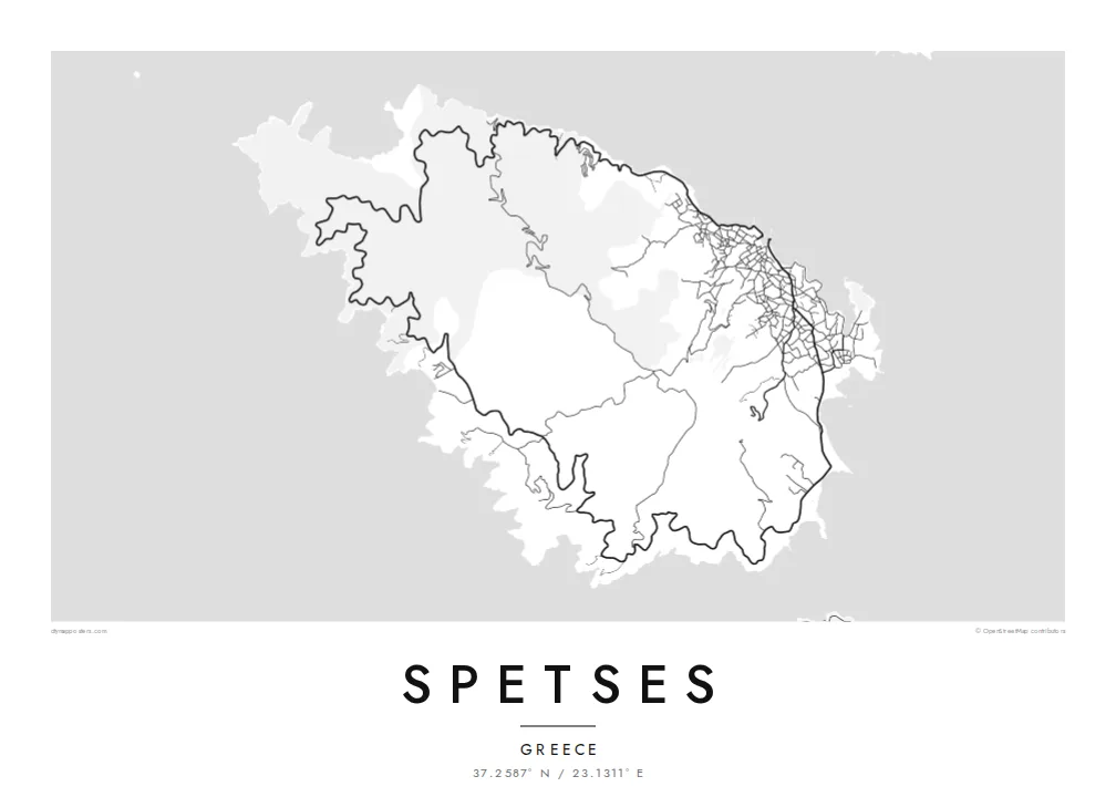
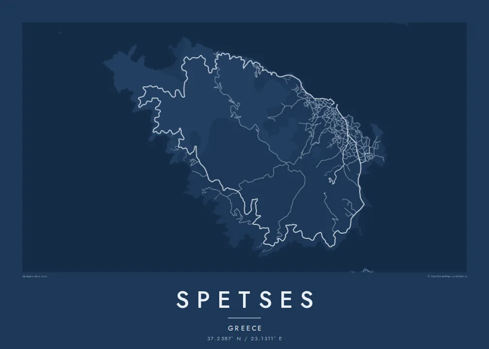
A single road circles almost the entire coast, a closed loop that holds the whole island together on the map and touches each of its bays.
پوستر نقشه مینیمال · یونان
37.2587° N / 23.1311° E
A compact, rounded island at the mouth of the Argolic Gulf, circled by a single coastal road and wooded with pine.



یک شهر، پنج حالوهوا
روی یک سبک ضربه بزنید تا آن را روی دیوار ببینید. همه سبکها قیمت یکسانی دارند — چاپی، قابشده یا فایلهای HD.
 پیکسل واقعی · فایل چاپی ۲۴ × ۳۶ اینچ
وضوح چاپی
این یک برش ۱۰۰٪ از فایل چاپی واقعی است. هر پوستر — چاپی، قابشده یا دانلودی — روی سرورهای ما با کیفیت 300 DPI و تا 7,200 × 10,800 پیکسل رندر میشود، به همین دلیل حتی ریزترین خیابانها هم روی چاپ ۲۴ × ۳۶ اینچ واضح میمانند.
روی دیوار


نقشه
Spetses lies just off the eastern tip of the Peloponnese, at the entrance to the Argolic Gulf, a short boat ride from the mainland village of Kosta. The island is small and roughly oval, its pine-covered hills rising gently toward the centre, and it is often counted among the Saronic islands. Private cars are restricted, so most people get around by scooter, bicycle, taxi or boat.
The town of Spetses spreads along the northeastern shore, from the Dapia waterfront past the Old Harbour, with lanes climbing the slopes behind. A coastal road loops around the island and links its bays and beaches, while the interior is mostly forest crossed by tracks. On a Spetses map poster, that loop forms a clean frame around the island's wooded centre.
The island's history is tied to the Greek War of Independence. Spetses was a significant naval power in 1821, and the naval commander Laskarina Bouboulina was based here; her house is now a museum. A battle from that war is re-enacted each September in the Armata festival. John Fowles taught at the island's Anargyrios and Korgialenios school, which inspired his novel The Magus.
A single road circles almost the entire coast, a closed loop that holds the whole island together on the map and touches each of its bays.
East of the main waterfront, the Old Harbour forms a narrow, sheltered inlet that has long served as a boatyard and mooring for traditional boats.
Behind the Dapia waterfront, a dense web of lanes climbs the hillside. It is the only part of the map where the linework becomes truly intricate.
شخصیسازی کنید
یک تاریخ، یک نام یا جملهای از خودتان اضافه کنید و سبک، اندازه یا جهت را تغییر دهید.
پیشنمایش رایگان کیفیت پایین و دارای واترمارک است. نسخههای چاپی و فایلهای HD با کیفیت 300 DPI، تا 7,200 × 10,800 پیکسل و بدون واترمارک رندر میشوند.
چرا Spetses
Spetses inspires strong loyalty among Athenian families who have summered there for decades, among sailors, and among readers who first met the island through The Magus. The rounded outline, circled by its road, makes one of the most graphic island maps in Greece.
Personalise the title, subtitle and coordinates line, perhaps with a house name or the year of a wedding on the island. Choose one of five styles, Classic black & white, Noir, Paper, Blueprint or Sand. Download the HD files for $9, or order a matte print with an optional wooden frame.
سفارش پوستر Spetses| اندازه چاپ | وضوح | فایلها |
|---|---|---|
| 30 × 40 cm (11.8 × 15.7″) | 3,543 × 4,724 px | PNG · PDF |
| 29.7 × 42 cm (A3, 11.7 × 16.5″) | 3,508 × 4,961 px | PNG · PDF |
| 42 × 59.4 cm (A2, 16.5 × 23.4″) | 4,961 × 7,016 px | PNG · PDF |
| 45.7 × 61 cm (18 × 24″) | 5,400 × 7,200 px | PNG · PDF |
| 50 × 70 cm (19.7 × 27.6″) | 5,906 × 8,268 px | PNG · PDF |
| 61 × 91.4 cm (24 × 36″) | 7,200 × 10,800 px | PNG · PDF |
برای مقایسه، پیشنمایش رایگان ۹۰۰ پیکسل عرض دارد، واترمارکدار است و برای نمایش روی صفحه در نظر گرفته شده. فایلهای HD در هر جهت تا ۸ برابر وضوح بیشتری دارند و در اندازه کامل پوستر بهخوبی چاپ میشوند.
یک سبک را از بالای صفحه انتخاب کنید، سپس پوستر چاپی — یک اندازه و در صورت تمایل یک قاب — یا فایلهای دیجیتال HD را انتخاب کنید. پرداخت فقط یک مرحله دارد و صفحه سفارش شما به محض تکمیل پرداخت بهروزرسانی میشود.
روی کاغذ مات پرمیوم ۲۰۰ گرمی و در یکی از شش اندازه، از ۳۰ × ۴۰ سانتیمتر تا ۲۴ × ۳۶ اینچ، چاپ میشود. قیمت پوسترهای چاپی از {printFrom} شروع میشود و هزینه ارسال هم شامل آن است.
بله. یک قاب چوب طبیعی به رنگ مشکی، سفید، بلوط طبیعی یا چوب تیره انتخاب کنید. این قاب با شیشه ضدشکست عرضه میشود و آماده نصب است. قیمت پوسترهای قابشده از {framedFrom} شروع میشود و هزینه ارسال هم شامل آن است.
ارسال در سراسر جهان رایگان است. هر پوستر توسط نزدیکترین شریک چاپ ما در بیش از ۳۰ کشور چاپ میشود و معمولاً طی ۳ تا ۷ روز کاری میرسد. میتوانید وضعیت و رهگیری سفارش را در بخش سفارشهای من دنبال کنید.
ظرف ۱۴ روز از تحویل، یک عکس برای ما بفرستید تا آن را بهصورت رایگان دوباره چاپ کنیم یا هزینهتان را بازگردانیم.
بله. در ویرایشگر همین صفحه، عنوان، زیرعنوان و خط مختصات را به دلخواه تغییر دهید و یک سبک و اندازه انتخاب کنید. سفارشهای چاپی، قابشده و دیجیتال همگی دقیقاً از طرح شما استفاده میکنند.
با $9 فایلهای PNG با کیفیت 300 DPI و فایلهای PDF آماده چاپ را در هر شش اندازه، بدون واترمارک، دریافت میکنید تا هر جا خواستید چاپ کنید. هنوز مطمئن نیستید؟ ابتدا یک پیشنمایش رایگان با واترمارک دانلود کنید.
