Sanmachi Suji
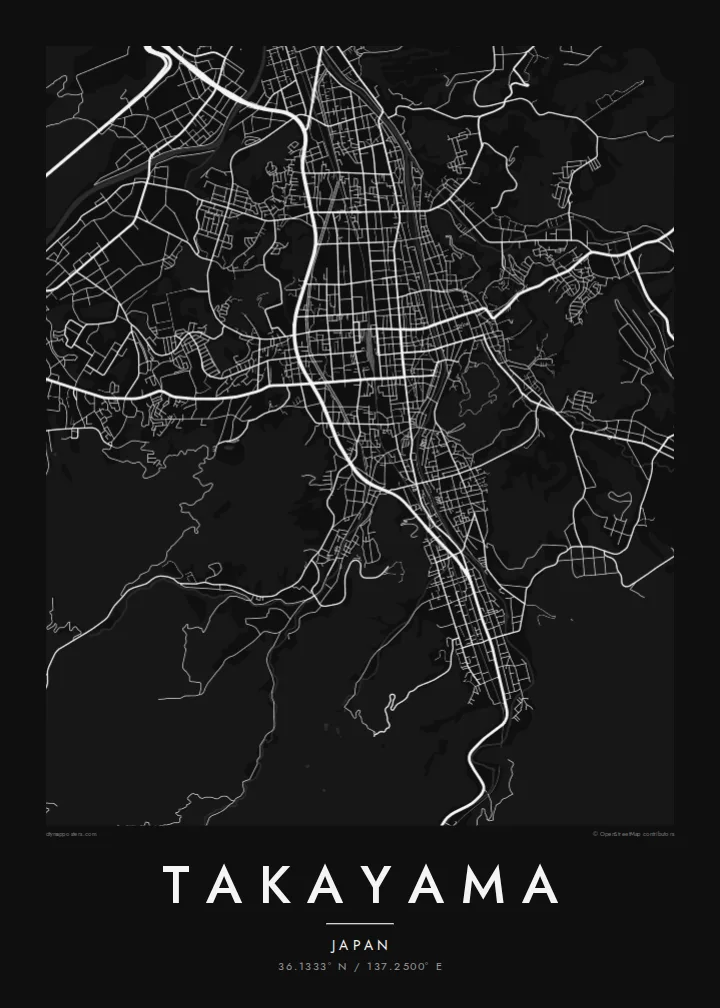
Parallel lanes of preserved merchant houses form the heart of the old town, a fine, regular grid that stands out clearly against the newer streets around it.
پوستر نقشه مینیمال · ژاپن
36.1333° N / 137.2500° E
A mountain town in the Hida highlands, its preserved merchant lanes laid in a tight grid beside the Miyagawa River.



یک شهر، پنج حالوهوا
روی یک سبک ضربه بزنید تا آن را روی دیوار ببینید. همه سبکها قیمت یکسانی دارند — چاپی، قابشده یا فایلهای HD.
 پیکسل واقعی · فایل چاپی ۲۴ × ۳۶ اینچ
وضوح چاپی
این یک برش ۱۰۰٪ از فایل چاپی واقعی است. هر پوستر — چاپی، قابشده یا دانلودی — روی سرورهای ما با کیفیت 300 DPI و تا 7,200 × 10,800 پیکسل رندر میشود، به همین دلیل حتی ریزترین خیابانها هم روی چاپ ۲۴ × ۳۶ اینچ واضح میمانند.
روی دیوار


نقشه
Takayama lies in a basin of the Hida highlands in Gifu Prefecture, surrounded by the peaks of the Japanese Alps. The Miyagawa River runs north through the town, and the old centre sits on its east bank. From above, the historic streets form a compact grid of narrow lanes, bordered by forested hills rising toward the old castle site.
The Sanmachi Suji district preserves rows of Edo-period merchant houses, sake breweries and shops along a few parallel streets. Nearby, the Takayama Jinya, a former government office of the shogunate, occupies a large walled compound. Morning markets are held along the Miyagawa and in front of the Jinya. A Takayama map poster places all of these within a few blocks of each other.
The town is famous for the Takayama Festival, held in spring and autumn, when elaborately decorated floats are drawn through the streets. Since municipal mergers in 2005, Takayama has been Japan's largest municipality by area, stretching deep into the mountains. The town itself remains small, walkable and closely bound to its river and hills.
Parallel lanes of preserved merchant houses form the heart of the old town, a fine, regular grid that stands out clearly against the newer streets around it.
The river runs north through the centre, crossed by a series of short bridges. Its banks host one of the town's morning markets, and it divides old and new Takayama.
East of the old town, the wooded hill where Takayama Castle once stood is now Shiroyama Park, a soft green mass that frames the tight streets below.
شخصیسازی کنید
یک تاریخ، یک نام یا جملهای از خودتان اضافه کنید و سبک، اندازه یا جهت را تغییر دهید.
پیشنمایش رایگان کیفیت پایین و دارای واترمارک است. نسخههای چاپی و فایلهای HD با کیفیت 300 DPI، تا 7,200 × 10,800 پیکسل و بدون واترمارک رندر میشوند.
چرا Takayama
Takayama is a place people remember precisely: the lanes of Sanmachi, the red bridges, the festival floats. A map of the old town makes a calm, detailed print for anyone who has walked there, and it sits well alongside prints of Kyoto or Kanazawa.
Personalise the title and subtitle, perhaps in Japanese or with the date of your visit, and adjust the coordinates line. Choose from Classic black and white, Noir, Paper, Blueprint and Sand. Paper suits the historic streets especially well.
سفارش پوستر Takayama| اندازه چاپ | وضوح | فایلها |
|---|---|---|
| 30 × 40 cm11.8 × 15.7″ | 3,543 × 4,724 px | PNG · PDF |
| 29.7 × 42 cm (A3)11.7 × 16.5″ | 3,508 × 4,961 px | PNG · PDF |
| 42 × 59.4 cm (A2)16.5 × 23.4″ | 4,961 × 7,016 px | PNG · PDF |
| 45.7 × 61 cm18 × 24″ | 5,400 × 7,200 px | PNG · PDF |
| 50 × 70 cm19.7 × 27.6″ | 5,906 × 8,268 px | PNG · PDF |
| 61 × 91.4 cm24 × 36″ | 7,200 × 10,800 px | PNG · PDF |
برای مقایسه، پیشنمایش رایگان ۹۰۰ پیکسل عرض دارد، واترمارکدار است و برای نمایش روی صفحه در نظر گرفته شده. فایلهای HD در هر جهت تا ۸ برابر وضوح بیشتری دارند و در اندازه کامل پوستر بهخوبی چاپ میشوند.
یک سبک را از بالای صفحه انتخاب کنید، سپس پوستر چاپی — یک اندازه و در صورت تمایل یک قاب — یا فایلهای دیجیتال HD را انتخاب کنید. پرداخت فقط یک مرحله دارد و صفحه سفارش شما به محض تکمیل پرداخت بهروزرسانی میشود.
روی کاغذ مات پرمیوم ۲۰۰ گرمی و در یکی از شش اندازه، از ۳۰ × ۴۰ سانتیمتر تا ۲۴ × ۳۶ اینچ، چاپ میشود. قیمت پوسترهای چاپی از $39 شروع میشود و هزینه ارسال هم شامل آن است.
بله. یک قاب چوب طبیعی به رنگ مشکی، سفید، بلوط طبیعی یا چوب تیره انتخاب کنید. این قاب با شیشه ضدشکست عرضه میشود و آماده نصب است. قیمت پوسترهای قابشده از $99 شروع میشود و هزینه ارسال هم شامل آن است.
ارسال به بیش از ۶۰ کشور رایگان است. هر پوستر را نزدیکترین شریک چاپ ما در بیش از ۳۰ کشور چاپ میکند و معمولاً ظرف ۳ تا ۷ روز کاری میرسد. وضعیت سفارش و کد رهگیری را در «سفارشهای من» میبینید. ارسال به چند کشور ۲ تا ۵ هفته طول میکشد و اگر هنوز به کشوری ارسال نداشته باشیم، سایت پیش از پرداخت به شما اطلاع میدهد.
ظرف ۱۴ روز از تحویل، یک عکس برای ما بفرستید تا آن را بهصورت رایگان دوباره چاپ کنیم یا هزینهتان را بازگردانیم.
بله. در ویرایشگر همین صفحه، عنوان، زیرعنوان و خط مختصات را به دلخواه تغییر دهید و یک سبک و اندازه انتخاب کنید. سفارشهای چاپی، قابشده و دیجیتال همگی دقیقاً از طرح شما استفاده میکنند.
با $9 فایلهای PNG با کیفیت 300 DPI و فایلهای PDF آماده چاپ را در هر شش اندازه، بدون واترمارک، دریافت میکنید تا هر جا خواستید چاپ کنید. هنوز مطمئن نیستید؟ ابتدا یک پیشنمایش رایگان با واترمارک دانلود کنید.
در همین نزدیکی
