Lac de Tignes
The natural lake sits at the centre of the resort, with Tignes Le Lac on its shore and paths around it, frozen in winter and used for walking and water sports in summer.
پوستر نقشه مینیمال · فرانسه
45.4697° N / 6.9094° E
A high resort arranged around a mountain lake, with further villages below near a dam and the Grande Motte glacier above.



یک شهر، پنج حالوهوا
روی یک سبک ضربه بزنید تا آن را روی دیوار ببینید. همه سبکها قیمت یکسانی دارند — چاپی، قابشده یا فایلهای HD.
 پیکسل واقعی · فایل چاپی ۲۴ × ۳۶ اینچ
وضوح چاپی
این یک برش ۱۰۰٪ از فایل چاپی واقعی است. هر پوستر — چاپی، قابشده یا دانلودی — روی سرورهای ما با کیفیت 300 DPI و تا 7,200 × 10,800 پیکسل رندر میشود، به همین دلیل حتی ریزترین خیابانها هم روی چاپ ۲۴ × ۳۶ اینچ واضح میمانند.
روی دیوار


نقشه
Tignes is not one village but several, spread across a high part of the Tarentaise in Savoie. The main resort areas cluster around the Lac de Tignes: Tignes Le Lac on its shore, Le Lavachet close by, and Val Claret at the far end of the valley below the Grande Motte. Lower down, Tignes-les-Brévières sits near the valley floor, reached by a winding road.
The original village of Tignes was flooded in 1952 when the Chevril dam was completed, creating the Lac du Chevril reservoir downstream from today's resort. The old houses lie beneath the water, and the concrete dam wall carries a large mural of Hercules painted in 1989. Tignes shares the Espace Killy ski area with Val d'Isère.
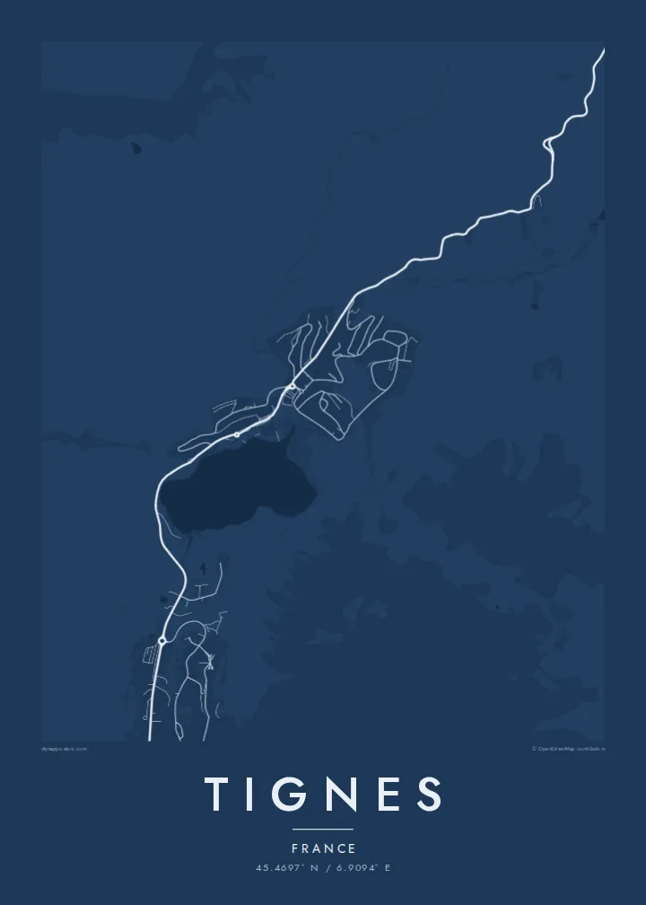
A Tignes map poster reflects a resort built mostly in the second half of the twentieth century: compact residential blocks, lift stations and roads curling around a lake. The Chevril reservoir adds a long water shape below, and the glacier terrain of the Grande Motte gives the upper edge of the map open, uninterrupted space.
The natural lake sits at the centre of the resort, with Tignes Le Lac on its shore and paths around it, frozen in winter and used for walking and water sports in summer.
The reservoir created by the Chevril dam lies below the resort along the Isère, a long, narrow body of water beside the road toward Val d'Isère.
At the head of the valley, Val Claret forms a dense cluster of buildings at the foot of the Grande Motte, the base for lifts climbing toward the glacier.
شخصیسازی کنید
یک تاریخ، یک نام یا جملهای از خودتان اضافه کنید و سبک، اندازه یا جهت را تغییر دهید.
پیشنمایش رایگان کیفیت پایین و دارای واترمارک است. نسخههای چاپی و فایلهای HD با کیفیت 300 DPI، تا 7,200 × 10,800 پیکسل و بدون واترمارک رندر میشوند.
چرا Tignes
Tignes is a resort of long seasons and high altitude, and for many it is where they spent a gap year, a first winter or countless holidays. A map poster of the lake and villages is a clean, personal reminder of that time.
Personalise the title, add a subtitle and edit the coordinates line to mark your apartment or a favourite run, then pick Classic black & white, Noir, Paper, Blueprint or Sand. It is available as a $9 download or a printed poster, framed in wood if you like.
سفارش پوستر Tignes| اندازه چاپ | وضوح | فایلها |
|---|---|---|
| 30 × 40 cm (11.8 × 15.7″) | 3,543 × 4,724 px | PNG · PDF |
| 29.7 × 42 cm (A3, 11.7 × 16.5″) | 3,508 × 4,961 px | PNG · PDF |
| 42 × 59.4 cm (A2, 16.5 × 23.4″) | 4,961 × 7,016 px | PNG · PDF |
| 45.7 × 61 cm (18 × 24″) | 5,400 × 7,200 px | PNG · PDF |
| 50 × 70 cm (19.7 × 27.6″) | 5,906 × 8,268 px | PNG · PDF |
| 61 × 91.4 cm (24 × 36″) | 7,200 × 10,800 px | PNG · PDF |
برای مقایسه، پیشنمایش رایگان ۹۰۰ پیکسل عرض دارد، واترمارکدار است و برای نمایش روی صفحه در نظر گرفته شده. فایلهای HD در هر جهت تا ۸ برابر وضوح بیشتری دارند و در اندازه کامل پوستر بهخوبی چاپ میشوند.
یک سبک را از بالای صفحه انتخاب کنید، سپس پوستر چاپی — یک اندازه و در صورت تمایل یک قاب — یا فایلهای دیجیتال HD را انتخاب کنید. پرداخت فقط یک مرحله دارد و صفحه سفارش شما به محض تکمیل پرداخت بهروزرسانی میشود.
روی کاغذ مات پرمیوم ۲۰۰ گرمی و در یکی از شش اندازه، از ۳۰ × ۴۰ سانتیمتر تا ۲۴ × ۳۶ اینچ، چاپ میشود. قیمت پوسترهای چاپی از {printFrom} شروع میشود و هزینه ارسال هم شامل آن است.
بله. یک قاب چوب طبیعی به رنگ مشکی، سفید، بلوط طبیعی یا چوب تیره انتخاب کنید. این قاب با شیشه ضدشکست عرضه میشود و آماده نصب است. قیمت پوسترهای قابشده از {framedFrom} شروع میشود و هزینه ارسال هم شامل آن است.
ارسال در سراسر جهان رایگان است. هر پوستر توسط نزدیکترین شریک چاپ ما، از میان شرکای ما در بیش از ۳۰ کشور، چاپ میشود و معمولاً ظرف ۳ تا ۷ روز کاری میرسد. وضعیت سفارش و کد رهگیری را میتوانید در «سفارشهای من» ببینید. ارسال به چند کشور ۲ تا ۵ هفته طول میکشد و اگر هنوز به کشوری ارسال نداشته باشیم، سایت پیش از پرداخت به شما اطلاع میدهد.
ظرف ۱۴ روز از تحویل، یک عکس برای ما بفرستید تا آن را بهصورت رایگان دوباره چاپ کنیم یا هزینهتان را بازگردانیم.
بله. در ویرایشگر همین صفحه، عنوان، زیرعنوان و خط مختصات را به دلخواه تغییر دهید و یک سبک و اندازه انتخاب کنید. سفارشهای چاپی، قابشده و دیجیتال همگی دقیقاً از طرح شما استفاده میکنند.
با $9 فایلهای PNG با کیفیت 300 DPI و فایلهای PDF آماده چاپ را در هر شش اندازه، بدون واترمارک، دریافت میکنید تا هر جا خواستید چاپ کنید. هنوز مطمئن نیستید؟ ابتدا یک پیشنمایش رایگان با واترمارک دانلود کنید.
