Gore Creek corridor
The creek runs the length of town beside Interstate 70, and the two lines together set the east-west grain of the whole map, from the Vail Pass approach down toward West Vail.
پوستر نقشه مینیمال · ایالات متحده
39.6438° N / 106.3888° W
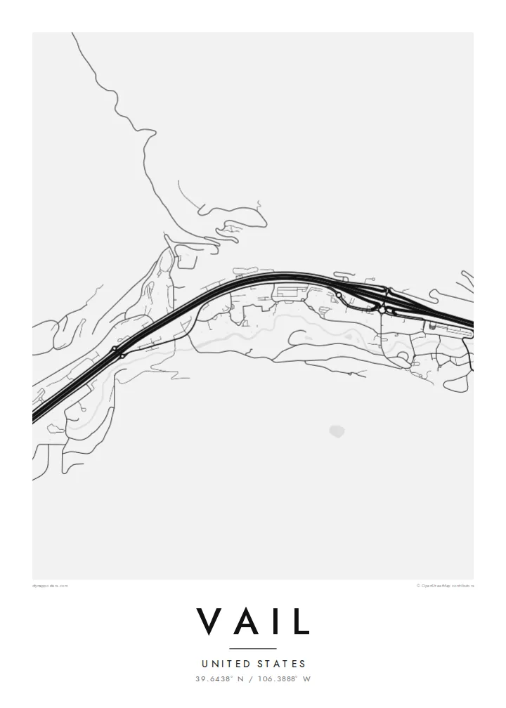
A long, narrow town pulled east to west along Gore Creek and the interstate, the ski mountain rising to its south.


یک شهر، پنج حالوهوا
روی یک سبک ضربه بزنید تا آن را روی دیوار ببینید. همه سبکها قیمت یکسانی دارند — چاپی، قابشده یا فایلهای HD.
 پیکسل واقعی · فایل چاپی ۲۴ × ۳۶ اینچ
وضوح چاپی
این یک برش ۱۰۰٪ از فایل چاپی واقعی است. هر پوستر — چاپی، قابشده یا دانلودی — روی سرورهای ما با کیفیت 300 DPI و تا 7,200 × 10,800 پیکسل رندر میشود، به همین دلیل حتی ریزترین خیابانها هم روی چاپ ۲۴ × ۳۶ اینچ واضح میمانند.
روی دیوار


نقشه
From above, Vail barely has a width. The town follows the floor of the Gore Creek valley for several miles, squeezed between steep slopes, with Interstate 70 running the full length of it. Frontage roads, roundabouts and the thin line of the creek all run in parallel, so the map reads as a set of stretched bands rather than a grid, broken only where the village cores cluster at the base of the lifts.
Vail opened as a ski area in 1962 on what had been grazing land, founded by a group that included Pete Seibert, a veteran of the 10th Mountain Division, which trained at nearby Camp Hale during the Second World War. The pedestrian lanes of Vail Village were laid out with Alpine towns in mind, and they still show up on the map as a knot of short, curving streets among the straight valley lines.
A Vail map poster keeps that contrast legible: the dense little villages of Vail Village and Lionshead, the long parallel ribbons of road and water, and the empty space where the mountain climbs toward the Back Bowls. It is a quiet, graphic picture of a place most people remember in terms of snow and light, redrawn as lines on paper.
The creek runs the length of town beside Interstate 70, and the two lines together set the east-west grain of the whole map, from the Vail Pass approach down toward West Vail.
The original village core is a tight cluster of short, bending pedestrian streets and a covered bridge over Gore Creek, noticeably finer in texture than anything else in the valley.
South of the ridge the mountain opens into wide, treeless bowls. On a street map they appear as open ground, a calm counterweight to the busy valley floor below.
شخصیسازی کنید
یک تاریخ، یک نام یا جملهای از خودتان اضافه کنید و سبک، اندازه یا جهت را تغییر دهید.
پیشنمایش رایگان کیفیت پایین و دارای واترمارک است. نسخههای چاپی و فایلهای HD با کیفیت 300 DPI، تا 7,200 × 10,800 پیکسل و بدون واترمارک رندر میشوند.
چرا Vail
For many people Vail is tied to a specific week: a first trip, an annual family tradition, a season spent working the lifts. A map of the valley brings that back without resorting to a photo, and it sits comfortably in a hallway, a cabin or a city apartment far from the mountains.
You can set your own title and subtitle, adjust the coordinates line to mark a lodge or a year, and choose from five styles: Classic black & white, Noir, Paper, Blueprint or Sand. Download the HD files for $9 or order a matte print, framed in wood if you like.
سفارش پوستر Vail| اندازه چاپ | وضوح | فایلها |
|---|---|---|
| 30 × 40 cm (11.8 × 15.7″) | 3,543 × 4,724 px | PNG · PDF |
| 29.7 × 42 cm (A3, 11.7 × 16.5″) | 3,508 × 4,961 px | PNG · PDF |
| 42 × 59.4 cm (A2, 16.5 × 23.4″) | 4,961 × 7,016 px | PNG · PDF |
| 45.7 × 61 cm (18 × 24″) | 5,400 × 7,200 px | PNG · PDF |
| 50 × 70 cm (19.7 × 27.6″) | 5,906 × 8,268 px | PNG · PDF |
| 61 × 91.4 cm (24 × 36″) | 7,200 × 10,800 px | PNG · PDF |
برای مقایسه، پیشنمایش رایگان ۹۰۰ پیکسل عرض دارد، واترمارکدار است و برای نمایش روی صفحه در نظر گرفته شده. فایلهای HD در هر جهت تا ۸ برابر وضوح بیشتری دارند و در اندازه کامل پوستر بهخوبی چاپ میشوند.
یک سبک را از بالای صفحه انتخاب کنید، سپس پوستر چاپی — یک اندازه و در صورت تمایل یک قاب — یا فایلهای دیجیتال HD را انتخاب کنید. پرداخت فقط یک مرحله دارد و صفحه سفارش شما به محض تکمیل پرداخت بهروزرسانی میشود.
روی کاغذ مات پرمیوم ۲۰۰ گرمی و در یکی از شش اندازه، از ۳۰ × ۴۰ سانتیمتر تا ۲۴ × ۳۶ اینچ، چاپ میشود. قیمت پوسترهای چاپی از {printFrom} شروع میشود و هزینه ارسال هم شامل آن است.
بله. یک قاب چوب طبیعی به رنگ مشکی، سفید، بلوط طبیعی یا چوب تیره انتخاب کنید. این قاب با شیشه ضدشکست عرضه میشود و آماده نصب است. قیمت پوسترهای قابشده از {framedFrom} شروع میشود و هزینه ارسال هم شامل آن است.
ارسال در سراسر جهان رایگان است. هر پوستر توسط نزدیکترین شریک چاپ ما در بیش از ۳۰ کشور چاپ میشود و معمولاً طی ۳ تا ۷ روز کاری میرسد. میتوانید وضعیت و رهگیری سفارش را در بخش سفارشهای من دنبال کنید.
ظرف ۱۴ روز از تحویل، یک عکس برای ما بفرستید تا آن را بهصورت رایگان دوباره چاپ کنیم یا هزینهتان را بازگردانیم.
بله. در ویرایشگر همین صفحه، عنوان، زیرعنوان و خط مختصات را به دلخواه تغییر دهید و یک سبک و اندازه انتخاب کنید. سفارشهای چاپی، قابشده و دیجیتال همگی دقیقاً از طرح شما استفاده میکنند.
با $9 فایلهای PNG با کیفیت 300 DPI و فایلهای PDF آماده چاپ را در هر شش اندازه، بدون واترمارک، دریافت میکنید تا هر جا خواستید چاپ کنید. هنوز مطمئن نیستید؟ ابتدا یک پیشنمایش رایگان با واترمارک دانلود کنید.
