Gulf of Gabès shoreline
The coast runs as one unbroken line along the town's seaward side, a strong edge that anchors the composition and separates the street pattern from open water.
پوستر نقشه مینیمال · تونس
33.5040° N / 11.1121° E
A low coastal town on the Gulf of Gabès, its streets thinning into olive groves and a long ribbon of shoreline


یک شهر، پنج حالوهوا
روی یک سبک ضربه بزنید تا آن را روی دیوار ببینید. همه سبکها قیمت یکسانی دارند — چاپی، قابشده یا فایلهای HD.
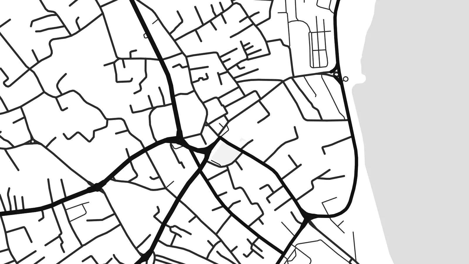 پیکسل واقعی · فایل چاپی ۲۴ × ۳۶ اینچ
وضوح چاپی
این یک برش ۱۰۰٪ از فایل چاپی واقعی است. هر پوستر — چاپی، قابشده یا دانلودی — روی سرورهای ما با کیفیت 300 DPI و تا 7,200 × 10,800 پیکسل رندر میشود، به همین دلیل حتی ریزترین خیابانها هم روی چاپ ۲۴ × ۳۶ اینچ واضح میمانند.
روی دیوار


نقشه
Zarzis sits on the southeastern coast of Tunisia, in the Medenine Governorate, facing the shallow waters of the Gulf of Gabès. From above, the town reads as a compact centre with streets that loosen as they move inland. The coast runs as one long line along its eastern side, and the land around it is flat and dry, marked by field boundaries and scattered buildings.
The area is known for its olive groves, which cover much of the land around the town and show as a fine, even texture beyond the built-up edge. A fishing port gives the shoreline a small hard-edged break, and a string of beach hotels stretches along the coast. To the north, the island of Djerba lies across a narrow stretch of water.
A Zarzis map poster shows a place where the sea sets the boundary and the town takes its shape from farmland and coast. In black and white, the meeting of dense streets, open ground and water becomes the whole composition. Nothing needs to be added. The contrast between the built town and the plain around it is enough to carry the frame.
The coast runs as one unbroken line along the town's seaward side, a strong edge that anchors the composition and separates the street pattern from open water.
Beyond the centre, the land opens into olive plantations and field plots, giving the outer parts of the map a quiet, regular texture instead of dense streets.
A small fishing port breaks the shoreline, and resort development follows the beach in a thin band, drawing the town out along the water.
شخصیسازی کنید
یک تاریخ، یک نام یا جملهای از خودتان اضافه کنید و سبک، اندازه یا جهت را تغییر دهید.
پیشنمایش رایگان کیفیت پایین و دارای واترمارک است. نسخههای چاپی و فایلهای HD با کیفیت 300 DPI، تا 7,200 × 10,800 پیکسل و بدون واترمارک رندر میشوند.
چرا Zarzis
People hang Zarzis for summers spent on its beaches, for family roots in southern Tunisia, or simply because they like how a coastline looks on paper. The map keeps the town's outline without decoration, so it sits comfortably in a hallway or a study.
You can add your own title, a subtitle such as a year or family name, and the coordinates line. Choose one of five styles: Classic black & white, Noir, Paper, Blueprint or Sand. Sand works especially well with this coast.
سفارش پوستر Zarzis| اندازه چاپ | وضوح | فایلها |
|---|---|---|
| 30 × 40 cm (11.8 × 15.7″) | 3,543 × 4,724 px | PNG · PDF |
| 29.7 × 42 cm (A3, 11.7 × 16.5″) | 3,508 × 4,961 px | PNG · PDF |
| 42 × 59.4 cm (A2, 16.5 × 23.4″) | 4,961 × 7,016 px | PNG · PDF |
| 45.7 × 61 cm (18 × 24″) | 5,400 × 7,200 px | PNG · PDF |
| 50 × 70 cm (19.7 × 27.6″) | 5,906 × 8,268 px | PNG · PDF |
| 61 × 91.4 cm (24 × 36″) | 7,200 × 10,800 px | PNG · PDF |
برای مقایسه، پیشنمایش رایگان ۹۰۰ پیکسل عرض دارد، واترمارکدار است و برای نمایش روی صفحه در نظر گرفته شده. فایلهای HD در هر جهت تا ۸ برابر وضوح بیشتری دارند و در اندازه کامل پوستر بهخوبی چاپ میشوند.
یک سبک را از بالای صفحه انتخاب کنید، سپس پوستر چاپی — یک اندازه و در صورت تمایل یک قاب — یا فایلهای دیجیتال HD را انتخاب کنید. پرداخت فقط یک مرحله دارد و صفحه سفارش شما به محض تکمیل پرداخت بهروزرسانی میشود.
روی کاغذ مات پرمیوم ۲۰۰ گرمی و در یکی از شش اندازه، از ۳۰ × ۴۰ سانتیمتر تا ۲۴ × ۳۶ اینچ، چاپ میشود. قیمت پوسترهای چاپی از $39 شروع میشود و هزینه ارسال هم شامل آن است.
بله. یک قاب چوب طبیعی به رنگ مشکی، سفید، بلوط طبیعی یا چوب تیره انتخاب کنید. این قاب با شیشه ضدشکست عرضه میشود و آماده نصب است. قیمت پوسترهای قابشده از $99 شروع میشود و هزینه ارسال هم شامل آن است.
ارسال در سراسر جهان رایگان است. هر پوستر توسط نزدیکترین شریک چاپ ما، از میان شرکای ما در بیش از ۳۰ کشور، چاپ میشود و معمولاً ظرف ۳ تا ۷ روز کاری میرسد. وضعیت سفارش و کد رهگیری را میتوانید در «سفارشهای من» ببینید. ارسال به چند کشور ۲ تا ۵ هفته طول میکشد و اگر هنوز به کشوری ارسال نداشته باشیم، سایت پیش از پرداخت به شما اطلاع میدهد.
ظرف ۱۴ روز از تحویل، یک عکس برای ما بفرستید تا آن را بهصورت رایگان دوباره چاپ کنیم یا هزینهتان را بازگردانیم.
بله. در ویرایشگر همین صفحه، عنوان، زیرعنوان و خط مختصات را به دلخواه تغییر دهید و یک سبک و اندازه انتخاب کنید. سفارشهای چاپی، قابشده و دیجیتال همگی دقیقاً از طرح شما استفاده میکنند.
با $9 فایلهای PNG با کیفیت 300 DPI و فایلهای PDF آماده چاپ را در هر شش اندازه، بدون واترمارک، دریافت میکنید تا هر جا خواستید چاپ کنید. هنوز مطمئن نیستید؟ ابتدا یک پیشنمایش رایگان با واترمارک دانلود کنید.
