The Niers
The small river winds through Goch and the surrounding meadows, drawing a soft, meandering line across the flat Lower Rhine landscape.
Minimalistinen karttajuliste · Saksa
51.6787° N / 6.1589° E
A Lower Rhine town on the Niers, with a medieval gate, a compact old centre and farmland towards the Dutch border



Yksi kaupunki, viisi tunnelmaa
Napauta tyyliä nähdäksesi sen seinällä. Kaikki tyylit maksavat saman verran — painettuna, kehystettynä tai HD-tiedostoina.
 Todelliset pikselit · 24 × 36″ tulostustiedosto
Terävä painojälki
Tämä on 100 %:n rajaus todellisesta tulostustiedostosta. Jokainen juliste — painettu, kehystetty tai ladattu — renderöidään palvelimillamme 300 DPI:n tarkkuudella, jopa 7,200 × 10,800 pikseliin asti, joten pienimmätkin kadut pysyvät terävinä 24 × 36″ -tulosteessa.
Seinällä


Kartta
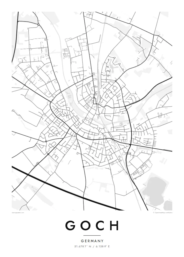
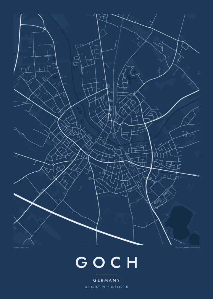
Goch lies in the Lower Rhine region of North Rhine-Westphalia, close to the border with the Netherlands. On a map the town gathers around a compact old centre on the Niers, a small river that winds through the town and the surrounding flat farmland. Roads fan out towards Kleve, Weeze and villages across the border, cutting through fields and wooded patches.
The Steintor, a medieval gate tower, is the most recognisable surviving part of the town's old fortifications and a symbol of Goch. The town was heavily damaged at the end of the Second World War, and much of its centre was rebuilt afterwards, while the Reichswald forest lies to the north.
A Goch map poster combines the curving line of the Niers with a small historic core and a broad, open landscape. The river adds movement, the old centre gives detail, and the fields and forest create generous white space around it. It is a calm composition that suits this quiet borderland.
The small river winds through Goch and the surrounding meadows, drawing a soft, meandering line across the flat Lower Rhine landscape.
The compact historic core around the medieval Steintor gate forms the densest part of the map, with streets converging on the old town.
Roads lead west and north through farmland and forest towards the Dutch border and the Reichswald, giving the map a quiet, open edge.
Tee siitä omasi
Lisää päivämäärä, nimi tai oma tekstisi, vaihda tyyliä, kokoa tai suuntaa.
Ilmainen esikatselu on matalaresoluutioinen ja vesileimattu. Painetut julisteet ja HD-tiedostot renderöidään 300 DPI:n tarkkuudella, jopa 7,200 × 10,800 px asti, ilman vesileimaa.
Miksi Goch
Goch appeals to people with ties to the Lower Rhine, whether they grew up by the Niers, crossed the nearby border often, or simply appreciate the calm order of a small German town.
The title, subtitle and coordinates can be personalised, and the poster is available in five styles. Download six print sizes for $9 as PNG and PDF files, or order a printed poster with an optional wooden frame.
Tilaa Goch-juliste| Tulostekoko | Resoluutio | Tiedostot |
|---|---|---|
| 30 × 40 cm (11.8 × 15.7″) | 3,543 × 4,724 px | PNG · PDF |
| 29.7 × 42 cm (A3, 11.7 × 16.5″) | 3,508 × 4,961 px | PNG · PDF |
| 42 × 59.4 cm (A2, 16.5 × 23.4″) | 4,961 × 7,016 px | PNG · PDF |
| 45.7 × 61 cm (18 × 24″) | 5,400 × 7,200 px | PNG · PDF |
| 50 × 70 cm (19.7 × 27.6″) | 5,906 × 8,268 px | PNG · PDF |
| 61 × 91.4 cm (24 × 36″) | 7,200 × 10,800 px | PNG · PDF |
Vertailun vuoksi: ilmainen esikatselu on 900 px leveä, vesileimattu ja tarkoitettu näytöille. HD-tiedostojen resoluutio on jopa 8-kertainen kumpaankin suuntaan, ja ne tulostuvat siististi täydessä julistekoossa.
Valitse tyyli sivun yläosasta ja sen jälkeen Painettu juliste — koko ja halutessasi kehys — tai Digitaaliset HD-tiedostot. Kassalla on vain yksi vaihe, ja tilaussivusi päivittyy heti maksun jälkeen.
Se painetaan laadukkaalle 200 g/m² mattapaperille kuudessa eri koossa, 30 × 40 cm:stä 24 × 36″:een. Painetut julisteet alkaen {printFrom}, toimitus sisältyy hintaan.
Kyllä. Valitse massiivipuinen kehys mustana, valkoisena, luonnontammena tai tummana puuna. Kehykseen kuuluu iskunkestävä lasitus, ja se on heti ripustusvalmis. Kehystetyt julisteet alkaen {framedFrom}, toimitus sisältyy hintaan.
Toimitus on ilmainen kaikkialle maailmaan. Jokaisen julisteen painaa lähin yli 30 maassa toimivista painokumppaneistamme, ja se saapuu yleensä 3–7 arkipäivässä. Tilauksen tilaa ja seurantatietoja voi seurata kohdassa Omat tilaukset. Joihinkin maihin toimitus kestää 2–5 viikkoa, ja jos emme vielä toimita maahasi, sivusto kertoo siitä ennen maksamista.
Lähetä meille kuva 14 päivän kuluessa toimituksesta, niin painamme uuden veloituksetta tai palautamme rahasi.
Kyllä. Muokkaa tämän sivun editorissa otsikkoa, alaotsikkoa ja koordinaattirivi haluamallasi tavalla, ja valitse tyyli ja koko. Painetut, kehystetyt ja digitaaliset tilaukset käyttävät kaikki juuri sinun suunnitelmaasi.
Hintaan $9 saat 300 DPI:n PNG- ja tulostusvalmiit PDF-tiedostot kaikissa kuudessa koossa, ilman vesileimaa, tulostettavaksi missä tahansa. Etkö ole vielä varma? Lataa ensin ilmainen esikatselu vesileimalla.
