The Karun River
Iran's longest river runs past the town as it comes out of the Zagros. Its meanders and the farmland along its banks give the composition its strongest line.
Minimalistinen karttajuliste · Iran
32.2458° N / 48.8132° E
A compact Khuzestan town beside the Karun River, where the plain begins to rise toward the Zagros foothills


Yksi kaupunki, viisi tunnelmaa
Napauta tyyliä nähdäksesi sen seinällä. Kaikki tyylit maksavat saman verran — painettuna, kehystettynä tai HD-tiedostoina.
 Todelliset pikselit · 24 × 36″ tulostustiedosto
Terävä painojälki
Tämä on 100 %:n rajaus todellisesta tulostustiedostosta. Jokainen juliste — painettu, kehystetty tai ladattu — renderöidään palvelimillamme 300 DPI:n tarkkuudella, jopa 7,200 × 10,800 pikseliin asti, joten pienimmätkin kadut pysyvät terävinä 24 × 36″ -tulosteessa.
Seinällä


Kartta
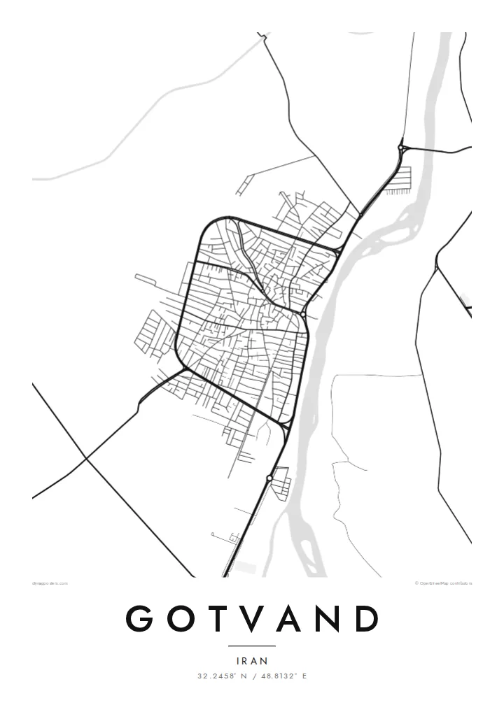
Gotvand sits in northern Khuzestan, where the flat farmland of southwestern Iran starts to fold into the first ridges of the Zagros. From above, the town is a small, dense cluster of streets on the plain. Irrigated fields and the line of the Karun River frame it, and the river is the feature that sets the direction of the whole map.
The Karun is Iran's longest river, and near Gotvand it leaves the mountains for the lowlands. Upstream, the Upper Gotvand Dam holds back one of the country's large reservoirs. Built for hydropower and water storage, it has been debated for years over salt deposits in the reservoir area. That puts the town at a point where a major river meets major engineering.
A Gotvand map poster keeps things plain: the grid of residential lanes, the roads heading out toward Shushtar and the dam, and the river's curve set against empty space. In black and white, the contrast between the settled plain and the rougher ground to the north comes through clearly. The result is a quiet, readable picture of a town shaped by water.
Iran's longest river runs past the town as it comes out of the Zagros. Its meanders and the farmland along its banks give the composition its strongest line.
North of the town, a large rockfill dam turns the Karun into a long reservoir. It is one of the best-known water projects in Khuzestan.
South of Gotvand the land lies flat and farmed. To the north the relief starts to break into ridges, so the map shows two landscapes meeting.
Tee siitä omasi
Lisää päivämäärä, nimi tai oma tekstisi, vaihda tyyliä, kokoa tai suuntaa.
Ilmainen esikatselu on matalaresoluutioinen ja vesileimattu. Painetut julisteet ja HD-tiedostot renderöidään 300 DPI:n tarkkuudella, jopa 7,200 × 10,800 px asti, ilman vesileimaa.
Miksi Gotvand
People who grew up in Gotvand, or whose families farmed along the Karun, often want something that shows home as it actually lies on the land. This map does that simply, with the river, the fields and the town between them.
You can set the title, subtitle and coordinates line to mark a family name, a year or the exact spot of a house. Then pick one of five styles: Classic black & white, Noir, Paper, Blueprint or Sand.
Tilaa Gotvand-juliste| Tulostekoko | Resoluutio | Tiedostot |
|---|---|---|
| 30 × 40 cm (11.8 × 15.7″) | 3,543 × 4,724 px | PNG · PDF |
| 29.7 × 42 cm (A3, 11.7 × 16.5″) | 3,508 × 4,961 px | PNG · PDF |
| 42 × 59.4 cm (A2, 16.5 × 23.4″) | 4,961 × 7,016 px | PNG · PDF |
| 45.7 × 61 cm (18 × 24″) | 5,400 × 7,200 px | PNG · PDF |
| 50 × 70 cm (19.7 × 27.6″) | 5,906 × 8,268 px | PNG · PDF |
| 61 × 91.4 cm (24 × 36″) | 7,200 × 10,800 px | PNG · PDF |
Vertailun vuoksi: ilmainen esikatselu on 900 px leveä, vesileimattu ja tarkoitettu näytöille. HD-tiedostojen resoluutio on jopa 8-kertainen kumpaankin suuntaan, ja ne tulostuvat siististi täydessä julistekoossa.
Valitse tyyli sivun yläosasta ja sen jälkeen Painettu juliste — koko ja halutessasi kehys — tai Digitaaliset HD-tiedostot. Kassalla on vain yksi vaihe, ja tilaussivusi päivittyy heti maksun jälkeen.
Se painetaan laadukkaalle 200 g/m² mattapaperille kuudessa eri koossa, 30 × 40 cm:stä 24 × 36″:een. Painetut julisteet alkaen $39, toimitus sisältyy hintaan.
Kyllä. Valitse massiivipuinen kehys mustana, valkoisena, luonnontammena tai tummana puuna. Kehykseen kuuluu iskunkestävä lasitus, ja se on heti ripustusvalmis. Kehystetyt julisteet alkaen $99, toimitus sisältyy hintaan.
Toimitus on ilmainen kaikkialle maailmaan. Jokaisen julisteen painaa lähin yli 30 maassa toimivista painokumppaneistamme, ja se saapuu yleensä 3–7 arkipäivässä. Tilauksen tilaa ja seurantatietoja voi seurata kohdassa Omat tilaukset. Joihinkin maihin toimitus kestää 2–5 viikkoa, ja jos emme vielä toimita maahasi, sivusto kertoo siitä ennen maksamista.
Lähetä meille kuva 14 päivän kuluessa toimituksesta, niin painamme uuden veloituksetta tai palautamme rahasi.
Kyllä. Muokkaa tämän sivun editorissa otsikkoa, alaotsikkoa ja koordinaattirivi haluamallasi tavalla, ja valitse tyyli ja koko. Painetut, kehystetyt ja digitaaliset tilaukset käyttävät kaikki juuri sinun suunnitelmaasi.
Hintaan $9 saat 300 DPI:n PNG- ja tulostusvalmiit PDF-tiedostot kaikissa kuudessa koossa, ilman vesileimaa, tulostettavaksi missä tahansa. Etkö ole vielä varma? Lataa ensin ilmainen esikatselu vesileimalla.
Lähistöllä
