Setit River
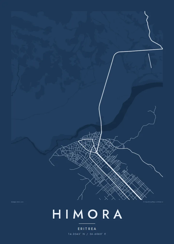
The Setit, or Tekezé, runs through the lowlands near Himora and forms part of the border with Ethiopia. It is the strongest natural line on the map.
Minimalist na map poster · Eritrea
14.3043° N / 36.6060° E
A lowland settlement in western Eritrea near the Setit River, close to where three national borders meet



Isang lungsod, limang mood
I-tap ang isang estilo para makita ito sa dingding. Pareho ang presyo ng bawat estilo — naka-print, naka-frame, o bilang HD files.
 Aktwal na pixels · 24 × 36″ print file
Matalas sa print
Ito ay 100% crop ng aktwal na print file. Bawat poster — naka-print, naka-frame, o na-download — ay ginagawa sa aming mga server sa 300 DPI, hanggang 7,200 × 10,800 pixels, kaya malinaw pa rin ang pinakamaliliit na kalye kahit sa 24 × 36″ na print.
Sa dingding


Ang mapa
Himora lies in the Gash-Barka region of western Eritrea, in the lowlands near the Setit River, also known as the Tekezé. In this area the river marks the border between Eritrea and Ethiopia, and the frontier with Sudan is not far away. The landscape is flat and open, with the river as its main line.
From above, the settlement is small and simply laid out, with streets and compounds arranged loosely on open ground. Tracks lead away across the plain, and the river runs to the south with its bends and seasonal channels. On a minimal map the contrast between the built area and the empty land around it is strong.
A Himora map poster is a personal piece, chosen by people with family or history in the western lowlands. It shows the place simply, with the river, the plain and the settlement together, without adding detail that is not there.
The Setit, or Tekezé, runs through the lowlands near Himora and forms part of the border with Ethiopia. It is the strongest natural line on the map.
Around the settlement the land is flat and sparsely built, drawn with little detail so that the streets and the river stand out clearly.
Himora lies close to the meeting point of Eritrea, Ethiopia and Sudan, and roads and tracks lead from it across this wide frontier landscape.
Gawin mong sa iyo
Magdagdag ng petsa, pangalan o sarili mong linya, at palitan ang estilo, sukat o oryentasyon.
Ang libreng preview ay low-resolution na may watermark. Ang mga print at HD files ay ginagawa sa 300 DPI, hanggang 7,200 × 10,800 px, walang watermark.
Bakit Himora
For families from the western lowlands, including many who now live abroad, a map of the settlement and river keeps a specific place in mind. It is a simple, respectful way to remember home.
The title, subtitle and coordinates line can be personalised, for example in Tigrinya or English. Choose Classic black & white, Noir, Paper, Blueprint or Sand, as $9 digital files or a printed poster.
I-order ang Himora poster| Sukat ng print | Resolution | Mga file |
|---|---|---|
| 30 × 40 cm (11.8 × 15.7″) | 3,543 × 4,724 px | PNG · PDF |
| 29.7 × 42 cm (A3, 11.7 × 16.5″) | 3,508 × 4,961 px | PNG · PDF |
| 42 × 59.4 cm (A2, 16.5 × 23.4″) | 4,961 × 7,016 px | PNG · PDF |
| 45.7 × 61 cm (18 × 24″) | 5,400 × 7,200 px | PNG · PDF |
| 50 × 70 cm (19.7 × 27.6″) | 5,906 × 8,268 px | PNG · PDF |
| 61 × 91.4 cm (24 × 36″) | 7,200 × 10,800 px | PNG · PDF |
Bilang paghahambing, ang libreng preview ay 900 px ang lapad, may watermark at para lang sa screen. Ang HD files ay may hanggang 8× na resolution sa bawat direksyon at malinis na napi-print sa buong laki ng poster.
Pumili ng estilo sa itaas ng page, pagkatapos ay piliin ang Printed Poster — isang size at, kung gusto mo, isang frame — o Digital HD Files. Isang hakbang lang ang checkout, at agad na mag-a-update ang iyong order page kapag natapos na ang bayad.
Naka-print ito sa premium na 200 gsm matte paper sa isa sa anim na sizes, mula 30 × 40 cm hanggang 24 × 36″. Nagsisimula ang naka-print na poster sa $39, kasama na ang shipping.
Oo. Pumili ng solid wood frame sa itim, puti, natural oak, o dark wood. May kasamang shatterproof glazing at handa nang isabit. Nagsisimula ang naka-frame na poster sa $99, kasama na ang shipping.
Libre ang pagpapadala sa buong mundo. Bawat poster ay piniprint ng pinakamalapit sa aming mga print partner sa mahigit 30 bansa at karaniwang dumarating sa loob ng 3–7 araw ng negosyo. Masusubaybayan mo ang status at tracking sa Aking Mga Order. May ilang bansang aabutin ng 2–5 linggo, at kung hindi pa kami nagpapadala sa inyong bansa, sasabihin ito ng site bago ka magbayad.
Magpadala lang ng larawan sa loob ng 14 na araw mula sa paghahatid at ipapa-print namin ulit ito nang libre o irerefund ka namin.
Oo. Sa editor sa page na ito, baguhin ang title, subtitle, at coordinates line sa anumang gusto mo, at pumili ng estilo at size. Ginagamit ng naka-print, naka-frame, at digital na order ang eksaktong disenyo mo.
Para sa $9, makukuha mo ang 300 DPI PNG at print-ready PDF files sa lahat ng anim na sizes, walang watermark, para ma-print kahit saan. Hindi pa sigurado? Mag-download muna ng libreng preview na may watermark.
Malapit
