İstiklal Avenue
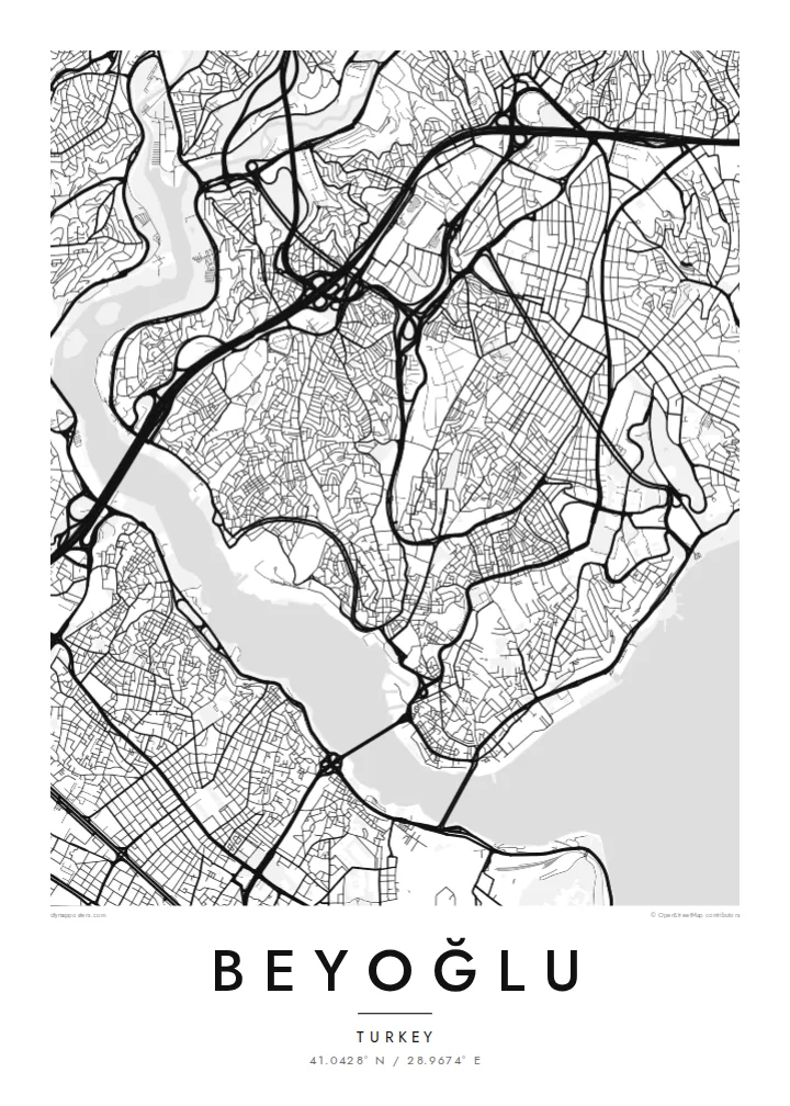
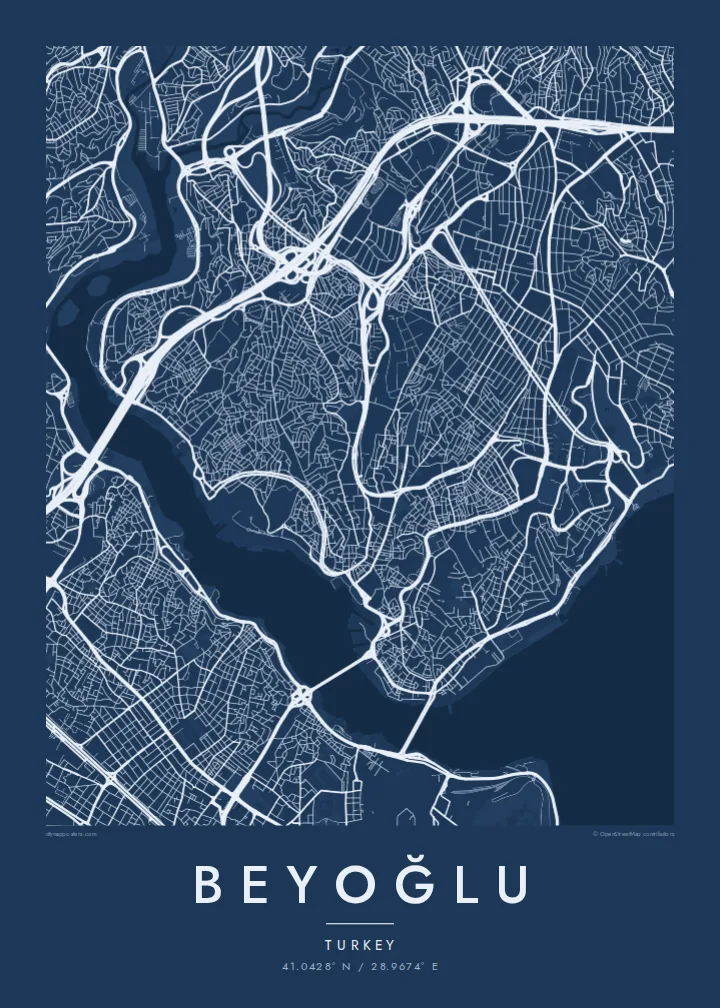
The pedestrian avenue from Taksim to Tünel follows the ridge in a long, slightly curving line. It is the clearest single stroke on the map.
פוסטר מפה מינימליסטי · טורקיה
41.0428° N / 28.9674° E
A hilly district above the Golden Horn and Bosphorus, with a pedestrian avenue running along the ridge from Taksim to Galata



עיר אחת, חמש אווירות
הקישו על סגנון כדי לראות אותו על הקיר. כל הסגנונות עולים אותו מחיר — מודפס, ממוסגר או כקבצי HD.
 פיקסלים אמיתיים · קובץ הדפסה 24 × 36″
חדות של הדפסה
זהו קטע בגודל 100% מקובץ ההדפסה האמיתי. כל פוסטר — מודפס, ממוסגר או מורד — מעובד בשרתים שלנו ברזולוציה של 300 DPI, עד 7,200 × 10,800 פיקסלים, כך שאפילו הרחובות הקטנים ביותר נשארים חדים בהדפסה בגודל 24 × 36″.
על הקיר


המפה
Beyoğlu covers the high ground north of the Golden Horn, where the land rises steeply from the water to a long ridge. The streets follow that terrain. Short, steep lanes and stairways drop down towards Karaköy and the Bosphorus shore, while the main avenue runs along the top. On the map, the district looks like a spine with ribs.
That spine is İstiklal Avenue, a pedestrian street about a kilometre and a half long. It links Taksim Square at the northern end to Tünel near the Galata Tower. A red heritage tram runs along it. At the southern end, the Tünel funicular, opened in 1875, carries passengers down the slope to Karaköy and is one of the oldest underground railways in the world.
Once known as Pera, the district was home to embassies, merchants and a large non-Muslim population in the late Ottoman period. Many of its apartment buildings and arcades date from that time. A Beyoğlu map poster shows how steep ground, a single strong avenue and two bodies of water shaped one of Istanbul's most distinctive districts.
The pedestrian avenue from Taksim to Tünel follows the ridge in a long, slightly curving line. It is the clearest single stroke on the map.
The medieval stone tower stands on the southern slope above Karaköy. It marks the point where the district begins its descent to the Golden Horn.
Short, steep streets and flights of steps connect the ridge to the waterfront, giving the map a dense, fine-grained texture on its southern and eastern edges.
התאימו אישית
הוסיפו תאריך, שם או שורה משלכם, והחליפו סגנון, גודל או כיוון.
התצוגה המקדימה החינמית היא ברזולוציה נמוכה ועם סימן מים. ההדפסים וקבצי ה-HD מעובדים ברזולוציה של 300 DPI, עד 7,200 × 10,800 px, ללא סימן מים.
למה Beyoğlu
Beyoğlu is where many people lived their Istanbul years, whether as students, new arrivals or night owls. A map of its ridge and slopes holds those streets together more faithfully than any photograph.
Personalise the title and subtitle with a date, an address or a line of your own. Choose one of five styles. Noir suits the district's late evenings, while Paper gives it the look of an old city plan.
הזמינו את פוסטר Beyoğlu| גודל הדפסה | רזולוציה | קבצים |
|---|---|---|
| 30 × 40 cm (11.8 × 15.7″) | 3,543 × 4,724 px | PNG · PDF |
| 29.7 × 42 cm (A3, 11.7 × 16.5″) | 3,508 × 4,961 px | PNG · PDF |
| 42 × 59.4 cm (A2, 16.5 × 23.4″) | 4,961 × 7,016 px | PNG · PDF |
| 45.7 × 61 cm (18 × 24″) | 5,400 × 7,200 px | PNG · PDF |
| 50 × 70 cm (19.7 × 27.6″) | 5,906 × 8,268 px | PNG · PDF |
| 61 × 91.4 cm (24 × 36″) | 7,200 × 10,800 px | PNG · PDF |
לשם השוואה, התצוגה המקדימה החינמית ברוחב 900 פיקסלים, עם סימן מים ומיועדת למסכים. לקובצי ה־HD רזולוציה גבוהה עד פי 8 בכל כיוון, והם מודפסים בצורה נקייה בגודל פוסטר מלא.
בחרו סגנון בראש העמוד, ואז בחרו פוסטר מודפס — גודל, ואם תרצו, גם מסגרת — או קבצי HD דיגיטליים. התשלום מתבצע בשלב אחד, ועמוד ההזמנה שלכם מתעדכן ברגע שהתשלום מאושר.
הוא מודפס על נייר מאט פרימיום במשקל 200 גרם, באחד משישה גדלים, מ-30 × 40 ס״מ ועד 24 × 36″. פוסטרים מודפסים מתחילים ב-{printFrom}, כולל משלוח.
כן. בחרו מסגרת מעץ מלא בשחור, לבן, אלון טבעי או עץ כהה. המסגרת מגיעה עם זכוכית בטיחותית ומוכנה לתלייה. פוסטרים ממוסגרים מתחילים ב-{framedFrom}, כולל משלוח.
המשלוח חינם בכל העולם. כל פוסטר מודפס אצל שותף ההדפסה הקרוב ביותר מבין למעלה מ-30 מדינות, ולרוב מגיע תוך 3–7 ימי עסקים. אפשר לעקוב אחרי הסטטוס והמעקב בעמוד ההזמנות שלי.
שלחו לנו תמונה תוך 14 יום מקבלת המשלוח, ואנחנו נדפיס אותו מחדש בחינם או נחזיר לכם את הכסף.
כן. בעורך שבעמוד הזה אפשר לשנות את הכותרת, כותרת המשנה ושורת הקואורדינטות לכל מה שתרצו, ולבחור סגנון וגודל. הזמנות מודפסות, ממוסגרות ודיגיטליות משתמשות בדיוק בעיצוב שלכם.
תמורת $9 תקבלו קבצי PNG ו-PDF מוכנים להדפסה ברזולוציה של 300 DPI, בכל שישה הגדלים, ללא סימן מים, להדפסה בכל מקום. עוד לא בטוחים? הורידו קודם תצוגה מקדימה חינמית עם סימן מים.
