Two framing rivers
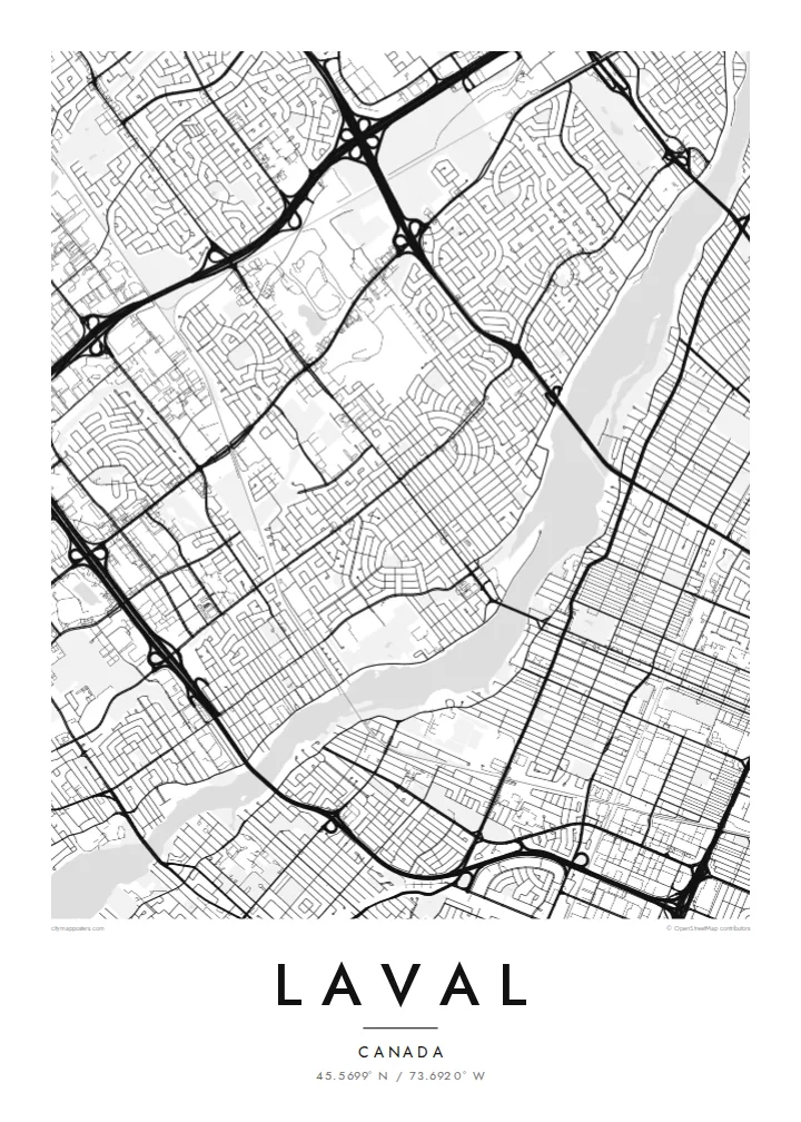
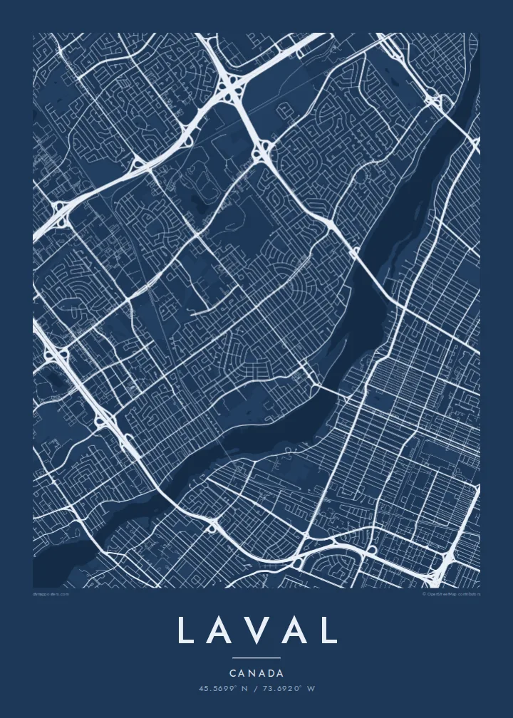
The Rivière des Prairies and the Rivière des Mille Îles wrap around the island. Their many small islands and inlets create a detailed, lacy edge on both sides.
פוסטר מפה מינימליסטי · קנדה
45.5699° N / 73.6920° W
An island city ringed by two rivers, with highways, suburban crescents and the metro's reach across the water.



עיר אחת, חמש אווירות
הקישו על סגנון כדי לראות אותו על הקיר. כל הסגנונות עולים אותו מחיר — מודפס, ממוסגר או כקבצי HD.
 פיקסלים אמיתיים · קובץ הדפסה 24 × 36″
חדות של הדפסה
זהו קטע בגודל 100% מקובץ ההדפסה האמיתי. כל פוסטר — מודפס, ממוסגר או מורד — מעובד בשרתים שלנו ברזולוציה של 300 DPI, עד 7,200 × 10,800 פיקסלים, כך שאפילו הרחובות הקטנים ביותר נשארים חדים בהדפסה בגודל 24 × 36″.
על הקיר


המפה
Laval covers all of Île Jésus, a large island north of Montreal. It is bounded by the Rivière des Prairies to the south and the Rivière des Mille Îles to the north. On a map it is one of the most clearly defined city shapes in Canada: an elongated island outline, fully built up in places, with both riverbanks traced by roads and small islands.
Inside that outline, Laval is a patchwork of suburban neighbourhoods. You see curving crescents and cul-de-sacs, older village cores along the rivers, and big commercial areas next to highway interchanges. Autoroutes 13, 15, 19 and 440 cut straight lines across the island, and bridges fan out to Montreal and to the North Shore.
The modern city was formed in 1965, when fourteen municipalities on the island merged. In 2007 Montreal's Orange Line crossed the river and three metro stations opened in Laval, including Montmorency. A Laval map poster shows the whole island at once, so the rivers frame the city like a border drawn by nature.
The Rivière des Prairies and the Rivière des Mille Îles wrap around the island. Their many small islands and inlets create a detailed, lacy edge on both sides.
Straight highways cross the island north to south and east to west. They meet in large cloverleaf interchanges that stand out clearly against the finer residential streets.
Along the riverbanks, older settlements such as Sainte-Rose and Saint-Vincent-de-Paul keep their small, irregular street patterns, unlike the planned suburbs inland.
התאימו אישית
הוסיפו תאריך, שם או שורה משלכם, והחליפו סגנון, גודל או כיוון.
התצוגה המקדימה החינמית היא ברזולוציה נמוכה ועם סימן מים. ההדפסים וקבצי ה-HD מעובדים ברזולוציה של 300 DPI, עד 7,200 × 10,800 px, ללא סימן מים.
למה Laval
People who grew up in Laval often feel it gets overlooked next to Montreal. This poster puts the island's own shape at the centre, and it makes a fitting gift for a first home, a family move or a return after years away.
The title, subtitle and coordinates line can all be changed. You could use a neighbourhood name, a street or a year. Choose from Classic black & white, Noir, Paper, Blueprint and Sand. The island shape reads well in each, and Paper suits a softer interior.
הזמינו את פוסטר Laval| גודל הדפסה | רזולוציה | קבצים |
|---|---|---|
| 30 × 40 cm (11.8 × 15.7″) | 3,543 × 4,724 px | PNG · PDF |
| 29.7 × 42 cm (A3, 11.7 × 16.5″) | 3,508 × 4,961 px | PNG · PDF |
| 42 × 59.4 cm (A2, 16.5 × 23.4″) | 4,961 × 7,016 px | PNG · PDF |
| 45.7 × 61 cm (18 × 24″) | 5,400 × 7,200 px | PNG · PDF |
| 50 × 70 cm (19.7 × 27.6″) | 5,906 × 8,268 px | PNG · PDF |
| 61 × 91.4 cm (24 × 36″) | 7,200 × 10,800 px | PNG · PDF |
לשם השוואה, התצוגה המקדימה החינמית ברוחב 900 פיקסלים, עם סימן מים ומיועדת למסכים. לקובצי ה־HD רזולוציה גבוהה עד פי 8 בכל כיוון, והם מודפסים בצורה נקייה בגודל פוסטר מלא.
בחרו סגנון בראש העמוד, ואז בחרו פוסטר מודפס — גודל, ואם תרצו, גם מסגרת — או קבצי HD דיגיטליים. התשלום מתבצע בשלב אחד, ועמוד ההזמנה שלכם מתעדכן ברגע שהתשלום מאושר.
הוא מודפס על נייר מאט פרימיום במשקל 200 גרם, באחד משישה גדלים, מ-30 × 40 ס״מ ועד 24 × 36″. פוסטרים מודפסים מתחילים ב-{printFrom}, כולל משלוח.
כן. בחרו מסגרת מעץ מלא בשחור, לבן, אלון טבעי או עץ כהה. המסגרת מגיעה עם זכוכית בטיחותית ומוכנה לתלייה. פוסטרים ממוסגרים מתחילים ב-{framedFrom}, כולל משלוח.
המשלוח חינם בכל העולם. כל פוסטר מודפס אצל שותף ההדפסה הקרוב ביותר אליכם, מבין שותפינו ביותר מ-30 מדינות, ובדרך כלל מגיע תוך 3–7 ימי עסקים. את הסטטוס ומעקב המשלוח אפשר לראות ב"ההזמנות שלי". למדינות מסוימות המשלוח לוקח 2–5 שבועות, ובמדינות שאליהן אנחנו עוד לא שולחים, האתר יודיע לכם לפני התשלום.
שלחו לנו תמונה תוך 14 יום מקבלת המשלוח, ואנחנו נדפיס אותו מחדש בחינם או נחזיר לכם את הכסף.
כן. בעורך שבעמוד הזה אפשר לשנות את הכותרת, כותרת המשנה ושורת הקואורדינטות לכל מה שתרצו, ולבחור סגנון וגודל. הזמנות מודפסות, ממוסגרות ודיגיטליות משתמשות בדיוק בעיצוב שלכם.
תמורת $9 תקבלו קבצי PNG ו-PDF מוכנים להדפסה ברזולוציה של 300 DPI, בכל שישה הגדלים, ללא סימן מים, להדפסה בכל מקום. עוד לא בטוחים? הורידו קודם תצוגה מקדימה חינמית עם סימן מים.
בסביבה
