Rustaq Fort
The fort stands at the centre of the old settlement, a solid block on the map with houses, lanes and palm gardens gathered around it.
פוסטר מפה מינימליסטי · עומאן
23.3908° N / 57.4244° E
An oasis town at the foot of Oman's Hajar mountains, where palm groves, wadis and a great fort shape the map
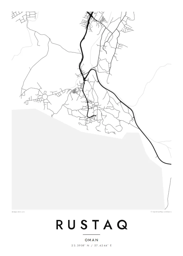


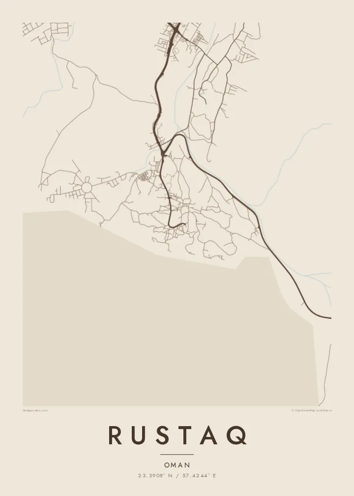
עיר אחת, חמש אווירות
הקישו על סגנון כדי לראות אותו על הקיר. כל הסגנונות עולים אותו מחיר — מודפס, ממוסגר או כקבצי HD.
 פיקסלים אמיתיים · קובץ הדפסה 24 × 36″
חדות של הדפסה
זהו קטע בגודל 100% מקובץ ההדפסה האמיתי. כל פוסטר — מודפס, ממוסגר או מורד — מעובד בשרתים שלנו ברזולוציה של 300 DPI, עד 7,200 × 10,800 פיקסלים, כך שאפילו הרחובות הקטנים ביותר נשארים חדים בהדפסה בגודל 24 × 36″.
על הקיר


המפה
Rustaq lies on the inland side of the Batinah plain, where the Western Hajar mountains begin to rise. From above, it is less a single compact town than a spread of settlements among date palm gardens, linked by roads that follow the wadis down from the hills. On the map, the groves show as open spaces between clusters of streets and houses.
The town has a long history as a seat of power. The origins of Rustaq Fort are often dated to before the Islamic era, and the fort was substantially rebuilt in later centuries. In the seventeenth century, under the Ya'ariba dynasty, Rustaq served as a capital of Oman. There are hot springs nearby, and the traditional falaj channels that carry water to the date gardens are still part of daily life.
A Rustaq map poster sets the soft, scattered forms of the oasis against the hard edge of the mountains beyond. Roads curve along dry riverbeds, the fort is a strong central mark, and the settlement fans out wherever there was water. The composition is shaped far more by geography than by planning.
The fort stands at the centre of the old settlement, a solid block on the map with houses, lanes and palm gardens gathered around it.
Date groves irrigated by falaj channels fill the spaces between settlements. They leave broad open areas that give the print a light, airy texture.
Roads follow the dry riverbeds that come down from the Hajar range, drawing gentle curved lines from the mountains toward the plain.
התאימו אישית
הוסיפו תאריך, שם או שורה משלכם, והחליפו סגנון, גודל או כיוון.
התצוגה המקדימה החינמית היא ברזולוציה נמוכה ועם סימן מים. ההדפסים וקבצי ה-HD מעובדים ברזולוציה של 300 DPI, עד 7,200 × 10,800 px, ללא סימן מים.
למה Rustaq
For Omanis from Rustaq and residents of the Batinah region, the map is a portrait of home shaped by water and mountains. Visitors who came for the fort, the springs or the mountain drives will recognise it too.
Set your own title, subtitle and coordinates, and choose Classic black & white, Noir, Paper, Blueprint or Sand. The $9 digital HD files come as 300 DPI PNG and print-ready PDF, or you can order a printed poster, framed or unframed.
הזמינו את פוסטר Rustaq| גודל הדפסה | רזולוציה | קבצים |
|---|---|---|
| 30 × 40 cm (11.8 × 15.7″) | 3,543 × 4,724 px | PNG · PDF |
| 29.7 × 42 cm (A3, 11.7 × 16.5″) | 3,508 × 4,961 px | PNG · PDF |
| 42 × 59.4 cm (A2, 16.5 × 23.4″) | 4,961 × 7,016 px | PNG · PDF |
| 45.7 × 61 cm (18 × 24″) | 5,400 × 7,200 px | PNG · PDF |
| 50 × 70 cm (19.7 × 27.6″) | 5,906 × 8,268 px | PNG · PDF |
| 61 × 91.4 cm (24 × 36″) | 7,200 × 10,800 px | PNG · PDF |
לשם השוואה, התצוגה המקדימה החינמית ברוחב 900 פיקסלים, עם סימן מים ומיועדת למסכים. לקובצי ה־HD רזולוציה גבוהה עד פי 8 בכל כיוון, והם מודפסים בצורה נקייה בגודל פוסטר מלא.
בחרו סגנון בראש העמוד, ואז בחרו פוסטר מודפס — גודל, ואם תרצו, גם מסגרת — או קבצי HD דיגיטליים. התשלום מתבצע בשלב אחד, ועמוד ההזמנה שלכם מתעדכן ברגע שהתשלום מאושר.
הוא מודפס על נייר מאט פרימיום במשקל 200 גרם, באחד משישה גדלים, מ-30 × 40 ס״מ ועד 24 × 36″. פוסטרים מודפסים מתחילים ב-{printFrom}, כולל משלוח.
כן. בחרו מסגרת מעץ מלא בשחור, לבן, אלון טבעי או עץ כהה. המסגרת מגיעה עם זכוכית בטיחותית ומוכנה לתלייה. פוסטרים ממוסגרים מתחילים ב-{framedFrom}, כולל משלוח.
המשלוח חינם בכל העולם. כל פוסטר מודפס אצל שותף ההדפסה הקרוב ביותר מבין למעלה מ-30 מדינות, ולרוב מגיע תוך 3–7 ימי עסקים. אפשר לעקוב אחרי הסטטוס והמעקב בעמוד ההזמנות שלי.
שלחו לנו תמונה תוך 14 יום מקבלת המשלוח, ואנחנו נדפיס אותו מחדש בחינם או נחזיר לכם את הכסף.
כן. בעורך שבעמוד הזה אפשר לשנות את הכותרת, כותרת המשנה ושורת הקואורדינטות לכל מה שתרצו, ולבחור סגנון וגודל. הזמנות מודפסות, ממוסגרות ודיגיטליות משתמשות בדיוק בעיצוב שלכם.
תמורת $9 תקבלו קבצי PNG ו-PDF מוכנים להדפסה ברזולוציה של 300 DPI, בכל שישה הגדלים, ללא סימן מים, להדפסה בכל מקום. עוד לא בטוחים? הורידו קודם תצוגה מקדימה חינמית עם סימן מים.
